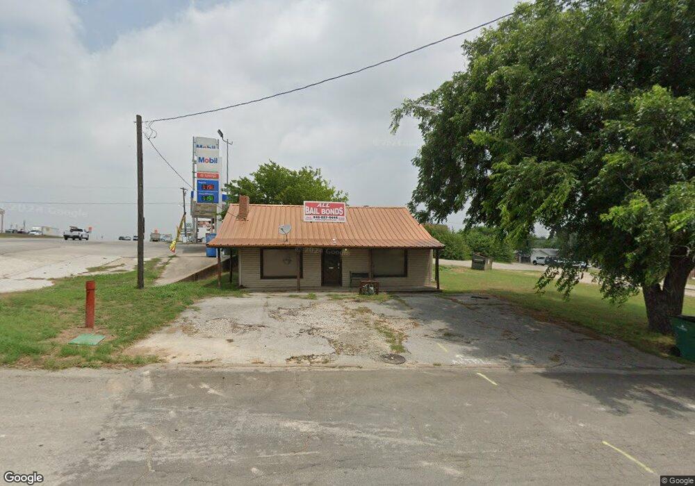
902 W Main St Decatur, TX 76234
Estimated Value: $169,913
--
Bed
1
Bath
1,102
Sq Ft
$154/Sq Ft
Est. Value
About This Home
This home is located at 902 W Main St, Decatur, TX 76234 and is currently priced at $169,913, approximately $154 per square foot. 902 W Main St is a home located in Wise County with nearby schools including Decatur High School and Victory Christian Academy.
Ownership History
Date
Name
Owned For
Owner Type
Purchase Details
Closed on
Apr 14, 2025
Sold by
Barnett Debbye and Barnett Debra Denise
Bought by
Al Jr Realestate Inc
Current Estimated Value
Purchase Details
Closed on
Jun 15, 2021
Sold by
Barnett Gary Michael
Bought by
Barnett Debbye
Purchase Details
Closed on
Dec 1, 2003
Sold by
Barnett Victor King
Bought by
Barnett Victor King
Purchase Details
Closed on
Jul 21, 2003
Sold by
Box David L
Bought by
Barnett Victor King
Create a Home Valuation Report for This Property
The Home Valuation Report is an in-depth analysis detailing your home's value as well as a comparison with similar homes in the area
Home Values in the Area
Average Home Value in this Area
Purchase History
| Date | Buyer | Sale Price | Title Company |
|---|---|---|---|
| Al Jr Realestate Inc | -- | Title Resources | |
| Barnett Debbye | -- | None Listed On Document | |
| Barnett Gary Michael | -- | None Listed On Document | |
| Barnett Victor King | -- | -- | |
| Barnett Victor King | -- | -- |
Source: Public Records
Tax History Compared to Growth
Tax History
| Year | Tax Paid | Tax Assessment Tax Assessment Total Assessment is a certain percentage of the fair market value that is determined by local assessors to be the total taxable value of land and additions on the property. | Land | Improvement |
|---|---|---|---|---|
| 2025 | $4,075 | $164,486 | $74,462 | $90,024 |
| 2024 | $4,075 | $223,871 | $75,790 | $148,081 |
| 2023 | $4,062 | $223,949 | $75,790 | $148,159 |
| 2022 | $3,789 | $173,032 | $75,790 | $97,242 |
| 2021 | $3,018 | $132,240 | $75,790 | $56,450 |
| 2020 | $3,102 | $132,240 | $75,790 | $56,450 |
| 2019 | $3,277 | $132,210 | $76,000 | $56,210 |
| 2018 | $2,930 | $113,340 | $60,800 | $52,540 |
| 2017 | $2,783 | $107,230 | $60,800 | $46,430 |
| 2016 | $2,778 | $107,020 | $60,800 | $46,220 |
| 2015 | -- | $107,850 | $60,800 | $47,050 |
| 2014 | -- | $109,260 | $60,800 | $48,460 |
Source: Public Records
Map
Nearby Homes
- 0 N Hwy 287 Unit 25379920
- W W Rose Ave
- 601 W Brady St
- 606 W Mulberry St
- 407 N Lane St
- 1208 Marsha Ln
- 4112 U S 380
- 50+/- acres U S 380
- 1216 Marsha Ln
- 1232 Marsha Ln
- 1204 Marsha Ln
- 808 Sage Dr
- 400 S Vick St
- 1210 Rockwater Dr
- 401 S Holman St
- 1215 Rockwater Dr
- 1234 Rockwater Dr
- 1224 Patti Ln
- 1 S Martin Extension
- 304 Cyndilu Ln
- 0 N Hwy 287 Unit 10789515
- 0 N Hwy 287 Unit 3 14310910
- 0 N Hwy 287 Unit 2 14310904
- 0 N Hwy 287 Unit 1 14310892
- 0 N Hwy 287 Unit 14049585
- 6 U S 287
- 5 U S 287
- 4 U S 287
- 3 U S 287
- 2 U S 287
- 7 U S 287
- 103 S Highway 287
- 808 W Main St
- 201 N Chico Ave
- 103 N Highway 287 Unit Former Patriot Tire
- 103 N Highway 287
- 203 N Chico Ave
- 000 W Main St
- 102 S Highway 287
- 00 W Rose Ave