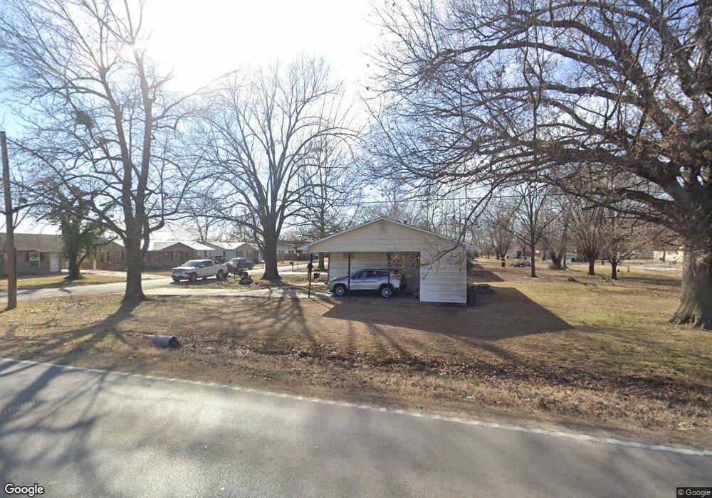
902 W Street Francis St Dexter, MO 63841
Estimated Value: $104,063 - $143,000
3
Beds
1
Bath
960
Sq Ft
$123/Sq Ft
Est. Value
About This Home
This home is located at 902 W Street Francis St, Dexter, MO 63841 and is currently estimated at $118,516, approximately $123 per square foot. 902 W Street Francis St is a home located in Stoddard County with nearby schools including Southwest Elementary School, Central Elementary School, and T.S. Hill Middle School.
Ownership History
Date
Name
Owned For
Owner Type
Purchase Details
Closed on
Nov 5, 2024
Sold by
Village Cap & Inv Llc
Bought by
Independent Springs Props Llc
Current Estimated Value
Purchase Details
Closed on
Jul 28, 2021
Sold by
Cobb Lonnie and Cobb Ginger
Bought by
Sweeney Christie N and Arnold Austin Cord
Home Financials for this Owner
Home Financials are based on the most recent Mortgage that was taken out on this home.
Original Mortgage
$94,373
Interest Rate
2.87%
Mortgage Type
Construction
Purchase Details
Closed on
Dec 19, 2017
Sold by
Mcaally Samuel R and Mcaally Pauline L
Bought by
Cobb Lonnie and Cobb Ginger
Create a Home Valuation Report for This Property
The Home Valuation Report is an in-depth analysis detailing your home's value as well as a comparison with similar homes in the area
Home Values in the Area
Average Home Value in this Area
Purchase History
| Date | Buyer | Sale Price | Title Company |
|---|---|---|---|
| Independent Springs Props Llc | $75,600 | National Title & Escrow Inc | |
| Sweeney Christie N | $117,966 | National Title & Escrow Inc | |
| Cobb Lonnie | -- | National Title & Escrow Inc |
Source: Public Records
Mortgage History
| Date | Status | Borrower | Loan Amount |
|---|---|---|---|
| Previous Owner | Sweeney Christie N | $94,373 |
Source: Public Records
Tax History Compared to Growth
Tax History
| Year | Tax Paid | Tax Assessment Tax Assessment Total Assessment is a certain percentage of the fair market value that is determined by local assessors to be the total taxable value of land and additions on the property. | Land | Improvement |
|---|---|---|---|---|
| 2025 | $466 | $10,735 | $0 | $0 |
| 2024 | $466 | $10,070 | $0 | $0 |
| 2023 | $465 | $10,070 | $0 | $0 |
| 2022 | $435 | $9,424 | $0 | $0 |
| 2021 | $435 | $9,424 | $0 | $0 |
| 2020 | $409 | $8,759 | $0 | $0 |
| 2019 | $408 | $8,816 | $0 | $0 |
| 2018 | $403 | $8,759 | $0 | $0 |
| 2016 | $362 | $8,113 | $0 | $0 |
| 2015 | -- | $7,923 | $0 | $0 |
| 2014 | -- | $7,923 | $0 | $0 |
| 2013 | -- | $0 | $0 | $0 |
Source: Public Records
Map
Nearby Homes
- 435 W Elk St
- 1013 Susan St
- 510 W Elk St
- 805 W Bain St
- 5 Kelly St
- 1101 N Sassafras
- 502 Chautauqua Ln
- 211 W Castor St
- 707 W Bain St
- 804 N Catalpa St
- 1002 Cottage Ln
- 727 W Fannetta St
- 316 W Bain St
- 211 S Park Ln
- 1207 W Kenton Rd
- 1 Crites Lane Lots 1-4
- 731 N Locust St
- 501 Forrest St
- 130 Hunt St
- 25 Brookfield Dr
- 902 W Saint Francis St
- 904 W Saint Francis St
- 904 W Street Francis St
- 906 W Saint Francis St
- 901 W Saint Francis St
- 903 W Saint Francis St
- 516 Hardy Dr
- 508 N One Mile Rd
- 905 W Saint Francis St
- 908 W Saint Francis St
- 908 W Street Francis St
- 907 W Saint Francis St
- 910 W Saint Francis St
- 907 Daisy Dr
- 909 Daisy Dr
- 909 W Saint Francis St
- 912 W Saint Francis St
- 908 Daisy Dr
- 910 Daisy Dr
- 911 Daisy Dr