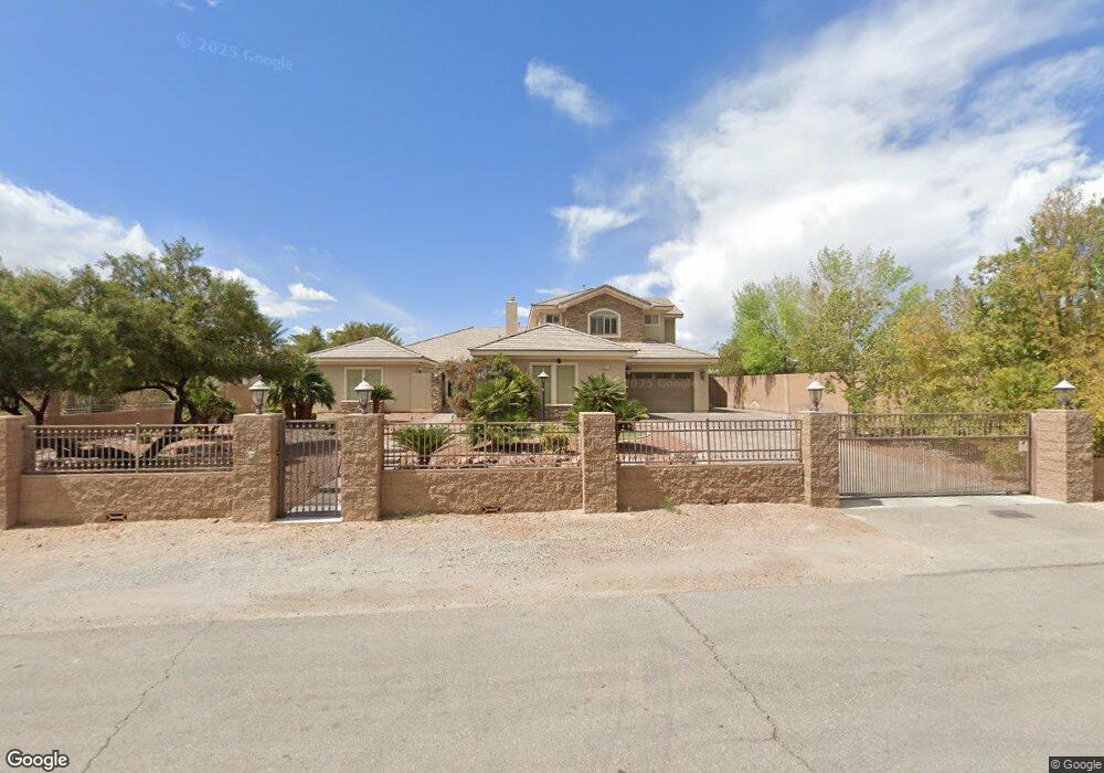
9027 Polaris Ave Las Vegas, NV 89139
Highlands Ranch NeighborhoodEstimated Value: $1,890,276 - $2,610,000
6
Beds
7
Baths
5,934
Sq Ft
$352/Sq Ft
Est. Value
About This Home
This home is located at 9027 Polaris Ave, Las Vegas, NV 89139 and is currently estimated at $2,091,569, approximately $352 per square foot. 9027 Polaris Ave is a home located in Clark County with nearby schools including Dennis Ortwein Elementary, Lois & Jerry Tarkanian Middle School, and Desert Oasis High School.
Ownership History
Date
Name
Owned For
Owner Type
Purchase Details
Closed on
Apr 11, 2008
Sold by
Desert Oak Development Inc
Bought by
Stanfield Ronald E and Stanfield Karen Y
Current Estimated Value
Home Financials for this Owner
Home Financials are based on the most recent Mortgage that was taken out on this home.
Original Mortgage
$966,334
Outstanding Balance
$659,123
Interest Rate
7.5%
Mortgage Type
Unknown
Estimated Equity
$1,432,446
Create a Home Valuation Report for This Property
The Home Valuation Report is an in-depth analysis detailing your home's value as well as a comparison with similar homes in the area
Home Values in the Area
Average Home Value in this Area
Purchase History
| Date | Buyer | Sale Price | Title Company |
|---|---|---|---|
| Stanfield Ronald E | $1,380,478 | Titleone |
Source: Public Records
Mortgage History
| Date | Status | Borrower | Loan Amount |
|---|---|---|---|
| Open | Stanfield Ronald E | $966,334 |
Source: Public Records
Tax History Compared to Growth
Tax History
| Year | Tax Paid | Tax Assessment Tax Assessment Total Assessment is a certain percentage of the fair market value that is determined by local assessors to be the total taxable value of land and additions on the property. | Land | Improvement |
|---|---|---|---|---|
| 2025 | $9,900 | $564,983 | $80,500 | $484,483 |
| 2024 | $9,612 | $564,983 | $80,500 | $484,483 |
| 2023 | $6,627 | $515,237 | $85,750 | $429,487 |
| 2022 | $9,785 | $430,189 | $75,950 | $354,239 |
| 2021 | $9,474 | $403,909 | $68,600 | $335,309 |
| 2020 | $8,638 | $394,773 | $68,600 | $326,173 |
| 2019 | $8,095 | $378,718 | $61,250 | $317,468 |
| 2018 | $7,083 | $323,749 | $40,250 | $283,499 |
| 2017 | $6,627 | $328,183 | $40,250 | $287,933 |
| 2016 | $6,627 | $245,454 | $34,650 | $210,804 |
| 2015 | $6,616 | $227,581 | $30,030 | $197,551 |
| 2014 | $6,411 | $212,095 | $19,250 | $192,845 |
Source: Public Records
Map
Nearby Homes
- 0 Polaris Ave
- 3458 W Agate Ave
- 3094 Mountain Bay Ave
- 3385 W Agate Ave
- 3757 Brittany Nicole Ct Unit 4
- 3668 Hillary Elan Ct
- 9190 Valerie Elaine St
- 9190 Oakdale Ranch Ct Plan at Reserves at Magnolia Ranch
- 9190 Oakdale Ranch Ct
- 3024 River Brook Ct
- 3031 Mountain Bay Ave
- 3910 W Pebble Rd
- 8736 Procyon St
- 2863 Red Ct
- 3580 W Ford Ave
- 9020 Kimo St
- 2775 W Pebble Rd Unit 501
- 2755 W Pebble Rd Unit 319
- 3800 W Ford Ave
- 2715 W Pebble Rd Unit 505
- 9057 Polaris Ave
- 3429 Raven Ave
- 3489 Raven Ave
- 3488 W Agate Ave
- 3428 W Agate Ave
- 9056 Procyon St
- 9026 Procyon St
- 3548 W Agate Ave
- 8981 Polaris Ave
- 8971 Polaris Ave
- 3579 Raven Ave
- 3578 W Agate Ave
- 3063 Mountain Bay Ave
- 8990 Procyon St
- 8951 Polaris Ave
- 8961 Polaris Ave
- 9055 Procyon St
- 9025 Procyon St
- 9075 Procyon St
- 8970 Procyon St