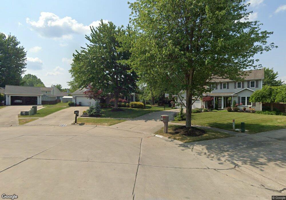
9029 Chapman Cir Strongsville, OH 44136
Estimated Value: $252,000 - $364,000
4
Beds
3
Baths
1,722
Sq Ft
$182/Sq Ft
Est. Value
About This Home
This home is located at 9029 Chapman Cir, Strongsville, OH 44136 and is currently estimated at $313,251, approximately $181 per square foot. 9029 Chapman Cir is a home located in Cuyahoga County with nearby schools including Strongsville High School, Sts Joseph & John Interparochial School, and Bethel Christian Academy.
Ownership History
Date
Name
Owned For
Owner Type
Purchase Details
Closed on
Aug 28, 2025
Sold by
Jarus Edward J and Jarus Sheryll A
Bought by
Forgach Brian M and Forgach Erin M
Current Estimated Value
Purchase Details
Closed on
Dec 29, 1989
Sold by
Ruby Terry M
Bought by
Jarus Edward J
Purchase Details
Closed on
Aug 18, 1989
Bought by
Ruby Terry M
Purchase Details
Closed on
Jan 1, 1989
Bought by
New Concord Homes
Create a Home Valuation Report for This Property
The Home Valuation Report is an in-depth analysis detailing your home's value as well as a comparison with similar homes in the area
Home Values in the Area
Average Home Value in this Area
Purchase History
| Date | Buyer | Sale Price | Title Company |
|---|---|---|---|
| Forgach Brian M | $250,000 | None Listed On Document | |
| Jarus Edward J | $112,000 | -- | |
| Ruby Terry M | $36,000 | -- | |
| New Concord Homes | -- | -- |
Source: Public Records
Tax History Compared to Growth
Tax History
| Year | Tax Paid | Tax Assessment Tax Assessment Total Assessment is a certain percentage of the fair market value that is determined by local assessors to be the total taxable value of land and additions on the property. | Land | Improvement |
|---|---|---|---|---|
| 2024 | $5,145 | $109,585 | $19,320 | $90,265 |
| 2023 | $5,324 | $85,020 | $21,420 | $63,600 |
| 2022 | $5,285 | $85,020 | $21,420 | $63,600 |
| 2021 | $5,243 | $85,020 | $21,420 | $63,600 |
| 2020 | $5,109 | $73,290 | $18,480 | $54,810 |
| 2019 | $4,959 | $209,400 | $52,800 | $156,600 |
| 2018 | $4,400 | $73,290 | $18,480 | $54,810 |
| 2017 | $4,379 | $66,010 | $16,450 | $49,560 |
| 2016 | $4,343 | $66,010 | $16,450 | $49,560 |
| 2015 | $4,277 | $66,010 | $16,450 | $49,560 |
| 2014 | $4,277 | $64,090 | $15,960 | $48,130 |
Source: Public Records
Map
Nearby Homes
- 9129 Tahoe Cir
- 9890 Webster Rd
- 10010 Chevy Chase
- 9531 Nicole Cir
- 9945 Twelve Oaks Cir
- 10369 Council Bluff
- 14015 Byron Blvd
- 13976 W Sprague Rd
- 7685 Saratoga Rd
- 0 Webster Rd
- 15485 Albion Rd
- Buchanan Plan at The Enclave at Pine Lakes Crossing
- Belleville Plan at The Enclave at Pine Lakes Crossing
- 14069 Basswood Cir
- 16519 Albion Rd
- 18203 Broxton Dr
- 7664 Gerald Dr
- 8761 Windfall Ct
- 14280 Pawnee Trail
- 14330 Pawnee Trail
- 8985 Chapman Cir
- 9000 Chapman Cir
- 15580 Whitney Rd
- 15614 Whitney Rd
- 8941 Chapman Cir
- 15546 Whitney Rd
- 8962 Chapman Cir
- 15648 Whitney Rd
- 15512 Whitney Rd
- 8914 Chapman Cir
- 15421 Dewitt Dr
- 8897 Chapman Cir
- 15730 Whitney Rd
- 9031 Groveside Dr
- 15393 Dewitt Dr
- 15478 Whitney Rd
- 8993 Groveside Dr
- 15440 Dewitt Dr
- 8866 Chapman Cir
- 8853 Chapman Cir