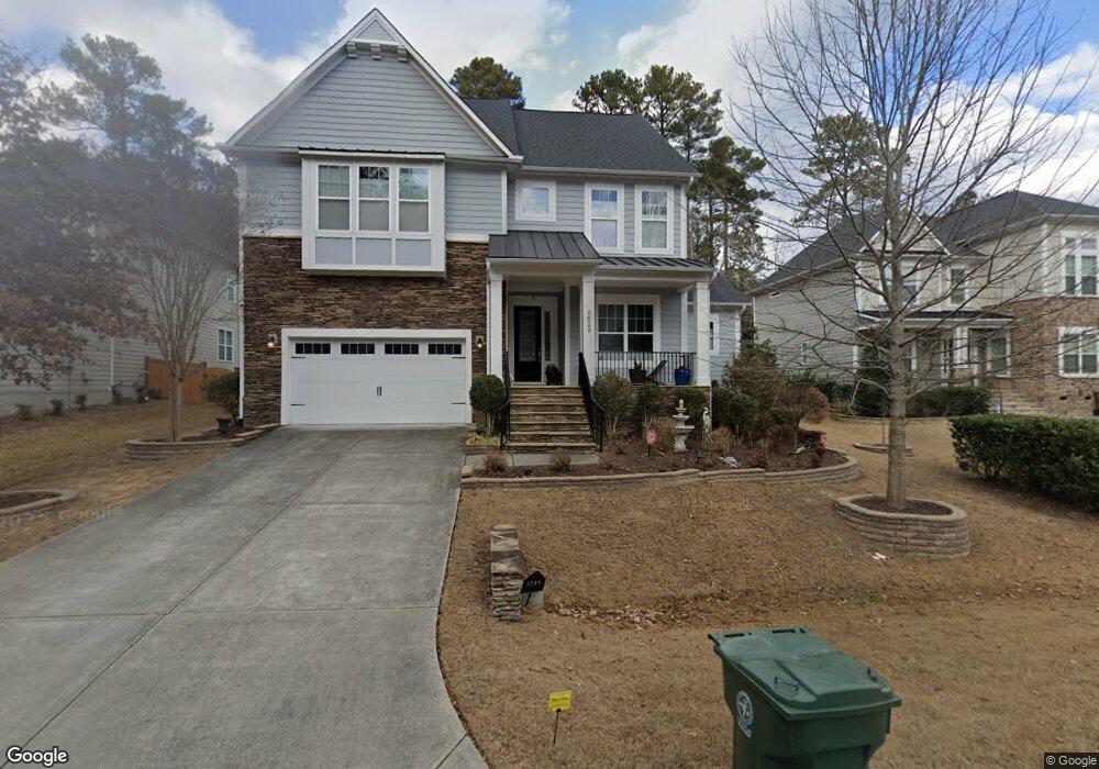
9029 Cobalt Ridge Way Cary, NC 27519
Green Level NeighborhoodEstimated Value: $1,056,927 - $1,099,000
5
Beds
6
Baths
4,062
Sq Ft
$264/Sq Ft
Est. Value
About This Home
This home is located at 9029 Cobalt Ridge Way, Cary, NC 27519 and is currently estimated at $1,074,232, approximately $264 per square foot. 9029 Cobalt Ridge Way is a home located in Wake County with nearby schools including Mills Park Elementary School, Mills Park Middle School, and Green Level High School.
Ownership History
Date
Name
Owned For
Owner Type
Purchase Details
Closed on
Aug 28, 2015
Sold by
M I Homes Of Raleigh Llc
Bought by
Nair Satheesh and Nair Sajini
Current Estimated Value
Home Financials for this Owner
Home Financials are based on the most recent Mortgage that was taken out on this home.
Original Mortgage
$458,800
Outstanding Balance
$363,404
Interest Rate
4.16%
Mortgage Type
New Conventional
Estimated Equity
$710,828
Create a Home Valuation Report for This Property
The Home Valuation Report is an in-depth analysis detailing your home's value as well as a comparison with similar homes in the area
Home Values in the Area
Average Home Value in this Area
Purchase History
| Date | Buyer | Sale Price | Title Company |
|---|---|---|---|
| Nair Satheesh | $574,000 | Attorney |
Source: Public Records
Mortgage History
| Date | Status | Borrower | Loan Amount |
|---|---|---|---|
| Open | Nair Satheesh | $458,800 |
Source: Public Records
Tax History Compared to Growth
Tax History
| Year | Tax Paid | Tax Assessment Tax Assessment Total Assessment is a certain percentage of the fair market value that is determined by local assessors to be the total taxable value of land and additions on the property. | Land | Improvement |
|---|---|---|---|---|
| 2025 | $7,907 | $920,240 | $270,000 | $650,240 |
| 2024 | $7,736 | $920,240 | $270,000 | $650,240 |
| 2023 | $5,526 | $549,452 | $140,000 | $409,452 |
| 2022 | $5,319 | $549,452 | $140,000 | $409,452 |
| 2021 | $5,212 | $549,452 | $140,000 | $409,452 |
| 2020 | $5,240 | $549,452 | $140,000 | $409,452 |
| 2019 | $5,841 | $543,670 | $140,000 | $403,670 |
| 2018 | $5,481 | $528,320 | $140,000 | $388,320 |
| 2017 | $5,118 | $528,320 | $140,000 | $388,320 |
| 2016 | $5,042 | $140,000 | $140,000 | $0 |
| 2015 | -- | $120,000 | $120,000 | $0 |
Source: Public Records
Map
Nearby Homes
- 2013 Austin Pond Dr
- 1012 Holland Bend Dr
- 1139 Grogans Mill Dr
- 301 Crayton Oak Dr
- 449 Christian Creek Place
- 105 Jessfield Place
- 6017 Mentmore Place
- 413 Westfalen Dr
- 2005 Mill Gate Ln
- 600 Ivyshaw Rd
- 129 Naperville Dr
- 609 Crooked Pine Dr
- 317 Castle Rock Ln
- 103 Alden Village Ct
- 1021 Ferson Rd
- 933 Portstewart Dr Unit 933
- 735 Portstewart Dr Unit 735
- 399 Waverly Hills Dr
- 734 Portstewart Dr Unit 734
- 228 Waterford Lake Dr Unit 228
- 9033 Cobalt Ridge Way
- 9025 Cobalt Ridge Way
- 9217 Green Level Church Rd
- 9037 Cobalt Ridge Way
- 1004 Austin Pond Dr
- 9028 Cobalt Ridge Way
- 1008 Austin Pond Dr
- 9036 Cobalt Ridge Way
- 9101 Cobalt Ridge Way
- 9100 Cobalt Ridge Way
- 1016 Austin Pond Dr
- 9105 Cobalt Ridge Way
- 9104 Cobalt Ridge Way
- 1017 Austin Pond Dr
- 1508 Furlong Loop
- 9109 Cobalt Ridge Way
- 1020 Austin Pond Dr
- 1512 Furlong Loop
- 1501 Furlong Loop
- 105 Carolina Sky Place