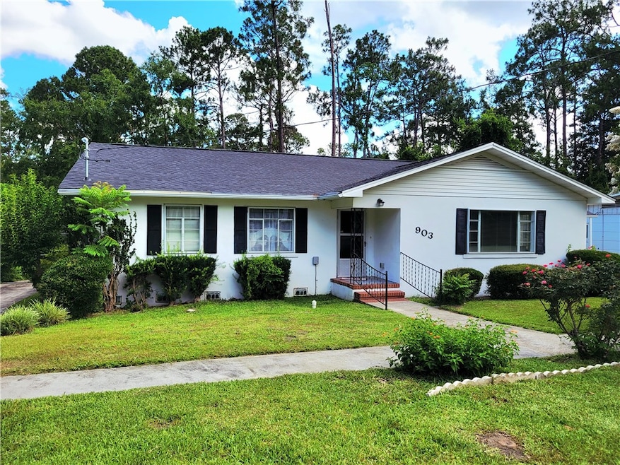
903 Atlantic Ave Waycross, GA 31501
Estimated payment $1,324/month
Highlights
- Traditional Architecture
- No HOA
- Laundry Room
- Wood Flooring
- Breakfast Area or Nook
- Central Heating and Cooling System
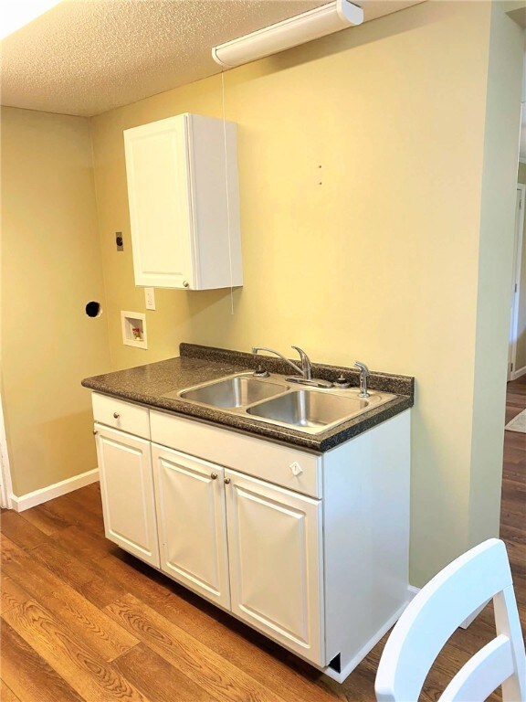
About This Home
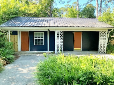
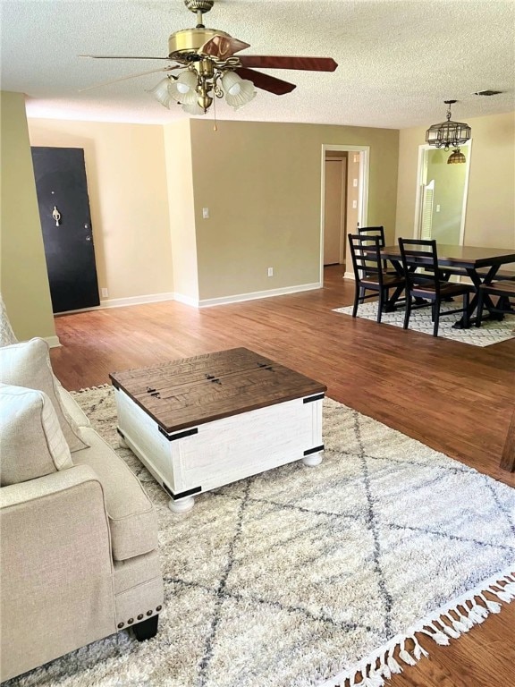
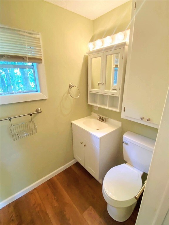
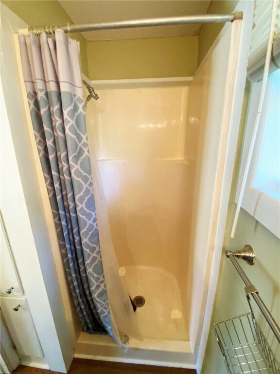
Take a look at this gem located in the Cherokee Heights are of Waycross. The main house has 2 bedrooms and 2 bathrooms and is 1577 sq ft. The main area has beautiful hardwood floors, there are updated countertops in the kitchen, and the master bedroom has a spacious master bath and a large master closet. The home also has a new roof. The guest home has 1 bedroom and 1 bathroom, is 476 sq ft, and also has a kitchen and eating area. Call your realtor today and come look at this home that has either a functioning in law suite or an income producing rental home!!
Home Details
Home Type
- Single Family
Est. Annual Taxes
- $1,979
Year Built
- Built in 1969
Parking
- 1 Carport Space
Home Design
- Traditional Architecture
Interior Spaces
- 2,053 Sq Ft Home
- Wood Flooring
- Breakfast Area or Nook
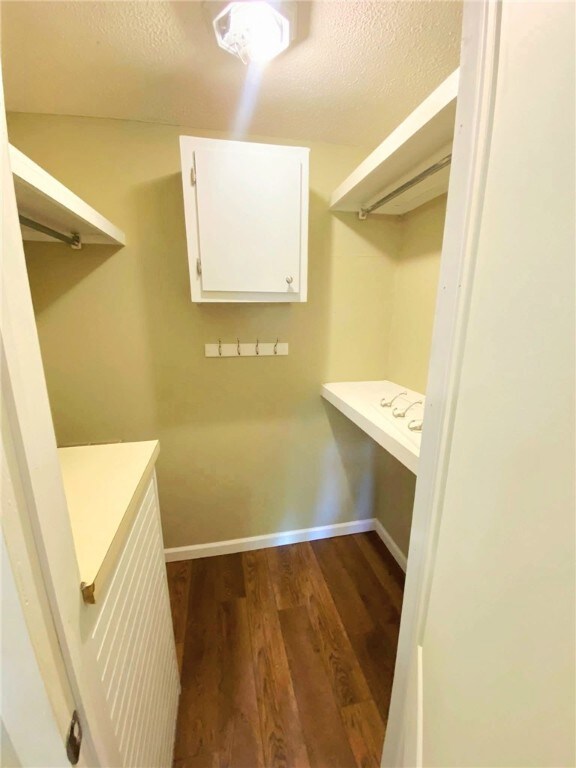
- Laundry Room
Bedrooms and Bathrooms
- 3 Bedrooms
- 3 Full Bathrooms
Additional Features
- 0.28 Acre Lot
- Central Heating and Cooling System
Community Details
- No Home Owners Association
Listing and Financial Details
- Assessor Parcel Number WA2105 011
Map
Home Values in the Area
Average Home Value in this Area
Tax History
| Year | Tax Paid | Tax Assessment Tax Assessment Total Assessment is a certain percentage of the fair market value that is determined by local assessors to be the total taxable value of land and additions on the property. | Land | Improvement |
|---|---|---|---|---|
| 2024 | $1,979 | $58,585 | $4,480 | $54,105 |
| 2023 | $2,020 | $50,546 | $2,643 | $47,903 |
| 2022 | $2,019 | $50,666 | $2,643 | $48,023 |
| 2021 | $1,747 | $40,408 | $2,643 | $37,765 |
| 2020 | $1,679 | $38,525 | $2,643 | $35,882 |
| 2019 | $1,578 | $35,702 | $2,643 | $33,059 |
| 2018 | $1,583 | $35,460 | $2,643 | $32,817 |
| 2017 | $1,546 | $35,460 | $2,643 | $32,817 |
| 2015 | $1,557 | $35,460 | $2,643 | $32,817 |
| 2014 | $1,321 | $35,460 | $2,643 | $32,817 |
| 2013 | -- | $35,472 | $2,643 | $32,828 |
Property History
| Date | Event | Price | List to Sale | Price per Sq Ft |
|---|---|---|---|---|
| 06/27/2025 06/27/25 | For Sale | $219,900 | -- | $107 / Sq Ft |
Purchase History
| Date | Type | Sale Price | Title Company |
|---|---|---|---|
| Warranty Deed | $160,000 | -- | |
| Warranty Deed | -- | -- | |
| Warranty Deed | $110,000 | -- | |
| Warranty Deed | $75,000 | -- |
Mortgage History
| Date | Status | Loan Amount | Loan Type |
|---|---|---|---|
| Previous Owner | $81,295 | New Conventional |
Source: Golden Isles Association of REALTORS®
MLS Number: 1654780
APN: WA21-05-011
Disclaimer: Certain information contained herein is derived from information provided by parties other than Homes.com. All information provided is deemed reliable, but is not guaranteed to be accurate and should be independently verified.
![]() IDX information is provided exclusively for personal, non-commercial use, and may not be used for any purpose other than to identify prospective properties consumers may be interested in purchasing. Information is deemed reliable but not guaranteed.
IDX information is provided exclusively for personal, non-commercial use, and may not be used for any purpose other than to identify prospective properties consumers may be interested in purchasing. Information is deemed reliable but not guaranteed.
- 1100 Atlantic Ave
- 713 Magnolia Dr
- 1205 Dean Dr
- 907 Euclid Ave
- 0 Saint Marys Dr Unit (TRACT 2 0.25 ACRES)
- 1002 Baltimore Ave
- 1100 Euclid Ave
- 1009 Euclid Ave
- 7438 Central Ave
- 707 Euclid Ave
- 1204 Richmond Ave
- 808 Satilla Blvd
- 1001 Coral Rd
- 1101 Cherokee Dr
- 807 City Blvd
- 511 Richmond Ave
- 506 Magnolia Dr
- 706 Cherokee Cir
- 00 Seminole Trail
- 1312 Atlantic Ave
