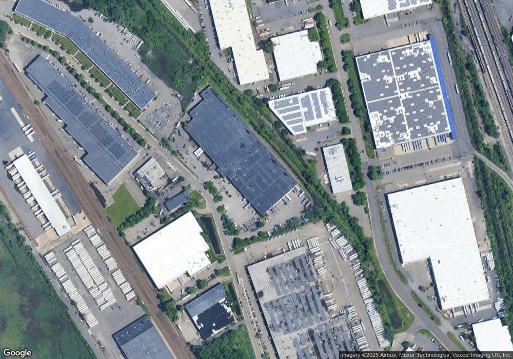
903 Castle Rd Unit B Secaucus, NJ 07094
Estimated Value: $704,000
--
Bed
--
Bath
--
Sq Ft
--
Built
About This Home
This home is located at 903 Castle Rd Unit B, Secaucus, NJ 07094 and is currently priced at $704,000. 903 Castle Rd Unit B is a home located in Hudson County with nearby schools including Secaucus High School and Golden Door Charter School.
Ownership History
Date
Name
Owned For
Owner Type
Purchase Details
Closed on
Aug 4, 2011
Sold by
Maita Starr And Brody Realty Company L
Bought by
903 Castle Llc
Current Estimated Value
Purchase Details
Closed on
Aug 22, 2006
Sold by
Fisher Group Llc
Bought by
Fae Holdings 383485R Llc
Purchase Details
Closed on
Sep 9, 1999
Sold by
Airmont Homes Inc
Bought by
Fisher Group Llc
Home Financials for this Owner
Home Financials are based on the most recent Mortgage that was taken out on this home.
Original Mortgage
$2,380,000
Interest Rate
7.83%
Mortgage Type
Purchase Money Mortgage
Create a Home Valuation Report for This Property
The Home Valuation Report is an in-depth analysis detailing your home's value as well as a comparison with similar homes in the area
Home Values in the Area
Average Home Value in this Area
Purchase History
| Date | Buyer | Sale Price | Title Company |
|---|---|---|---|
| 903 Castle Llc | $5,555,000 | -- | |
| Fae Holdings 383485R Llc | $7,156,800 | Accusearch Title Svcs Inc | |
| Fisher Group Llc | $2,753,800 | -- |
Source: Public Records
Mortgage History
| Date | Status | Borrower | Loan Amount |
|---|---|---|---|
| Previous Owner | Fisher Group Llc | $2,380,000 |
Source: Public Records
Tax History Compared to Growth
Tax History
| Year | Tax Paid | Tax Assessment Tax Assessment Total Assessment is a certain percentage of the fair market value that is determined by local assessors to be the total taxable value of land and additions on the property. | Land | Improvement |
|---|---|---|---|---|
| 2021 | $105,086 | $2,812,800 | $1,225,700 | $1,587,100 |
| 2020 | $105,086 | $2,812,800 | $1,225,700 | $1,587,100 |
| 2019 | $104,411 | $2,753,800 | $1,225,700 | $1,528,100 |
| 2018 | $99,412 | $2,753,800 | $1,225,700 | $1,528,100 |
| 2017 | $99,522 | $2,753,800 | $1,225,700 | $1,528,100 |
| 2016 | $102,083 | $2,753,800 | $1,225,700 | $1,528,100 |
| 2015 | $101,946 | $2,753,800 | $1,225,700 | $1,528,100 |
| 2014 | $103,708 | $2,753,800 | $1,225,700 | $1,528,100 |
Source: Public Records
Map
Nearby Homes
- 2508 Harmon Cove Tower
- 2234 Harmon Cove Tower Unit 2234
- 0 Harmon Cove Tower Unit 426 250010795
- 611 Sanderling Ct Unit 611
- 530 Harmon Cove Tower Unit 530
- 704 Harmon Cove Tower Unit 704
- 401 Harmon Cove Tower Unit 401
- 414 Harmon Cove Tower
- 429 Harmon Cove Tower
- 1705 Harmon Cove Tower Unit 1705
- 2006 Harmon Cove Tower
- 625 Harmon Cove Tower Unit 625
- 2110 Harmon Cove Tower Unit 2110
- 149 Charles St
- 750 Mainsail Ln Unit 3C
- 705 Mainsail Ln Unit 2C
- 901 Castle Rd
- 300 Castle Rd
- 300 Castle Rd Unit 1
- 300 Castle Rd
- 118 Seaview Dr
- 10 Aquarium Dr
- 4000 Riverside Station Blvd
- 421 Meadowlands Pkwy Unit 421
- 5000 Brianna Ln
- 4050 Riverside Station Blvd
- 4000 Riverside Station Blvd Unit 4211
- 79 County Ave
- 135 County Ave Unit 45
- 135 County Ave Unit 45
- 135 County Ave
- 75 County Ave
- 2532 Harmon Cove Tower Unit 2532
- 2434 Harmon Cove Tower Unit 2434
- 2438 Harmon Cove Tower Unit 2438
- 2432 Harmon Cove Tower
