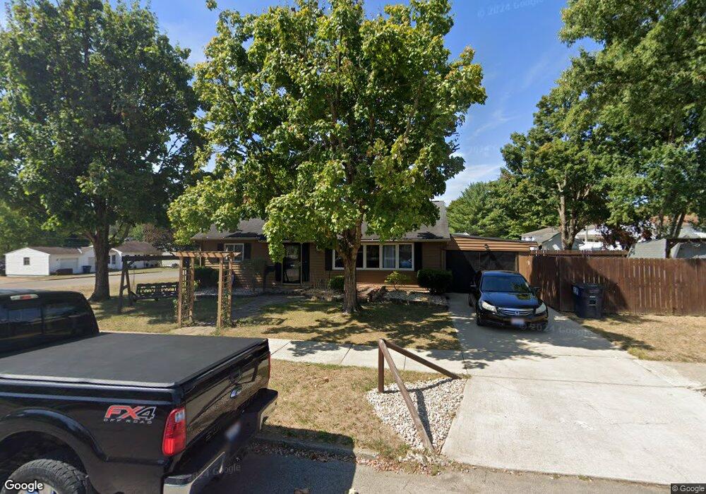
903 James Rd Lancaster, OH 43130
Estimated Value: $168,000 - $221,000
3
Beds
1
Bath
984
Sq Ft
$203/Sq Ft
Est. Value
About This Home
This home is located at 903 James Rd, Lancaster, OH 43130 and is currently estimated at $199,369, approximately $202 per square foot. 903 James Rd is a home located in Fairfield County with nearby schools including Medill Elementary School, Thomas Ewing Junior High School, and Lancaster High School.
Ownership History
Date
Name
Owned For
Owner Type
Purchase Details
Closed on
Jul 26, 2016
Sold by
Sparks Glenn E
Bought by
Eggleston Jeffrey W and Eggleston Susanna L
Current Estimated Value
Home Financials for this Owner
Home Financials are based on the most recent Mortgage that was taken out on this home.
Original Mortgage
$77,600
Outstanding Balance
$61,236
Interest Rate
3.56%
Mortgage Type
New Conventional
Estimated Equity
$138,133
Purchase Details
Closed on
Aug 9, 2011
Sold by
Sparks Tamara S
Bought by
Sparks Glenn E
Purchase Details
Closed on
Nov 6, 1997
Sold by
Est Eva E Zumbach
Bought by
Sparks Glenn E and Sparks Tamara S
Home Financials for this Owner
Home Financials are based on the most recent Mortgage that was taken out on this home.
Original Mortgage
$74,481
Interest Rate
7.42%
Mortgage Type
FHA
Purchase Details
Closed on
Jul 30, 1992
Sold by
Vaughan James O
Bought by
Zumbach Eva E
Create a Home Valuation Report for This Property
The Home Valuation Report is an in-depth analysis detailing your home's value as well as a comparison with similar homes in the area
Home Values in the Area
Average Home Value in this Area
Purchase History
| Date | Buyer | Sale Price | Title Company |
|---|---|---|---|
| Eggleston Jeffrey W | $80,000 | Transcounty Title Agency | |
| Sparks Glenn E | -- | Attorney | |
| Sparks Glenn E | $75,000 | -- | |
| Zumbach Eva E | $55,000 | -- |
Source: Public Records
Mortgage History
| Date | Status | Borrower | Loan Amount |
|---|---|---|---|
| Open | Eggleston Jeffrey W | $77,600 | |
| Previous Owner | Sparks Glenn E | $74,481 |
Source: Public Records
Tax History
| Year | Tax Paid | Tax Assessment Tax Assessment Total Assessment is a certain percentage of the fair market value that is determined by local assessors to be the total taxable value of land and additions on the property. | Land | Improvement |
|---|---|---|---|---|
| 2025 | $3,848 | $52,140 | $13,440 | $38,700 |
| 2024 | $3,848 | $42,800 | $10,710 | $32,090 |
| 2023 | $1,557 | $42,800 | $10,710 | $32,090 |
| 2022 | $1,563 | $42,800 | $10,710 | $32,090 |
| 2021 | $1,254 | $32,170 | $8,930 | $23,240 |
| 2020 | $1,202 | $32,170 | $8,930 | $23,240 |
| 2019 | $1,142 | $32,170 | $8,930 | $23,240 |
| 2018 | $1,093 | $26,120 | $8,930 | $17,190 |
| 2017 | $1,094 | $29,240 | $8,930 | $20,310 |
| 2016 | $1,065 | $29,240 | $8,930 | $20,310 |
| 2015 | $1,063 | $28,320 | $8,930 | $19,390 |
| 2014 | $1,012 | $28,320 | $8,930 | $19,390 |
| 2013 | $1,012 | $28,320 | $8,930 | $19,390 |
Source: Public Records
Map
Nearby Homes
- 1285 Huffer Ave
- 1066 Lanreco Blvd
- 1306 Shumaker Ave
- 1281 E Allen St
- 105 Dogwood Ln
- 1234 Stonehouse Ct Unit 1234
- 274 Kanawha Rd
- 1275 Stonington Ct Unit 1275
- 1286 Stonehill Ln
- 630 Sheridan Dr
- 641 Sheridan Dr
- 627 Sheridan Dr
- 1434 Pleasantville Rd
- 0 E Main St Unit 225040917
- 627 Harding Ave
- 1560 E Main St
- 245 Overlook Dr NE
- 1570 E Main St Unit 60
- 810 N Eastwood Ave
- 632 N Eastwood Ave
Your Personal Tour Guide
Ask me questions while you tour the home.