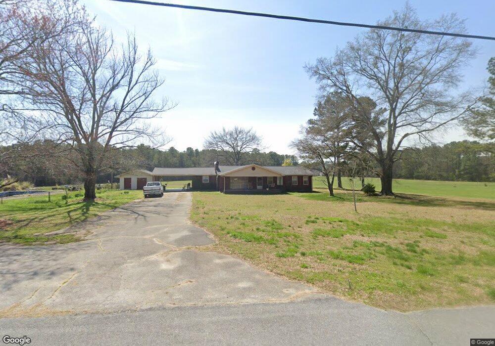
903 Stringer Rd Rockmart, GA 30153
Estimated Value: $272,000 - $370,000
3
Beds
2
Baths
1,956
Sq Ft
$154/Sq Ft
Est. Value
About This Home
This home is located at 903 Stringer Rd, Rockmart, GA 30153 and is currently estimated at $300,536, approximately $153 per square foot. 903 Stringer Rd is a home located in Polk County with nearby schools including Rockmart Middle School.
Ownership History
Date
Name
Owned For
Owner Type
Purchase Details
Closed on
Aug 14, 2009
Sold by
Phillips Ramah Ritter
Bought by
Phiilips Bobby Stephen
Current Estimated Value
Purchase Details
Closed on
May 3, 2002
Sold by
Conring Chris F and Conring Jada*
Bought by
Phiilips Ramah Ritter
Purchase Details
Closed on
Jul 7, 1993
Sold by
Phillips Ramah R Exe
Bought by
Phillips Ramah Ritte
Purchase Details
Closed on
Apr 12, 1993
Sold by
Phillips Carl Stephens
Bought by
Phillips Ramah Ritter As Executor F
Purchase Details
Closed on
Apr 23, 1979
Sold by
Stringer Joyce W
Bought by
Phillips Carl S
Purchase Details
Closed on
Jun 30, 1975
Bought by
Stringer Joyce W
Purchase Details
Closed on
Mar 12, 1964
Bought by
Stringe Joyce W
Create a Home Valuation Report for This Property
The Home Valuation Report is an in-depth analysis detailing your home's value as well as a comparison with similar homes in the area
Purchase History
| Date | Buyer | Sale Price | Title Company |
|---|---|---|---|
| Phiilips Bobby Stephen | -- | -- | |
| Phiilips Ramah Ritter | -- | -- | |
| Phillips Ramah Ritte | -- | -- | |
| Phillips Ramah Ritter As Executor F | -- | -- | |
| Phillips Carl S | -- | -- | |
| Stringer Joyce W | -- | -- | |
| Stringe Joyce W | -- | -- |
Source: Public Records
Tax History
| Year | Tax Paid | Tax Assessment Tax Assessment Total Assessment is a certain percentage of the fair market value that is determined by local assessors to be the total taxable value of land and additions on the property. | Land | Improvement |
|---|---|---|---|---|
| 2025 | $1,854 | $86,041 | $6,565 | $79,476 |
| 2024 | $1,722 | $84,400 | $4,924 | $79,476 |
| 2023 | $1,286 | $56,176 | $4,924 | $51,252 |
| 2022 | $1,079 | $47,479 | $3,283 | $44,196 |
| 2021 | $1,093 | $47,479 | $3,283 | $44,196 |
| 2020 | $1,096 | $47,479 | $3,283 | $44,196 |
| 2019 | $674 | $27,089 | $3,283 | $23,806 |
| 2018 | $674 | $26,465 | $3,283 | $23,182 |
| 2017 | $666 | $26,465 | $3,283 | $23,182 |
| 2016 | $643 | $25,614 | $2,432 | $23,182 |
| 2015 | $654 | $25,966 | $2,432 | $23,534 |
| 2014 | $659 | $25,966 | $2,432 | $23,534 |
Source: Public Records
Map
Nearby Homes
- 907 Stringer Rd
- 93 Clay Rd
- 397 Stringer Rd
- 461 Lakeview Rd
- 957 Bethlehem Rd
- 65 Wheeler Rd
- 0 Bethlehem Rd Unit 7730467
- 0 Bethlehem Rd Unit 10705308
- 184 Morgan Ln
- 18 Hillside Dr
- 865 Morgan Valley Rd
- 0 Tolbert Town Rd Unit 10640593
- 0 Tolbert Town Rd Unit 7678739
- 2512 Tolbert Town Rd
- 1714 Cedartown Hwy
- 3566 Rockmart Hwy
- 2056 Bellview Rd
- 60 Lee St
- 11 Lee St
- Lot 10 Sunset Loop
Your Personal Tour Guide
Ask me questions while you tour the home.