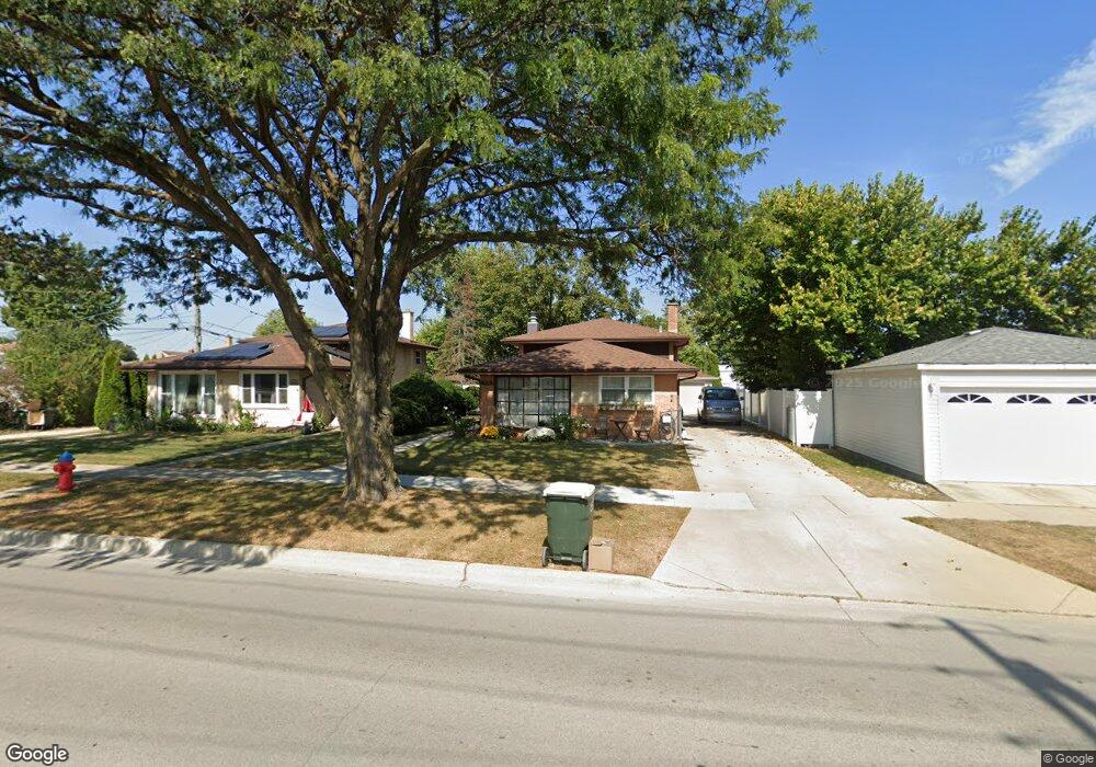
9030 Shields Ave Brookfield, IL 60513
Estimated Value: $374,000 - $392,000
3
Beds
2
Baths
1,450
Sq Ft
$264/Sq Ft
Est. Value
About This Home
This home is located at 9030 Shields Ave, Brookfield, IL 60513 and is currently estimated at $383,419, approximately $264 per square foot. 9030 Shields Ave is a home located in Cook County with nearby schools including Lincoln Elementary School, George Washington Middle School, and Lyons Township High School.
Ownership History
Date
Name
Owned For
Owner Type
Purchase Details
Closed on
Jan 17, 2012
Sold by
Beneficial Financial 1 Inc
Bought by
Hasanbegovic Kenan and Hasanbegovic Belma
Current Estimated Value
Home Financials for this Owner
Home Financials are based on the most recent Mortgage that was taken out on this home.
Original Mortgage
$153,994
Outstanding Balance
$102,176
Interest Rate
3.62%
Mortgage Type
FHA
Estimated Equity
$281,243
Purchase Details
Closed on
Jun 21, 2011
Sold by
Daltorio Joann M
Bought by
Beneficial Financial 1 Inc
Purchase Details
Closed on
Jul 7, 1998
Sold by
Behnke Mary
Bought by
Daltorio Paul J and Daltorio Joann M
Home Financials for this Owner
Home Financials are based on the most recent Mortgage that was taken out on this home.
Original Mortgage
$131,600
Interest Rate
7.03%
Create a Home Valuation Report for This Property
The Home Valuation Report is an in-depth analysis detailing your home's value as well as a comparison with similar homes in the area
Home Values in the Area
Average Home Value in this Area
Purchase History
| Date | Buyer | Sale Price | Title Company |
|---|---|---|---|
| Hasanbegovic Kenan | $158,000 | Premier Title | |
| Beneficial Financial 1 Inc | -- | Premier Title | |
| Daltorio Paul J | $164,500 | -- |
Source: Public Records
Mortgage History
| Date | Status | Borrower | Loan Amount |
|---|---|---|---|
| Open | Hasanbegovic Kenan | $153,994 | |
| Previous Owner | Daltorio Paul J | $131,600 |
Source: Public Records
Tax History
| Year | Tax Paid | Tax Assessment Tax Assessment Total Assessment is a certain percentage of the fair market value that is determined by local assessors to be the total taxable value of land and additions on the property. | Land | Improvement |
|---|---|---|---|---|
| 2025 | $8,159 | $28,637 | $5,438 | $23,199 |
| 2024 | $8,159 | $28,637 | $5,438 | $23,199 |
| 2023 | $6,634 | $29,948 | $5,438 | $24,510 |
| 2022 | $6,634 | $21,852 | $4,688 | $17,164 |
| 2021 | $7,003 | $23,675 | $4,687 | $18,988 |
| 2020 | $7,809 | $25,595 | $4,687 | $20,908 |
| 2019 | $6,903 | $22,185 | $4,312 | $17,873 |
| 2018 | $6,632 | $22,185 | $4,312 | $17,873 |
| 2017 | $6,328 | $22,185 | $4,312 | $17,873 |
| 2016 | $5,631 | $18,047 | $3,750 | $14,297 |
| 2015 | $5,382 | $18,047 | $3,750 | $14,297 |
| 2014 | $5,202 | $18,047 | $3,750 | $14,297 |
| 2013 | $5,155 | $18,700 | $3,750 | $14,950 |
Source: Public Records
Map
Nearby Homes
- 4239 Park Ave
- 4417 Arthur Ave
- 4118 Prairie Ave
- 4341 Madison Ave
- 4023 Oak Ave
- 4032 Prairie Ave
- 8834 Plainfield Rd
- 8820 Plainfield Rd
- 8745 43rd St
- 4214 Deyo Ave
- 8803 Ogden Ave
- 4247 Anna Ave
- 4021 Deyo Ave
- 9016 Southview Ave
- 4218 Konrad Ave
- 9031 Fairview Ave
- 8625 43rd St
- 4423 Eberly Ave
- 4627 Custer Ave
- 4040 Rose Ave
Your Personal Tour Guide
Ask me questions while you tour the home.