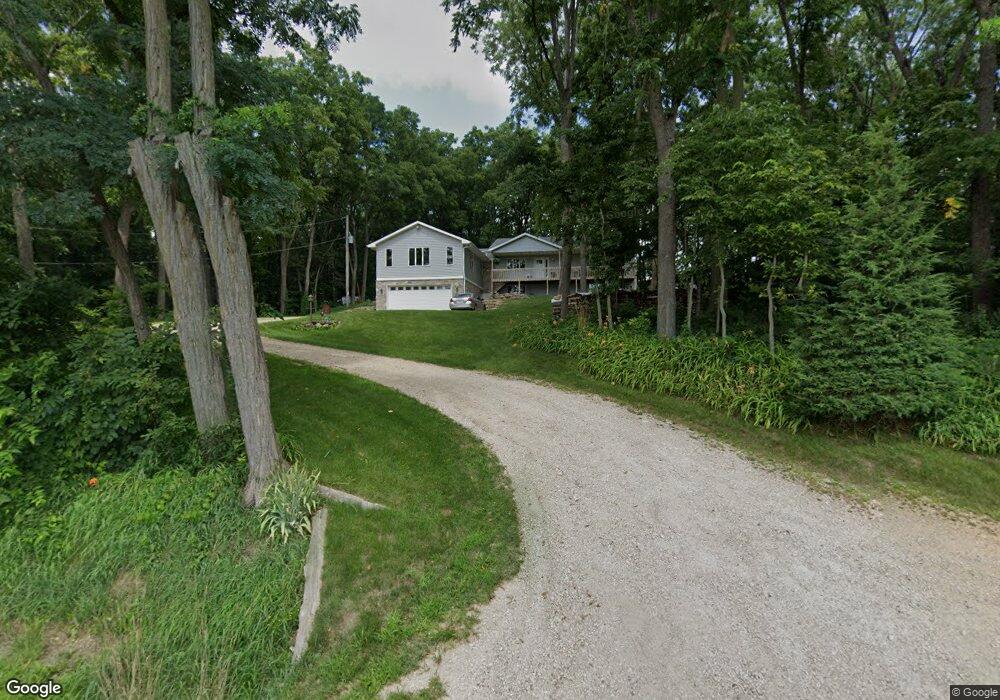
9030 W Mineral Point Rd Mount Horeb, WI 53572
Estimated Value: $567,000 - $599,000
--
Bed
--
Bath
--
Sq Ft
2.41
Acres
About This Home
This home is located at 9030 W Mineral Point Rd, Mount Horeb, WI 53572 and is currently estimated at $587,905. 9030 W Mineral Point Rd is a home located in Dane County with nearby schools including Mount Horeb Intermediate School, Mount Horeb Primary Center, and Mount Horeb Middle School.
Ownership History
Date
Name
Owned For
Owner Type
Purchase Details
Closed on
Dec 18, 2006
Sold by
Bollig Douglas M
Bought by
Bollig Douglas M and Bollig Shawn
Current Estimated Value
Home Financials for this Owner
Home Financials are based on the most recent Mortgage that was taken out on this home.
Original Mortgage
$176,000
Interest Rate
6.24%
Mortgage Type
New Conventional
Create a Home Valuation Report for This Property
The Home Valuation Report is an in-depth analysis detailing your home's value as well as a comparison with similar homes in the area
Home Values in the Area
Average Home Value in this Area
Purchase History
| Date | Buyer | Sale Price | Title Company |
|---|---|---|---|
| Bollig Douglas M | -- | None Available |
Source: Public Records
Mortgage History
| Date | Status | Borrower | Loan Amount |
|---|---|---|---|
| Closed | Bollig Douglas M | $176,000 |
Source: Public Records
Tax History Compared to Growth
Tax History
| Year | Tax Paid | Tax Assessment Tax Assessment Total Assessment is a certain percentage of the fair market value that is determined by local assessors to be the total taxable value of land and additions on the property. | Land | Improvement |
|---|---|---|---|---|
| 2024 | $6,222 | $536,600 | $208,200 | $328,400 |
| 2023 | $5,738 | $329,900 | $116,300 | $213,600 |
| 2021 | $5,219 | $329,900 | $116,300 | $213,600 |
| 2020 | $5,265 | $329,900 | $116,300 | $213,600 |
| 2019 | $4,970 | $329,900 | $116,300 | $213,600 |
| 2018 | $5,038 | $329,900 | $116,300 | $213,600 |
| 2017 | $5,286 | $329,900 | $116,300 | $213,600 |
| 2016 | $4,854 | $329,900 | $116,300 | $213,600 |
| 2015 | $4,839 | $329,900 | $116,300 | $213,600 |
| 2014 | $5,340 | $329,900 | $116,300 | $213,600 |
| 2013 | $4,221 | $329,900 | $116,300 | $213,600 |
Source: Public Records
Map
Nearby Homes
- 21.99 Observatory Rd
- 0 Observatory Rd Unit 24972390
- Lot 1 County Rd S
- Lot 3 County Rd S
- 4274 County Road P
- County Road J
- State Hwy 78 Trunk
- County Highway J
- 4435 Gil's Way
- Gil's Way
- 1768 Cornerstone Dr
- 1769 Woodford Rd
- 1771 Woodford Rd
- 1773 Woodford Rd
- 1777 Woodford Rd
- 1778 Cornerstone Dr
- 1779 Woodford Rd
- 1780 Cornerstone Dr
- 35.17 ac Gil's Way
- 1782 Cornerstone Dr
- 9042 W Mineral Point Rd
- 9045 W Mineral Point Rd
- 9019 W Mineral Point Rd
- 3725 Red Hawk Ln
- 3697 Red Hawk Ln
- 3810 Barlow Rd
- 3675 Red Hawk Ln
- 9141 W Mineral Point Rd
- 3649 Red Hawk Ln
- 3620 Red Hawk Ln
- Lot 3 W Mineral Point Rd
- Lot 2 W Mineral Point Rd
- Lot 1 W Mineral Point Rd
- 0 Red Hawk Ln Unit 1624448
- 8880 W Mineral Point Rd
- 8878 W Mineral Point Rd
- 9180 W Mineral Point Rd
- 9198 W Mineral Point Rd
- 3599 Wild Deer Trail
- 9220 W Mineral Point Rd