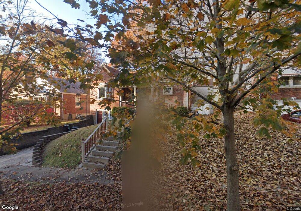
9033 Mcnulty Dr Saint Louis, MO 63114
Estimated Value: $150,000 - $191,000
2
Beds
1
Bath
1,089
Sq Ft
$152/Sq Ft
Est. Value
About This Home
This home is located at 9033 Mcnulty Dr, Saint Louis, MO 63114 and is currently estimated at $165,419, approximately $151 per square foot. 9033 Mcnulty Dr is a home located in St. Louis County with nearby schools including Marvin Elementary School, Ritenour Middle School, and Ritenour Senior High School.
Ownership History
Date
Name
Owned For
Owner Type
Purchase Details
Closed on
Oct 23, 1997
Sold by
Tjr Schaefermeier Richard and Tjr Maureen
Bought by
Wood Kathe Ann and Schaefermeier Richard David
Current Estimated Value
Create a Home Valuation Report for This Property
The Home Valuation Report is an in-depth analysis detailing your home's value as well as a comparison with similar homes in the area
Home Values in the Area
Average Home Value in this Area
Purchase History
| Date | Buyer | Sale Price | Title Company |
|---|---|---|---|
| Wood Kathe Ann | -- | -- |
Source: Public Records
Tax History Compared to Growth
Tax History
| Year | Tax Paid | Tax Assessment Tax Assessment Total Assessment is a certain percentage of the fair market value that is determined by local assessors to be the total taxable value of land and additions on the property. | Land | Improvement |
|---|---|---|---|---|
| 2025 | $2,119 | $32,170 | $7,960 | $24,210 |
| 2024 | $2,119 | $24,510 | $1,600 | $22,910 |
| 2023 | $2,077 | $24,510 | $1,600 | $22,910 |
| 2022 | $1,893 | $19,550 | $3,170 | $16,380 |
| 2021 | $1,892 | $19,550 | $3,170 | $16,380 |
| 2020 | $1,848 | $17,550 | $3,930 | $13,620 |
| 2019 | $1,828 | $17,550 | $3,930 | $13,620 |
| 2018 | $1,883 | $16,300 | $2,030 | $14,270 |
| 2017 | $1,798 | $16,300 | $2,030 | $14,270 |
| 2016 | $1,652 | $15,050 | $2,410 | $12,640 |
| 2015 | $1,690 | $15,050 | $2,410 | $12,640 |
| 2014 | $1,603 | $14,500 | $1,670 | $12,830 |
Source: Public Records
Map
Nearby Homes
- 9015 Mcnulty Dr
- 9060 Patrick Dr
- 9047 Kathlyn Dr
- 9207 Bataan Dr
- 9018 Gedde Ave
- 3562 Boswell Ave
- 3563 Boswell Ave
- 13 Jonell Ct
- 8909 Tutwiler Ave
- 4210 Gordon Ave
- 9033 Trefore Ave
- 9006 Bessemer Ave
- 3534 Calvert Ave
- 9422 Chester Ave
- 4359 Boswell Ave
- 9427 Bataan Dr Unit 2
- 9429 Burdella Ave
- 8718 Mavis Place
- 4421 Boswell Ave
- 9436 North Ave
- 9037 Mcnulty Dr
- 9029 Mcnulty Dr
- 9041 Mcnulty Dr
- 9045 Mcnulty Dr
- 9027 Mcnulty Dr
- 9023 Mcnulty Dr
- 9033 Bobb Ave
- 9029 Bobb Ave
- 9049 Mcnulty Dr
- 9037 Bobb Ave
- 9034 Mcnulty Dr
- 9038 Mcnulty Dr
- 9025 Bobb Ave
- 9030 Mcnulty Dr
- 9019 Mcnulty Dr
- 9041 Bobb Ave
- 9042 Mcnulty Dr
- 9026 Mcnulty Dr
- 9019 Bobb Ave
- 9045 Bobb Ave