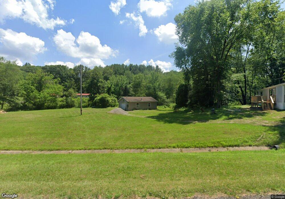
9034 State Route 39 NE Sherrodsville, OH 44675
Estimated Value: $55,000 - $273,000
3
Beds
2
Baths
1,716
Sq Ft
$119/Sq Ft
Est. Value
About This Home
This home is located at 9034 State Route 39 NE, Sherrodsville, OH 44675 and is currently estimated at $204,848, approximately $119 per square foot. 9034 State Route 39 NE is a home located in Tuscarawas County with nearby schools including Tuscarawas Valley Primary School, Tuscarawas Valley Intermediate School, and Tuscarawas Valley Middle School.
Ownership History
Date
Name
Owned For
Owner Type
Purchase Details
Closed on
Oct 30, 2020
Sold by
Merryman Edward T and Alsept Vicesaha K
Bought by
Ball Brittany and Odell Kevin
Current Estimated Value
Home Financials for this Owner
Home Financials are based on the most recent Mortgage that was taken out on this home.
Original Mortgage
$131,920
Outstanding Balance
$117,390
Interest Rate
2.8%
Mortgage Type
New Conventional
Estimated Equity
$87,458
Purchase Details
Closed on
Mar 13, 2013
Sold by
Merryman Carol J
Bought by
Merryman Edward Thomas
Purchase Details
Closed on
Oct 1, 2010
Sold by
Price Vicki L
Bought by
Merryman Edward and Merrman Carol J
Create a Home Valuation Report for This Property
The Home Valuation Report is an in-depth analysis detailing your home's value as well as a comparison with similar homes in the area
Home Values in the Area
Average Home Value in this Area
Purchase History
| Date | Buyer | Sale Price | Title Company |
|---|---|---|---|
| Ball Brittany | $164,900 | Colonial Title Agency | |
| Merryman Edward Thomas | -- | None Available | |
| Merryman Carol J | -- | None Available | |
| Merryman Edward | $114,900 | Alban Title |
Source: Public Records
Mortgage History
| Date | Status | Borrower | Loan Amount |
|---|---|---|---|
| Open | Ball Brittany | $131,920 |
Source: Public Records
Tax History Compared to Growth
Tax History
| Year | Tax Paid | Tax Assessment Tax Assessment Total Assessment is a certain percentage of the fair market value that is determined by local assessors to be the total taxable value of land and additions on the property. | Land | Improvement |
|---|---|---|---|---|
| 2024 | $2,111 | $51,600 | $10,090 | $41,510 |
| 2023 | $2,111 | $147,430 | $28,840 | $118,590 |
| 2022 | $2,115 | $51,601 | $10,094 | $41,507 |
| 2021 | $1,918 | $45,546 | $10,469 | $35,077 |
| 2020 | $1,552 | $45,546 | $10,469 | $35,077 |
| 2019 | $1,562 | $45,546 | $10,469 | $35,077 |
| 2018 | $1,326 | $38,440 | $8,840 | $29,600 |
| 2017 | $1,351 | $38,440 | $8,840 | $29,600 |
| 2016 | $1,336 | $38,440 | $8,840 | $29,600 |
| 2014 | $1,279 | $35,560 | $7,070 | $28,490 |
| 2013 | $1,022 | $35,560 | $7,070 | $28,490 |
Source: Public Records
Map
Nearby Homes
- 0 Cutler Rd NE Unit 5156445
- 0 Cutler Rd NE Unit 5156452
- 0 Cutler Rd NE Unit 5156457
- 1223 New Cumberland Rd NE
- 240 S Church St
- 6006 Echo Lake Rd NE
- 9156 Cherry Ln NE
- 4414 Cumberland Rd SW Unit 9
- 9248 Lakewood Dr NE
- 6285 Adams Rd NE
- 9035 N Shore Dr NE
- 0 Azalea Rd SW
- 9203 Azalea Rd SW
- 3340 Lombardy Rd SW
- 1734 Barnhill Rd
- 0 Irish Run Rd SE
- 2258 Laurel Dr
- 1728 Tall Timber Rd NE
- 150 W Green St
- 0 Deer Rd SW
- 9062 State Route 39 NE
- 9006 State Route 39 NE
- 9011 State Route 39 NE
- 9120 State Route 39 NE
- 9170 NE State Route 39
- 9081 State Route 39 NE
- 8911 State Route 39 NE
- 9179 State Route 39 NE
- 754 Oak Dale Rd NE
- 790 Oak Dale Rd NE
- 798 Oak Dale Rd NE
- 9332 State Route 39 NE
- 8467 Old Roswell Rd NE
- 8415 Old Roswell Rd NE
- 8381 Old Roswell Rd NE
- 8658 State Route 39 NE
- 8473 Old Roswell Rd NE
- 8367 Old Roswell Rd NE
- 8259 Old Roswell Rd NE
- 810 Oak Dale Rd NE