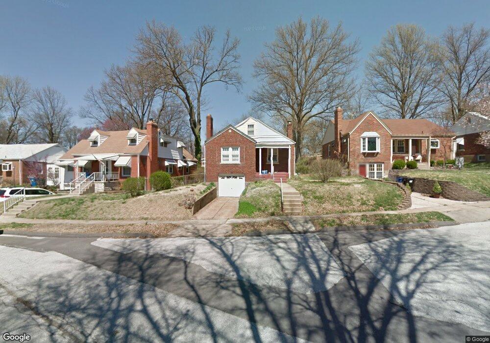
9037 Mcnulty Dr Saint Louis, MO 63114
Estimated Value: $106,000 - $173,000
2
Beds
1
Bath
1,218
Sq Ft
$122/Sq Ft
Est. Value
About This Home
This home is located at 9037 Mcnulty Dr, Saint Louis, MO 63114 and is currently estimated at $148,667, approximately $122 per square foot. 9037 Mcnulty Dr is a home located in St. Louis County with nearby schools including Marvin Elementary School, Ritenour Middle School, and Ritenour Senior High School.
Ownership History
Date
Name
Owned For
Owner Type
Purchase Details
Closed on
May 19, 2014
Sold by
Mill Land Company Inc
Bought by
Ggyo Llc
Current Estimated Value
Home Financials for this Owner
Home Financials are based on the most recent Mortgage that was taken out on this home.
Original Mortgage
$204,750
Outstanding Balance
$155,985
Interest Rate
4.32%
Mortgage Type
Future Advance Clause Open End Mortgage
Estimated Equity
-$7,318
Purchase Details
Closed on
Jan 13, 2014
Sold by
Aish Properties Lc
Bought by
Eagle Bank & Trust Company
Purchase Details
Closed on
Aug 23, 2010
Sold by
Swetz Greg
Bought by
Aish Properties Lc
Home Financials for this Owner
Home Financials are based on the most recent Mortgage that was taken out on this home.
Original Mortgage
$46,400
Interest Rate
4.41%
Mortgage Type
Construction
Purchase Details
Closed on
Jan 29, 2010
Sold by
Richardson Virginia H and Richardson Robert S
Bought by
Swetz Greg
Create a Home Valuation Report for This Property
The Home Valuation Report is an in-depth analysis detailing your home's value as well as a comparison with similar homes in the area
Home Values in the Area
Average Home Value in this Area
Purchase History
| Date | Buyer | Sale Price | Title Company |
|---|---|---|---|
| Ggyo Llc | $227,500 | Hillsboro Title Company | |
| Eagle Bank & Trust Company | $35,000 | None Available | |
| Aish Properties Lc | -- | Hillsboro Title Company | |
| Swetz Greg | $10,500 | Integrity Land Title Co Inc |
Source: Public Records
Mortgage History
| Date | Status | Borrower | Loan Amount |
|---|---|---|---|
| Open | Ggyo Llc | $204,750 | |
| Previous Owner | Aish Properties Lc | $46,400 |
Source: Public Records
Tax History
| Year | Tax Paid | Tax Assessment Tax Assessment Total Assessment is a certain percentage of the fair market value that is determined by local assessors to be the total taxable value of land and additions on the property. | Land | Improvement |
|---|---|---|---|---|
| 2025 | $1,935 | $28,820 | $7,960 | $20,860 |
| 2024 | $1,935 | $22,350 | $1,600 | $20,750 |
| 2023 | $1,896 | $22,350 | $1,600 | $20,750 |
| 2022 | $1,751 | $18,070 | $3,190 | $14,880 |
| 2021 | $1,751 | $18,070 | $3,190 | $14,880 |
| 2020 | $1,725 | $16,360 | $3,930 | $12,430 |
| 2019 | $1,706 | $16,360 | $3,930 | $12,430 |
| 2018 | $1,704 | $14,720 | $2,030 | $12,690 |
| 2017 | $1,626 | $14,720 | $2,030 | $12,690 |
| 2016 | $1,494 | $13,580 | $2,410 | $11,170 |
Source: Public Records
Map
Nearby Homes
- 9056 Mcnulty Dr
- 9047 Kathlyn Dr
- 8910 Harold Dr
- 9207 Bataan Dr
- 3630 Brown Rd
- 9225 Corregidor Ave
- 8811 North Ave
- 9121 Guthrie Ave
- 9310 Shirley Gardens Dr
- 9406 Bataan Dr
- 9422 Chester Ave
- 3315 Eminence Blvd
- 3311 Eminence Blvd
- 8710 Ezra Dr
- 3304 S Gordon Ct
- 8728 Susan Ave
- 8647 Belcrest Ln
- 9255 Leith Ave
- 3355 Edmundson Rd
- 8570 North Ave
- 9033 Mcnulty Dr
- 9041 Mcnulty Dr
- 9045 Mcnulty Dr
- 9029 Mcnulty Dr
- 9049 Mcnulty Dr
- 9038 Mcnulty Dr
- 9034 Mcnulty Dr
- 9037 Bobb Ave
- 9042 Mcnulty Dr
- 9027 Mcnulty Dr
- 9041 Bobb Ave
- 9053 Mcnulty Dr
- 9030 Mcnulty Dr
- 9029 Bobb Ave
- 9046 Mcnulty Dr
- 9045 Bobb Ave
- 9023 Mcnulty Dr
- 9025 Bobb Ave
- 9026 Mcnulty Dr
- 9019 Mcnulty Dr
Your Personal Tour Guide
Ask me questions while you tour the home.