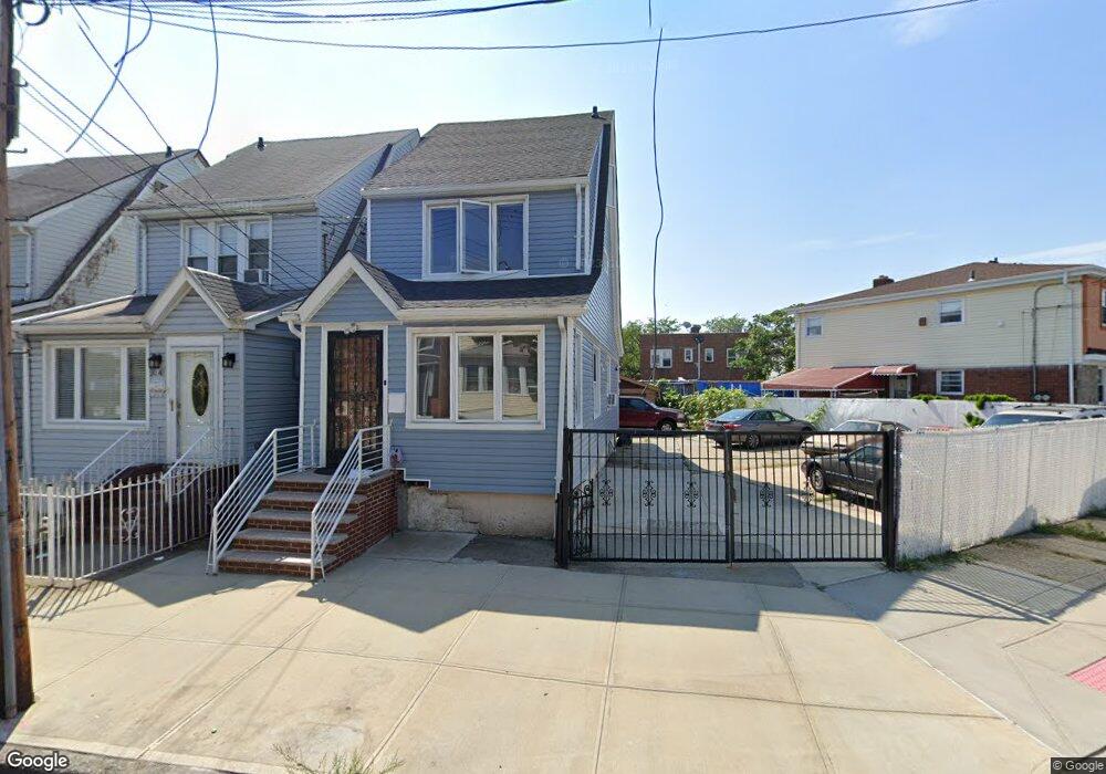
9038 Desarc Rd Ozone Park, NY 11417
Ozone Park NeighborhoodEstimated Value: $738,867 - $856,000
Studio
--
Bath
1,197
Sq Ft
$660/Sq Ft
Est. Value
About This Home
This home is located at 9038 Desarc Rd, Ozone Park, NY 11417 and is currently estimated at $790,217, approximately $660 per square foot. 9038 Desarc Rd is a home located in Queens County with nearby schools including P.S. 63 - Old South, Robert H. Goddard High School, and Divine Mercy Catholic Academy.
Ownership History
Date
Name
Owned For
Owner Type
Purchase Details
Closed on
Jun 7, 2019
Sold by
Hossain Mohammad Z and Uddin Mohin
Bought by
Uddin Mohin and Yeasmin Fahmidah
Current Estimated Value
Home Financials for this Owner
Home Financials are based on the most recent Mortgage that was taken out on this home.
Original Mortgage
$65,249
Outstanding Balance
$57,012
Interest Rate
4%
Mortgage Type
New Conventional
Estimated Equity
$733,205
Purchase Details
Closed on
Aug 9, 2018
Sold by
Santos Mark
Bought by
Hossain Mohammad Z and Uddin Mohin
Home Financials for this Owner
Home Financials are based on the most recent Mortgage that was taken out on this home.
Original Mortgage
$460,000
Interest Rate
4.5%
Mortgage Type
New Conventional
Purchase Details
Closed on
Dec 10, 2007
Sold by
Santos Susan and Santos William
Bought by
Santos Mark
Purchase Details
Closed on
Mar 28, 2006
Sold by
Taveras Jaime A
Bought by
Santos William
Home Financials for this Owner
Home Financials are based on the most recent Mortgage that was taken out on this home.
Original Mortgage
$96,000
Interest Rate
6.28%
Purchase Details
Closed on
Oct 29, 2004
Sold by
Rodriguez Renee Vee and Williams Joseph
Bought by
Taveras Jaime A
Home Financials for this Owner
Home Financials are based on the most recent Mortgage that was taken out on this home.
Original Mortgage
$348,000
Interest Rate
5.75%
Mortgage Type
Purchase Money Mortgage
Purchase Details
Closed on
May 18, 2001
Sold by
Schaub Marcela and Sollosqui Marcela
Bought by
Rodriguez Reneevee and Williams Joseph
Home Financials for this Owner
Home Financials are based on the most recent Mortgage that was taken out on this home.
Original Mortgage
$273,700
Interest Rate
7.09%
Purchase Details
Closed on
Mar 14, 1996
Sold by
Sollosqui Marcela and Sollosqui Daniel O
Bought by
Sollosqui Marcela and Sanchez Maria E
Create a Home Valuation Report for This Property
The Home Valuation Report is an in-depth analysis detailing your home's value as well as a comparison with similar homes in the area
Home Values in the Area
Average Home Value in this Area
Purchase History
| Date | Buyer | Sale Price | Title Company |
|---|---|---|---|
| Uddin Mohin | -- | -- | |
| Uddin Mohin | -- | -- | |
| Uddin Mohin | -- | -- | |
| Hossain Mohammad Z | $575,000 | -- | |
| Hossain Mohammad Z | $575,000 | -- | |
| Hossain Mohammad Z | $575,000 | -- | |
| Santos Mark | $399,000 | -- | |
| Santos Mark | $399,000 | -- | |
| Santos William | $480,000 | -- | |
| Santos William | $480,000 | -- | |
| Taveras Jaime A | $435,000 | -- | |
| Taveras Jaime A | $435,000 | -- | |
| Rodriguez Reneevee | -- | -- | |
| Rodriguez Reneevee | -- | -- | |
| Sollosqui Marcela | -- | -- | |
| Sollosqui Marcela | -- | -- |
Source: Public Records
Mortgage History
| Date | Status | Borrower | Loan Amount |
|---|---|---|---|
| Open | Uddin Mohin | $65,249 | |
| Closed | Uddin Mohin | $65,249 | |
| Previous Owner | Hossain Mohammad Z | $460,000 | |
| Previous Owner | Santos William | $96,000 | |
| Previous Owner | Santos William | $336,000 | |
| Previous Owner | Taveras Jaime A | $43,500 | |
| Previous Owner | Taveras Jaime A | $348,000 | |
| Previous Owner | Rodriguez Reneevee | $273,700 |
Source: Public Records
Tax History
| Year | Tax Paid | Tax Assessment Tax Assessment Total Assessment is a certain percentage of the fair market value that is determined by local assessors to be the total taxable value of land and additions on the property. | Land | Improvement |
|---|---|---|---|---|
| 2025 | $6,390 | $33,680 | $11,732 | $21,948 |
| 2024 | $6,390 | $31,814 | $10,700 | $21,114 |
| 2023 | $6,390 | $31,814 | $10,304 | $21,510 |
| 2022 | $4,604 | $44,340 | $15,780 | $28,560 |
| 2021 | $6,260 | $38,820 | $15,780 | $23,040 |
| 2020 | $5,941 | $34,860 | $15,780 | $19,080 |
| 2019 | $5,546 | $38,400 | $15,780 | $22,620 |
| 2018 | $5,404 | $26,512 | $11,602 | $14,910 |
| 2017 | $5,113 | $25,081 | $12,148 | $12,933 |
| 2016 | $4,956 | $25,081 | $12,148 | $12,933 |
| 2015 | $2,854 | $23,389 | $10,004 | $13,385 |
| 2014 | $2,854 | $22,094 | $9,395 | $12,699 |
Source: Public Records
Map
Nearby Homes
- 13723 Lafayette St
- 8851 Pitkin Ave
- 91-25 Gold Rd
- 8839 Pitkin Ave
- 8837 Pitkin Ave
- 13803 Lafayette St
- 9003 Albert Rd
- 8812 Albert Rd
- 13319 Crossbay Blvd
- 13716 88th St
- 9417 Pitkin Ave
- 13734 94th St
- 9439 134th Ave
- 9515 Pitkin Ave
- 95-03 149th Ave
- 96-06 134th Rd
- 9610 Linden Blvd
- 84-07 Sutter Ave
- 133-42 86th St
- 133-28 86th St
- 9040 Desarc Rd
- 9106 Linden Blvd
- 90-38 Desarc Rd
- 9042 Desarc Rd
- 9044 Desarc Rd
- 9102 Linden Blvd
- 90-46 Desarc Rd
- 9046 Desarc Rd
- 9035 Pitkin Ave
- 9039 Pitkin Ave
- 9048 Desarc Rd
- 9045 Pitkin Ave
- 9031 Pitkin Ave
- 9035 Pitkin Ave
- 134-35 Desarc Rd
- 9037 Pitkin Ave
- 9037 Pitkin Ave Unit 2
- 90-37 Pitkin Ave Unit 2
- 9031 Pitkin Ave
- 9047 Pitkin Ave
Your Personal Tour Guide
Ask me questions while you tour the home.