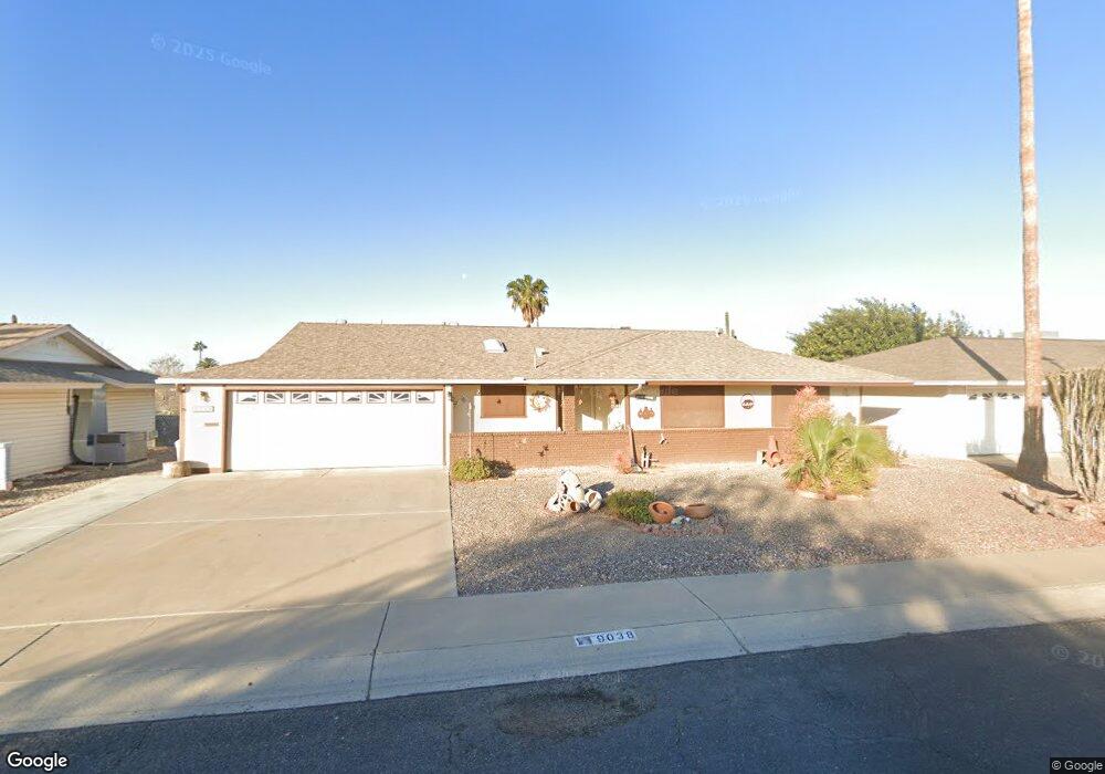
9038 N 102nd Dr Sun City, AZ 85351
Estimated Value: $285,712 - $318,000
3
Beds
2
Baths
1,448
Sq Ft
$209/Sq Ft
Est. Value
About This Home
This home is located at 9038 N 102nd Dr, Sun City, AZ 85351 and is currently estimated at $302,178, approximately $208 per square foot. 9038 N 102nd Dr is a home located in Maricopa County with nearby schools including Ombudsman - Northwest Charter and Peoria Accelerated High School.
Ownership History
Date
Name
Owned For
Owner Type
Purchase Details
Closed on
Feb 8, 2005
Sold by
Mcfarlane Marietta
Bought by
Lloyd Randy L and Lloyd Petra
Current Estimated Value
Home Financials for this Owner
Home Financials are based on the most recent Mortgage that was taken out on this home.
Original Mortgage
$131,200
Outstanding Balance
$66,599
Interest Rate
5.73%
Mortgage Type
Purchase Money Mortgage
Estimated Equity
$235,579
Purchase Details
Closed on
Mar 24, 1997
Sold by
Reed Carla R
Bought by
Mcfarlane William E and Mcfarlane Marietta M
Home Financials for this Owner
Home Financials are based on the most recent Mortgage that was taken out on this home.
Original Mortgage
$25,000
Interest Rate
7.86%
Mortgage Type
New Conventional
Create a Home Valuation Report for This Property
The Home Valuation Report is an in-depth analysis detailing your home's value as well as a comparison with similar homes in the area
Home Values in the Area
Average Home Value in this Area
Purchase History
| Date | Buyer | Sale Price | Title Company |
|---|---|---|---|
| Lloyd Randy L | $164,000 | Arizona Title Agency Inc | |
| Mcfarlane William E | $92,900 | Nations Title Insurance |
Source: Public Records
Mortgage History
| Date | Status | Borrower | Loan Amount |
|---|---|---|---|
| Open | Lloyd Randy L | $131,200 | |
| Previous Owner | Mcfarlane William E | $25,000 | |
| Closed | Lloyd Randy L | $16,400 |
Source: Public Records
Tax History Compared to Growth
Tax History
| Year | Tax Paid | Tax Assessment Tax Assessment Total Assessment is a certain percentage of the fair market value that is determined by local assessors to be the total taxable value of land and additions on the property. | Land | Improvement |
|---|---|---|---|---|
| 2025 | $956 | $11,767 | -- | -- |
| 2024 | $862 | $11,207 | -- | -- |
| 2023 | $862 | $21,130 | $4,220 | $16,910 |
| 2022 | $802 | $16,570 | $3,310 | $13,260 |
| 2021 | $829 | $15,480 | $3,090 | $12,390 |
| 2020 | $806 | $13,410 | $2,680 | $10,730 |
| 2019 | $803 | $12,370 | $2,470 | $9,900 |
| 2018 | $776 | $11,210 | $2,240 | $8,970 |
| 2017 | $746 | $9,910 | $1,980 | $7,930 |
| 2016 | $697 | $9,350 | $1,870 | $7,480 |
| 2015 | $667 | $8,330 | $1,660 | $6,670 |
Source: Public Records
Map
Nearby Homes
- 10201 W Caron Dr
- 10326 W Caron Dr
- 10001 W Caron Dr Unit 8
- 10221 W Puget Ave
- 10014 W Mission Ln
- 10109 W Mountain View Rd
- 9815 N 103rd Ave
- 10022 W Mountain View Rd
- 10316 W Salem Dr Unit 6D
- 9925 W Mountain View Rd Unit 27
- 9915 W Mountain View Rd
- 10166 W Cinnebar Ave
- 10302 W Cheryl Dr Unit D
- 9834 N Balboa Dr
- 8803 N 105th Dr
- 10131 W Cheryl Dr Unit 6D
- 8601 N 103rd Ave Unit 313
- 8601 N 103rd Ave Unit 271
- 8601 N 103rd Ave Unit 58
- 8601 N 103rd Ave Unit 72
- 9044 N 102nd Dr
- 9043 N 103rd Ave
- 9037 N 103rd Ave
- 9047 N 103rd Ave
- 9047 N 103rd Ave
- 9047 N 103rd Ave Unit 8
- 9050 N 102nd Dr Unit 8
- 9026 N 102nd Dr
- 9026 N 102nd Dr
- 9035 N 102nd Dr
- 10218 W Kelso Dr
- 9031 N 103rd Ave
- 9055 N 103rd Ave
- 9027 N 102nd Dr
- 9056 N 102nd Dr Unit 8
- 9022 N 102nd Dr
- 9059 N 103rd Ave
- 10210 W Kelso Dr Unit 8
- 9025 N 103rd Ave
- 10225 W Mission Ln