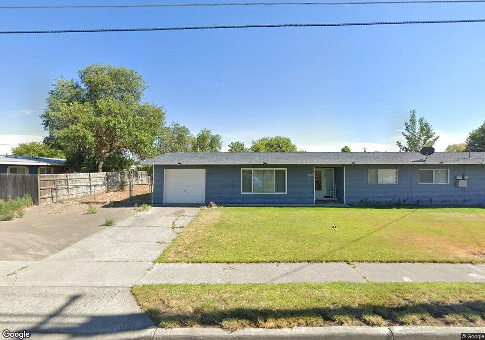
9039 Forrestal Ln Moses Lake, WA 98837
Estimated Value: $186,000 - $250,000
3
Beds
2
Baths
1,454
Sq Ft
$157/Sq Ft
Est. Value
About This Home
This home is located at 9039 Forrestal Ln, Moses Lake, WA 98837 and is currently estimated at $227,675, approximately $156 per square foot. 9039 Forrestal Ln is a home located in Grant County with nearby schools including Larson Heights Elementary School, Endeavor Middle School, and Moses Lake High School.
Ownership History
Date
Name
Owned For
Owner Type
Purchase Details
Closed on
Mar 6, 2019
Sold by
Gwyn Gerald Roger and Gwyn Marlene Susan
Bought by
Haer Carolyn M
Current Estimated Value
Home Financials for this Owner
Home Financials are based on the most recent Mortgage that was taken out on this home.
Original Mortgage
$99,170
Outstanding Balance
$87,010
Interest Rate
4.4%
Mortgage Type
FHA
Estimated Equity
$140,665
Purchase Details
Closed on
May 6, 2011
Sold by
Gwyn Gerald R and Gwyn Marlene S
Bought by
The Jerry & Marlene Gwyn Family Trust
Purchase Details
Closed on
Jan 3, 2005
Sold by
Stroud Douglas L and Stroud Carol A
Bought by
Gwyn Gerald R and Gwyn Marlene S
Home Financials for this Owner
Home Financials are based on the most recent Mortgage that was taken out on this home.
Original Mortgage
$80,500
Interest Rate
5.7%
Mortgage Type
New Conventional
Create a Home Valuation Report for This Property
The Home Valuation Report is an in-depth analysis detailing your home's value as well as a comparison with similar homes in the area
Home Values in the Area
Average Home Value in this Area
Purchase History
| Date | Buyer | Sale Price | Title Company |
|---|---|---|---|
| Haer Carolyn M | $101,000 | Stewart Title | |
| The Jerry & Marlene Gwyn Family Trust | -- | None Available | |
| Gwyn Gerald R | -- | Security Title Guaranty Inc |
Source: Public Records
Mortgage History
| Date | Status | Borrower | Loan Amount |
|---|---|---|---|
| Open | Haer Carolyn M | $99,170 | |
| Previous Owner | Gwyn Gerald R | $80,500 |
Source: Public Records
Tax History Compared to Growth
Tax History
| Year | Tax Paid | Tax Assessment Tax Assessment Total Assessment is a certain percentage of the fair market value that is determined by local assessors to be the total taxable value of land and additions on the property. | Land | Improvement |
|---|---|---|---|---|
| 2025 | $1,716 | $170,102 | -- | -- |
| 2024 | $1,868 | $160,330 | $22,500 | $137,830 |
| 2023 | $1,549 | $107,910 | $22,500 | $85,410 |
| 2022 | $1,369 | $107,910 | $22,500 | $85,410 |
| 2021 | $1,178 | $107,910 | $22,500 | $85,410 |
| 2020 | $1,433 | $88,940 | $22,500 | $66,440 |
| 2019 | $1,443 | $93,970 | $20,000 | $73,970 |
| 2018 | $1,480 | $90,595 | $20,000 | $70,595 |
| 2017 | $1,315 | $90,595 | $20,000 | $70,595 |
| 2016 | $1,212 | $81,695 | $20,000 | $61,695 |
| 2013 | -- | $76,085 | $20,000 | $56,085 |
Source: Public Records
Map
Nearby Homes
- 9035 Forrestal Ln
- 9023 Mcconnell Dr Unit A
- 9021 Mcconnell Dr Unit A
- 9016 Bong Loop Unit B
- 141 Carswell Dr
- 9008 Bong Loop Unit B
- 205 March Dr NE
- 410 Biggs Dr NE
- 8958 Tinker Loop Unit A & B
- 8910 Travis Dr Unit B
- 7613 Cox St NE
- 1127 Arlington Dr
- 4926 Shorecrest Dr NE
- 4898 Shorecrest Dr NE
- 4815 Airway Dr NE Unit 86
- 4815 Airway Dr NE Unit 72
- 4815 Airway Dr NE Unit 12
- 8653 Harris Rd NE
- 8674 Vince Rd NE
- 0 Harris Road Ne & Ray Rd NE Unit NWM2453754
- 9039 Forrestal Ln Unit B
- 9040 A & B Forrestal Ln
- 9037 Mcconnell Dr
- 9041 Forrestal Ln
- 9035 Forrestal Ln Unit A + B
- 9042 Forrestal Ln Unit A
- 9042 Forrestal Ln
- 9042 Forrestal Ln
- 9023 Mcconnell Dr
- 9023 Mcconnell Dr Unit A & B
- 9038B Forrestal Ln
- 9031 A & B Mc Connell Dr
- 9025 Mcconnell Dr
- 9046 Forrestal Ln
- 9046 Forrestal Ln Unit B
- 9045 Forrestal Ln
- 9045 Forrestal Ln
- 9019 Daley Dr
- 9034 Mcconnell Dr
- 9036 Mcconnell Dr