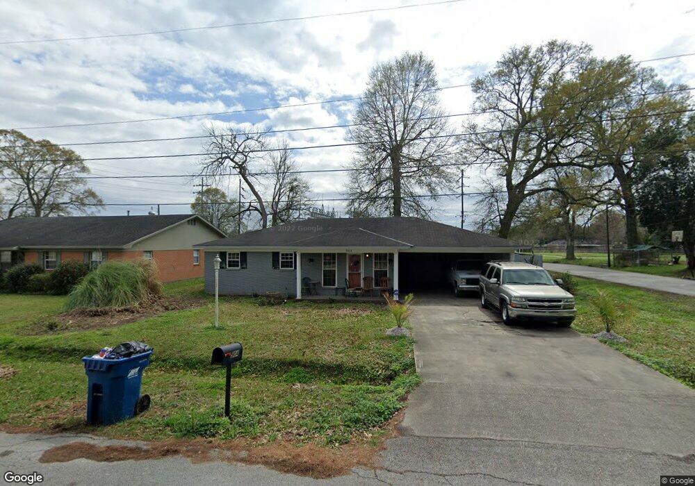
904 Amilcar Blvd Lafayette, LA 70501
Larabee NeighborhoodEstimated Value: $124,000 - $142,000
3
Beds
2
Baths
1,294
Sq Ft
$101/Sq Ft
Est. Value
About This Home
This home is located at 904 Amilcar Blvd, Lafayette, LA 70501 and is currently estimated at $131,149, approximately $101 per square foot. 904 Amilcar Blvd is a home located in Lafayette Parish with nearby schools including J.W. Faulk Elementary School, Paul Breaux Middle School, and Northside High School.
Ownership History
Date
Name
Owned For
Owner Type
Purchase Details
Closed on
Jun 7, 2011
Sold by
Wells Fargo Bank Na
Bought by
Federal Home Loan Mortgag Corp
Current Estimated Value
Purchase Details
Closed on
Dec 20, 2007
Sold by
Clay Donald James
Bought by
Howard Tommy Keith and Howard Lilly Matthe
Home Financials for this Owner
Home Financials are based on the most recent Mortgage that was taken out on this home.
Original Mortgage
$115,000
Interest Rate
6.23%
Mortgage Type
New Conventional
Purchase Details
Closed on
May 2, 2007
Sold by
Mississippi Land Co Inc
Bought by
State Of Louisiana
Purchase Details
Closed on
May 5, 2006
Sold by
Clay Donald James and State Of Louisiana
Bought by
Mississippi Land Co Inc
Create a Home Valuation Report for This Property
The Home Valuation Report is an in-depth analysis detailing your home's value as well as a comparison with similar homes in the area
Home Values in the Area
Average Home Value in this Area
Purchase History
| Date | Buyer | Sale Price | Title Company |
|---|---|---|---|
| Federal Home Loan Mortgag Corp | $62,500 | None Available | |
| Howard Tommy Keith | $115,000 | None Available | |
| State Of Louisiana | -- | None Available | |
| Mississippi Land Co Inc | $905 | None Available |
Source: Public Records
Mortgage History
| Date | Status | Borrower | Loan Amount |
|---|---|---|---|
| Previous Owner | Howard Tommy Keith | $115,000 |
Source: Public Records
Tax History Compared to Growth
Tax History
| Year | Tax Paid | Tax Assessment Tax Assessment Total Assessment is a certain percentage of the fair market value that is determined by local assessors to be the total taxable value of land and additions on the property. | Land | Improvement |
|---|---|---|---|---|
| 2024 | $1,140 | $10,839 | $1,034 | $9,805 |
| 2023 | $1,140 | $10,373 | $1,034 | $9,339 |
| 2022 | $1,085 | $10,373 | $1,034 | $9,339 |
| 2021 | $1,089 | $10,373 | $1,034 | $9,339 |
| 2020 | $1,085 | $10,373 | $1,034 | $9,339 |
| 2019 | $855 | $10,373 | $1,034 | $9,339 |
| 2018 | $1,059 | $10,373 | $1,034 | $9,339 |
| 2017 | $1,057 | $10,373 | $1,034 | $9,339 |
| 2015 | $920 | $9,039 | $1,000 | $8,039 |
| 2013 | -- | $9,040 | $1,000 | $8,040 |
Source: Public Records
Map
Nearby Homes
- 103 Calais St
- 114 Japonica Dr
- 906 & 908 Center St
- 106 Wallace Dr
- 211 Teurlings Dr
- 900 Teurlings Dr
- 253 Sherwood Dr
- Justin Plan at Cedar Creek
- Huntsville Plan at Cedar Creek
- Lakeview Plan at Cedar Creek
- Bellvue Plan at Cedar Creek
- Denton Plan at Cedar Creek
- Fargo Plan at Cedar Creek
- Kingston Plan at Cedar Creek
- Cali Plan at Cedar Creek
- Rosemont Plan at Cedar Creek
- 1750 E Willow St
- 2401 Louisiana Ave
- 2400 Blk Louisiana Ave
- 205 Rue Viansa
- 908 Amilcar Blvd
- 830 Amilcar Blvd
- 910 Amilcar Blvd
- 114 Margaret St
- 114 Margaret St
- 828 Amilcar Blvd
- 111 Calais St
- 100 Denver Cir
- 102 Denver Cir
- 112 Margaret St
- 115 Margaret St
- 109 Calais St
- 826 Amilcar Blvd
- 103 Denver Cir
- 110 Margaret St
- 101 Denver Cir
- 113 Margaret St
- 105 Denver Cir
- 107 Calais St
- 111 Margaret St