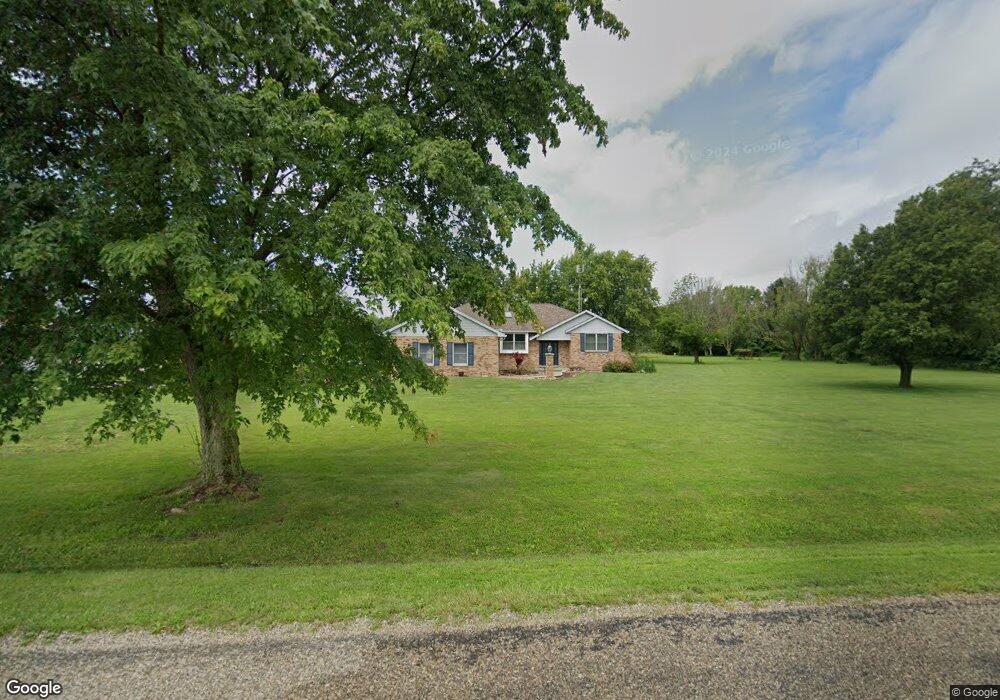
904 Coalshaft Bridge Rd Sullivan, IL 61951
Estimated Value: $132,000 - $470,000
3
Beds
2
Baths
1,891
Sq Ft
$169/Sq Ft
Est. Value
About This Home
This home is located at 904 Coalshaft Bridge Rd, Sullivan, IL 61951 and is currently estimated at $319,337, approximately $168 per square foot. 904 Coalshaft Bridge Rd is a home located in Moultrie County with nearby schools including Sullivan Elementary School, Sullivan Middle School, and Sullivan High School.
Ownership History
Date
Name
Owned For
Owner Type
Purchase Details
Closed on
Jul 18, 2023
Sold by
Marie Nalley Stadler Trust
Bought by
Peterson Jacob L
Current Estimated Value
Home Financials for this Owner
Home Financials are based on the most recent Mortgage that was taken out on this home.
Original Mortgage
$423,922
Outstanding Balance
$413,620
Interest Rate
6.69%
Mortgage Type
VA
Estimated Equity
-$94,283
Purchase Details
Closed on
May 20, 2016
Sold by
Stalder Marie Nelley
Bought by
Stalder Marie Nelley and Stalder Trust
Create a Home Valuation Report for This Property
The Home Valuation Report is an in-depth analysis detailing your home's value as well as a comparison with similar homes in the area
Home Values in the Area
Average Home Value in this Area
Purchase History
| Date | Buyer | Sale Price | Title Company |
|---|---|---|---|
| Peterson Jacob L | -- | None Listed On Document | |
| Stalder Marie Nelley | -- | -- |
Source: Public Records
Mortgage History
| Date | Status | Borrower | Loan Amount |
|---|---|---|---|
| Open | Peterson Jacob L | $423,922 |
Source: Public Records
Tax History Compared to Growth
Tax History
| Year | Tax Paid | Tax Assessment Tax Assessment Total Assessment is a certain percentage of the fair market value that is determined by local assessors to be the total taxable value of land and additions on the property. | Land | Improvement |
|---|---|---|---|---|
| 2024 | $5,693 | $86,595 | $11,410 | $75,185 |
| 2023 | $5,280 | $81,590 | $10,666 | $70,924 |
| 2022 | $5,710 | $87,895 | $11,336 | $76,559 |
| 2021 | $5,596 | $83,811 | $10,726 | $73,085 |
| 2020 | $5,623 | $83,273 | $10,243 | $73,030 |
| 2019 | $5,480 | $81,091 | $9,239 | $71,852 |
| 2018 | $4,792 | $71,916 | $6,908 | $65,008 |
| 2017 | $4,789 | $71,596 | $6,815 | $64,781 |
| 2016 | $4,854 | $71,674 | $6,764 | $64,910 |
| 2015 | $4,746 | $70,356 | $6,586 | $63,770 |
| 2014 | -- | $65,935 | $6,695 | $59,240 |
| 2013 | -- | $65,895 | $6,655 | $59,240 |
Source: Public Records
Map
Nearby Homes
- 50 Lakeside Villa
- 1414 South Shores
- 122 South Shores
- 41 South Shores
- 6 Grandview Heights
- 2107 N 2295 Rd
- 7 Deer Lake Estates
- 11 Deer Lake Estates
- 10 Deer Lake Estates
- 1682 N 2175 Rd E
- 1520 E 1900 North Rd
- 108 E North 2nd
- 104 E North 2nd
- 502 W North 3rd St
- 1650 & 1660 S Patterson Rd
- 2 Mattox St
- 508 S Grant St
- 322 W Raymond St
- 1 Mattox St
- 4 Okaw Ct
- 78 Lakeside Villa
- 77 Lakeside Villa
- 1 Lakeside Villa
- 3 Lakeside Villa
- 74 Lakeside Villa
- 73A Lakeside Villa
- 889 Coalshaft Bridge Rd
- 4 Lakeside Villa
- 72A Lakeside Villa
- 6 Lakeside Villa
- 70A Lakeside Villa
- 69A Lakeside Villa
- 10 Lakeside Villa
- 68A Lakeside Villa
- 11 Lakeside Villa
- 67 Lakeside Villa
- 12 Lakeside Villa
- 13 Lakeside Villa
- 47 Lakeside Villa
- Lot 71 Lakeside Villa