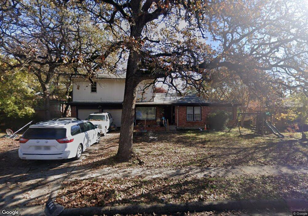
904 Glenda Dr Bedford, TX 76022
Estimated Value: $296,000 - $381,000
4
Beds
2
Baths
2,384
Sq Ft
$146/Sq Ft
Est. Value
About This Home
This home is located at 904 Glenda Dr, Bedford, TX 76022 and is currently estimated at $347,522, approximately $145 per square foot. 904 Glenda Dr is a home located in Tarrant County with nearby schools including Stonegate Elementary School, Central J High School, and L.D. Bell High School.
Ownership History
Date
Name
Owned For
Owner Type
Purchase Details
Closed on
Mar 1, 2013
Sold by
Parnell Timothy and Parnell Alison
Bought by
Villegas Teresa and Villegas Ismael
Current Estimated Value
Home Financials for this Owner
Home Financials are based on the most recent Mortgage that was taken out on this home.
Original Mortgage
$90,000
Outstanding Balance
$63,193
Interest Rate
3.43%
Mortgage Type
Purchase Money Mortgage
Estimated Equity
$284,329
Purchase Details
Closed on
Jun 16, 2010
Sold by
Parnell Timothy and Parnell Alison
Bought by
Pingree Todd
Home Financials for this Owner
Home Financials are based on the most recent Mortgage that was taken out on this home.
Original Mortgage
$115,000
Interest Rate
4.81%
Mortgage Type
Seller Take Back
Purchase Details
Closed on
Mar 20, 2008
Sold by
Fannie Mae
Bought by
Parnell Timothy and Parnell Alison
Home Financials for this Owner
Home Financials are based on the most recent Mortgage that was taken out on this home.
Original Mortgage
$82,000
Interest Rate
6.11%
Mortgage Type
Purchase Money Mortgage
Purchase Details
Closed on
Dec 4, 2007
Sold by
Church Jason
Bought by
Federal National Mortgage Association
Purchase Details
Closed on
Mar 29, 2002
Sold by
Jeremiah Land Management Trust
Bought by
Church Jason
Home Financials for this Owner
Home Financials are based on the most recent Mortgage that was taken out on this home.
Original Mortgage
$100,000
Interest Rate
6.78%
Purchase Details
Closed on
Jun 13, 2001
Sold by
Dash Property Co
Bought by
Jeremiah Land Management Trust
Home Financials for this Owner
Home Financials are based on the most recent Mortgage that was taken out on this home.
Original Mortgage
$70,000
Interest Rate
7.16%
Mortgage Type
Seller Take Back
Purchase Details
Closed on
Mar 7, 2001
Sold by
Conry Delores Amedia Lowrance
Bought by
Benjamin/Price Inc
Purchase Details
Closed on
Feb 8, 2001
Sold by
Coker Jimmie P
Bought by
Freeman Elva Lee Lowrance and Huneycutt Wanda Jean Lowrance
Create a Home Valuation Report for This Property
The Home Valuation Report is an in-depth analysis detailing your home's value as well as a comparison with similar homes in the area
Home Values in the Area
Average Home Value in this Area
Purchase History
| Date | Buyer | Sale Price | Title Company |
|---|---|---|---|
| Villegas Teresa | -- | None Available | |
| Pingree Todd | -- | Stnt | |
| Parnell Timothy | -- | None Available | |
| Federal National Mortgage Association | $99,081 | None Available | |
| Church Jason | -- | Safeco Land Title | |
| Jeremiah Land Management Trust | -- | -- | |
| Benjamin/Price Inc | -- | Stewart Title | |
| Benjamin/Price Inc | -- | Stewart Title | |
| Freeman Elva Lee Lowrance | -- | Stewart Title | |
| Freeman Elva Lee Lowrance | -- | Stewart Title | |
| Freeman Elva Lee Lowrance | -- | Stewart Title | |
| Freeman Elva Lee Lowrance | -- | Stewart Title |
Source: Public Records
Mortgage History
| Date | Status | Borrower | Loan Amount |
|---|---|---|---|
| Open | Villegas Teresa | $90,000 | |
| Previous Owner | Pingree Todd | $115,000 | |
| Previous Owner | Parnell Timothy | $82,000 | |
| Previous Owner | Church Jason | $100,000 | |
| Previous Owner | Jeremiah Land Management Trust | $70,000 | |
| Closed | Church Jason | $25,000 |
Source: Public Records
Tax History Compared to Growth
Tax History
| Year | Tax Paid | Tax Assessment Tax Assessment Total Assessment is a certain percentage of the fair market value that is determined by local assessors to be the total taxable value of land and additions on the property. | Land | Improvement |
|---|---|---|---|---|
| 2025 | $6,458 | $331,691 | $55,000 | $276,691 |
| 2024 | $6,458 | $331,691 | $55,000 | $276,691 |
| 2023 | $6,009 | $313,292 | $35,000 | $278,292 |
| 2022 | $5,804 | $265,745 | $35,000 | $230,745 |
| 2021 | $5,617 | $238,464 | $35,000 | $203,464 |
| 2020 | $4,770 | $200,605 | $35,000 | $165,605 |
| 2019 | $4,641 | $191,024 | $35,000 | $156,024 |
| 2018 | $3,797 | $156,285 | $16,000 | $140,285 |
| 2017 | $3,779 | $156,193 | $16,000 | $140,193 |
| 2016 | $3,217 | $132,981 | $16,000 | $116,981 |
| 2015 | $2,818 | $112,200 | $15,000 | $97,200 |
| 2014 | $2,818 | $112,200 | $15,000 | $97,200 |
Source: Public Records
Map
Nearby Homes
- 341 Hurst Dr
- 905 Brown Trail
- 344 Bedford Ct E
- 803 Glenda Dr
- 802 Brown Trail
- 849 Russell Ln
- 1008 Russell Ln
- 501 Merrill Dr
- 1136 Simpson Dr
- 1236 King Dr
- 933 Wade Dr
- 1220 Norwood Dr
- 1108 Wade Dr
- 1016 Keith Dr
- 604 Donna Ln
- 49 Coffee Tavern Rd
- 832 Chateau Valee Cir
- 116 Oakhurst Dr
- 127 W Cedar St
- 644 Caduceus Ln