Estimated Value: $255,000 - $261,109
3
Beds
1
Bath
1,582
Sq Ft
$163/Sq Ft
Est. Value
About This Home
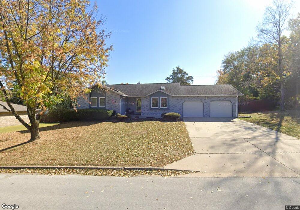
This home is located at 904 Laurel Dr, Rolla, MO 65401 and is currently estimated at $258,370, approximately $163 per square foot. 904 Laurel Dr is a home located in Phelps County with nearby schools including Rolla Junior High School, Rolla Senior High School, and Rolla Seventh-Day Adventist School.
Ownership History
Date
Name
Owned For
Owner Type
Purchase Details
Closed on
Feb 9, 2023
Sold by
Ryce Judith G Trust
Bought by
Sparks Brandan and Sparks Kylie
Current Estimated Value
Home Financials for this Owner
Home Financials are based on the most recent Mortgage that was taken out on this home.
Original Mortgage
$200,000
Outstanding Balance
$193,423
Interest Rate
6.26%
Mortgage Type
Construction
Estimated Equity
$64,948
Purchase Details
Closed on
Aug 27, 2020
Bought by
Ryce Robert B and Ryce Judith G
Purchase Details
Closed on
Aug 21, 2014
Purchase Details
Closed on
Jun 8, 1994
Purchase Details
Closed on
Jul 10, 1992
Purchase Details
Closed on
Aug 5, 1987
Purchase Details
Closed on
Sep 15, 1983
Purchase Details
Closed on
Mar 24, 1983
Create a Home Valuation Report for This Property
The Home Valuation Report is an in-depth analysis detailing your home's value as well as a comparison with similar homes in the area
Home Values in the Area
Average Home Value in this Area
Purchase History
| Date | Buyer | Sale Price | Title Company |
|---|---|---|---|
| Sparks Brandan | $250,000 | Other | |
| Ryce Robert B | $156,580 | -- | |
| -- | -- | -- | |
| -- | -- | -- | |
| -- | -- | -- | |
| -- | -- | -- | |
| -- | -- | -- | |
| -- | -- | -- |
Source: Public Records
Mortgage History
| Date | Status | Borrower | Loan Amount |
|---|---|---|---|
| Open | Sparks Brandan | $200,000 |
Source: Public Records
Tax History
| Year | Tax Paid | Tax Assessment Tax Assessment Total Assessment is a certain percentage of the fair market value that is determined by local assessors to be the total taxable value of land and additions on the property. | Land | Improvement |
|---|---|---|---|---|
| 2025 | $1,964 | $37,630 | $4,560 | $33,070 |
| 2024 | $1,810 | $33,670 | $3,610 | $30,060 |
| 2023 | $1,822 | $33,670 | $3,610 | $30,060 |
| 2022 | $1,547 | $33,670 | $3,610 | $30,060 |
| 2021 | $1,558 | $33,670 | $3,610 | $30,060 |
| 2020 | $1,410 | $29,750 | $3,610 | $26,140 |
| 2019 | $1,403 | $29,490 | $3,610 | $25,880 |
| 2018 | $1,378 | $29,490 | $3,610 | $25,880 |
| 2017 | $1,375 | $29,490 | $3,610 | $25,880 |
| 2016 | $1,331 | $29,490 | $3,610 | $25,880 |
| 2015 | -- | $29,490 | $3,610 | $25,880 |
| 2014 | -- | $29,490 | $3,610 | $25,880 |
| 2013 | -- | $29,490 | $0 | $0 |
Source: Public Records
Map
Nearby Homes
- Lot 74 B Cedar Hill Ct
- Lot 74 A Cedar Hill Ct
- 1102 Sycamore Dr
- 816 Laurel Dr
- 821 Cambridge Dr
- 807 Lariat Ln
- 814 Oxford Dr
- 909 Cypress Dr
- 45 Mcfarland Dr
- 38 Johnson Dr
- 1011 Carriage Ln
- 403 Hutchinson Dr
- 503 Lariat Ln
- 509 Oak Knoll Rd
- 60 Richard Dr
- 687 Salem Ave
- 1206 Elliott Dr
- 821 Highway O
- 1132 Leonard Ave
- 495 Countryside Dr
- 906 Laurel Dr
- 902 Laurel Dr
- 907 Sycamore Dr
- 905 Laurel Dr
- 1001 Sycamore Dr
- 907 Laurel Dr
- 903 Laurel Dr
- 1002 Laurel Dr
- 1001 Laurel Dr
- 900 Laurel Dr
- 903 Sycamore Dr
- 912 Winchester Dr
- 901 Laurel Dr
- 906 Sycamore Dr
- 801 Cedar Hill Ct
- 910 Winchester Dr
- 904 Sycamore Dr
- 1004 Laurel Dr
- 908 Winchester Dr
- 1004 Sycamore Dr
Your Personal Tour Guide
Ask me questions while you tour the home.