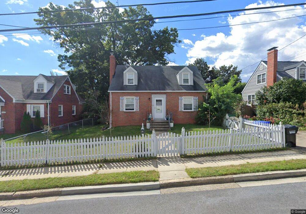
904 Philip Powers Dr Laurel, MD 20707
Estimated Value: $355,000 - $472,000
Studio
2
Baths
1,248
Sq Ft
$323/Sq Ft
Est. Value
About This Home
This home is located at 904 Philip Powers Dr, Laurel, MD 20707 and is currently estimated at $403,561, approximately $323 per square foot. 904 Philip Powers Dr is a home located in Prince George's County with nearby schools including Laurel Elementary School, Dwight D. Eisenhower Middle School, and Laurel High School.
Ownership History
Date
Name
Owned For
Owner Type
Purchase Details
Closed on
Mar 7, 2006
Sold by
Mcglynn Michele V
Bought by
Blair Michele V
Current Estimated Value
Home Financials for this Owner
Home Financials are based on the most recent Mortgage that was taken out on this home.
Original Mortgage
$216,000
Outstanding Balance
$121,383
Interest Rate
6.17%
Mortgage Type
Stand Alone Refi Refinance Of Original Loan
Estimated Equity
$282,178
Purchase Details
Closed on
Feb 13, 2006
Sold by
Mcglynn Michele V
Bought by
Blair Michele V
Home Financials for this Owner
Home Financials are based on the most recent Mortgage that was taken out on this home.
Original Mortgage
$216,000
Outstanding Balance
$121,383
Interest Rate
6.17%
Mortgage Type
Stand Alone Refi Refinance Of Original Loan
Estimated Equity
$282,178
Purchase Details
Closed on
Aug 6, 1996
Sold by
Casula Frank P
Bought by
Mcglynn Michele V
Create a Home Valuation Report for This Property
The Home Valuation Report is an in-depth analysis detailing your home's value as well as a comparison with similar homes in the area
Home Values in the Area
Average Home Value in this Area
Purchase History
| Date | Buyer | Sale Price | Title Company |
|---|---|---|---|
| Blair Michele V | -- | -- | |
| Blair Michele V | -- | -- | |
| Mcglynn Michele V | $130,000 | -- |
Source: Public Records
Mortgage History
| Date | Status | Borrower | Loan Amount |
|---|---|---|---|
| Open | Blair Michele V | $216,000 | |
| Closed | Blair Michele V | $216,000 |
Source: Public Records
Tax History
| Year | Tax Paid | Tax Assessment Tax Assessment Total Assessment is a certain percentage of the fair market value that is determined by local assessors to be the total taxable value of land and additions on the property. | Land | Improvement |
|---|---|---|---|---|
| 2025 | $5,616 | $389,500 | $100,200 | $289,300 |
| 2024 | $5,616 | $373,533 | -- | -- |
| 2023 | $5,381 | $357,567 | $0 | $0 |
| 2022 | $5,104 | $341,600 | $75,200 | $266,400 |
| 2021 | $4,772 | $318,233 | $0 | $0 |
| 2020 | $4,525 | $294,867 | $0 | $0 |
| 2019 | $4,271 | $271,500 | $75,100 | $196,400 |
| 2018 | $4,038 | $251,900 | $0 | $0 |
| 2017 | $3,826 | $232,300 | $0 | $0 |
| 2016 | -- | $212,700 | $0 | $0 |
| 2015 | $3,465 | $212,700 | $0 | $0 |
| 2014 | $3,465 | $212,700 | $0 | $0 |
Source: Public Records
Map
Nearby Homes
- 916 Philip Powers Dr
- 1016 Phillip Powers Dr
- 910 Montgomery St Unit A
- 501 8th St
- 1116 Westview Terrace
- 1103 Montgomery St
- 903 Montrose Ave
- 1012 Ward St
- 8040 Sandy Spring Rd
- 9425 Fairview Ave
- 1000 8th St
- 1028 Ward St
- 9437 Fairview Ave
- 413 Talbott Ave
- 505A Montgomery St
- 15781 Haynes Rd
- 509 4th St
- 9401 Riverbrink Ct
- 19 Post Office Ave Unit 203
- 15012 Wheatland Place
- 902 Philip Powers Dr
- 906 Philip Powers Dr
- 905 Carroll Ave
- 903 Carroll Ave
- 908 Philip Powers Dr
- 909 Nichols Dr
- 907 Nichols Dr
- 911 Nichols Dr
- 907 Carroll Ave
- 909 Philip Powers Dr
- 913 Philip Powers Dr
- 911 Philip Powers Dr
- 915 Philip Powers Dr
- 903 Phillip Powers Dr
- 907 Philip Powers Dr
- 913 Nichols Dr
- 910 Philip Powers Dr
- 919 Phillip Powers Dr
- 917 Phillip Powers Dr
- 909 Carroll Ave
Your Personal Tour Guide
Ask me questions while you tour the home.