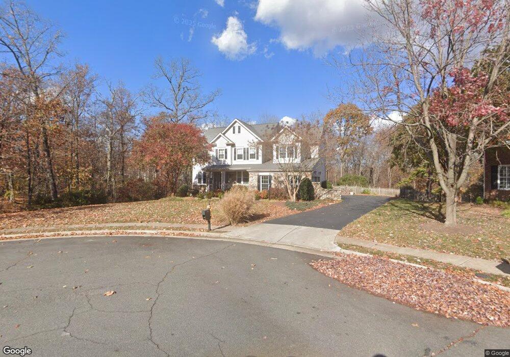
904 Powhatan Ct NE Leesburg, VA 20176
Estimated Value: $1,055,000 - $1,199,979
4
Beds
5
Baths
4,048
Sq Ft
$275/Sq Ft
Est. Value
About This Home
This home is located at 904 Powhatan Ct NE, Leesburg, VA 20176 and is currently estimated at $1,114,495, approximately $275 per square foot. 904 Powhatan Ct NE is a home located in Loudoun County with nearby schools including Ball's Bluff Elementary School, Smart's Mill Middle School, and Tuscarora High School.
Ownership History
Date
Name
Owned For
Owner Type
Purchase Details
Closed on
Nov 16, 2020
Sold by
Mallott Michael A and Mallott Linda M
Bought by
Mallott Michael A and Mallott Linda M
Current Estimated Value
Purchase Details
Closed on
Jan 7, 2020
Sold by
Mallott Michael Anton and Mallott Linda Marie
Bought by
Mallott Michael A and Mallott Linda M
Purchase Details
Closed on
Dec 23, 2019
Sold by
Mallott Michael A and Mallott Linda M
Bought by
Mallott Michael Anton and Mallott Linda Marie
Create a Home Valuation Report for This Property
The Home Valuation Report is an in-depth analysis detailing your home's value as well as a comparison with similar homes in the area
Home Values in the Area
Average Home Value in this Area
Purchase History
| Date | Buyer | Sale Price | Title Company |
|---|---|---|---|
| Mallott Michael A | -- | None Available | |
| Mallott Michael A | -- | None Available | |
| Mallott Michael Anton | -- | None Available |
Source: Public Records
Tax History Compared to Growth
Tax History
| Year | Tax Paid | Tax Assessment Tax Assessment Total Assessment is a certain percentage of the fair market value that is determined by local assessors to be the total taxable value of land and additions on the property. | Land | Improvement |
|---|---|---|---|---|
| 2025 | $8,336 | $1,035,530 | $282,400 | $753,130 |
| 2024 | $8,116 | $938,240 | $282,400 | $655,840 |
| 2023 | $8,184 | $935,350 | $282,400 | $652,950 |
| 2022 | $7,631 | $857,380 | $232,400 | $624,980 |
| 2021 | $6,731 | $686,830 | $182,400 | $504,430 |
| 2020 | $6,942 | $670,690 | $182,400 | $488,290 |
| 2019 | $6,845 | $655,000 | $182,400 | $472,600 |
| 2018 | $6,796 | $626,400 | $162,400 | $464,000 |
| 2017 | $6,191 | $550,300 | $162,400 | $387,900 |
| 2016 | $6,263 | $546,990 | $0 | $0 |
| 2015 | $1,042 | $407,220 | $0 | $407,220 |
| 2014 | $1,028 | $414,540 | $0 | $414,540 |
Source: Public Records
Map
Nearby Homes
- 903 Powhatan Ct NE
- 1818 Woods Edge Dr NE
- 1616 Chickasaw Place NE
- 1515 Artillery Terrace NE
- 1636 Field Sparrow Terrace NE
- 1504 Shields Terrace NE
- 820 Ferndale Terrace NE
- 1411 Barksdale Dr NE
- 18252 Hobbes Rest Ln
- 18257 Hobbes Rest Ln
- 18256 Hobbes Rest Ln
- 18261 Hobbes Rest Ln
- 1148 Keokuk Terrace NE
- 18260 Hobbes Rest Ln
- 18324 Sugar Snap Cir
- 42871 Robins Perch Terrace
- 18275 Cresswell Rest Ln
- 42832 Dames Rocket Dr
- 42639 Daybreak Meadow Dr
- 18315 Fox Crossing Terrace
- 905 Powhatan Ct NE
- 1808 Woods Edge Dr NE
- 1806 Woods Edge Dr NE
- 1810 Woods Edge Dr NE
- 1812 Woods Edge Dr NE
- 1802 Woods Edge Dr NE
- 901 Tinsman Dr NE
- 1814 Woods Edge Dr NE
- 610 Hunton Place NE
- 612 Hunton Place NE
- 608 Hunton Place NE
- 900 Tinsman Dr NE
- 1800 Woods Edge Dr NE
- 606 Hunton Place NE
- 900 Catskill Ct NE
- 604 Hunton Place NE
- 903 Tinsman Dr NE
- 1816 Woods Edge Dr NE
- 614 Hunton Place NE
- 1811 Woods Edge Dr NE