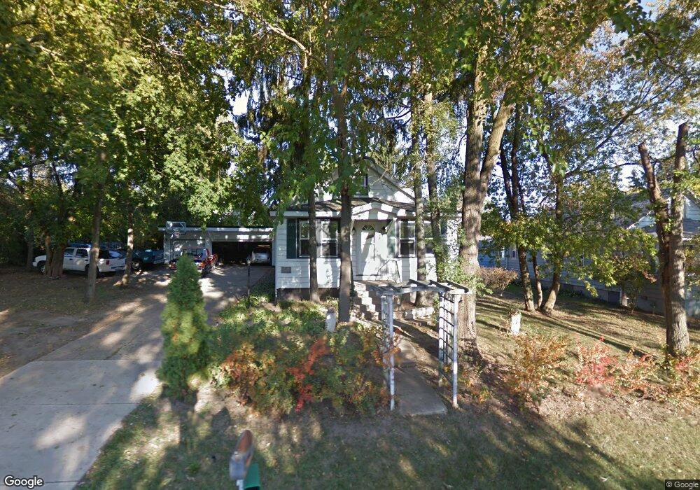
904 Ridge Ave Wauconda, IL 60084
Estimated Value: $259,174 - $308,000
--
Bed
1
Bath
1,008
Sq Ft
$278/Sq Ft
Est. Value
About This Home
This home is located at 904 Ridge Ave, Wauconda, IL 60084 and is currently estimated at $280,544, approximately $278 per square foot. 904 Ridge Ave is a home located in Lake County with nearby schools including Wauconda Grade School, Wauconda Middle School, and Wauconda High School.
Ownership History
Date
Name
Owned For
Owner Type
Purchase Details
Closed on
Jan 4, 2019
Sold by
Madsen Duane A
Bought by
Madsen Steven D
Current Estimated Value
Purchase Details
Closed on
Jun 27, 2002
Sold by
Jost Jeanette M
Bought by
Madsen Steven D and Madsen Mary Sue
Home Financials for this Owner
Home Financials are based on the most recent Mortgage that was taken out on this home.
Original Mortgage
$149,625
Outstanding Balance
$63,924
Interest Rate
6.82%
Estimated Equity
$216,620
Create a Home Valuation Report for This Property
The Home Valuation Report is an in-depth analysis detailing your home's value as well as a comparison with similar homes in the area
Home Values in the Area
Average Home Value in this Area
Purchase History
| Date | Buyer | Sale Price | Title Company |
|---|---|---|---|
| Madsen Steven D | -- | None Available | |
| Madsen Steven D | $157,500 | Heritage Title Co | |
| Madsen Duane | $40,000 | -- |
Source: Public Records
Mortgage History
| Date | Status | Borrower | Loan Amount |
|---|---|---|---|
| Open | Madsen Steven D | $149,625 |
Source: Public Records
Tax History Compared to Growth
Tax History
| Year | Tax Paid | Tax Assessment Tax Assessment Total Assessment is a certain percentage of the fair market value that is determined by local assessors to be the total taxable value of land and additions on the property. | Land | Improvement |
|---|---|---|---|---|
| 2024 | $4,500 | $69,801 | $19,398 | $50,403 |
| 2023 | $5,695 | $63,803 | $17,731 | $46,072 |
| 2022 | $5,695 | $58,191 | $21,309 | $36,882 |
| 2021 | $5,422 | $54,985 | $20,135 | $34,850 |
| 2020 | $5,236 | $52,407 | $19,191 | $33,216 |
| 2019 | $4,641 | $49,529 | $18,137 | $31,392 |
| 2018 | $4,596 | $45,985 | $21,463 | $24,522 |
| 2017 | $4,590 | $45,453 | $21,215 | $24,238 |
| 2016 | $4,293 | $43,043 | $20,090 | $22,953 |
| 2015 | $4,008 | $39,514 | $18,443 | $21,071 |
| 2014 | $4,676 | $43,265 | $20,486 | $22,779 |
| 2012 | $4,574 | $46,051 | $19,599 | $26,452 |
Source: Public Records
Map
Nearby Homes
- 701 Lake Shore Dr
- 1260 Water Stone Cir
- 0 Bonner Rd
- 419 Hill St Unit 2805
- 315 Grand Blvd
- 302 Stillwater Ct Unit 1702
- 303 Stillwater Ct Unit 1106
- 309 Stillwater Ct Unit 1101
- 28722 N Madison Ave
- 315 Hill St Unit A
- 325 Sundown Ct Unit B
- 310 Sundown Ct Unit E
- 28177 N Garland Rd
- 28855 N Garland Rd
- 26049 N Il Route 59
- 29564 N Garland Rd
- 25570 W High St
- 107 Hammond Ave
- 25578 W High St
- 25586 W High St