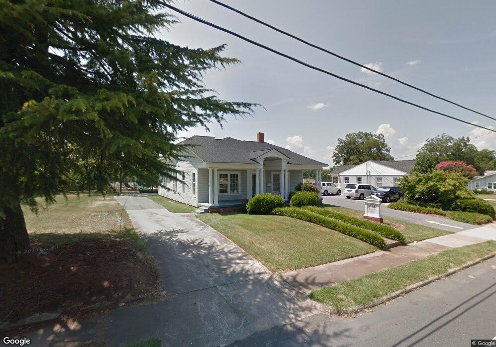
904 S Cox St Asheboro, NC 27203
Estimated Value: $235,154 - $289,000
--
Bed
--
Bath
1,762
Sq Ft
$146/Sq Ft
Est. Value
About This Home
This home is located at 904 S Cox St, Asheboro, NC 27203 and is currently estimated at $257,039, approximately $145 per square foot. 904 S Cox St is a home with nearby schools including Lindley Park Elementary School, South Asheboro Middle School, and Asheboro High School.
Ownership History
Date
Name
Owned For
Owner Type
Purchase Details
Closed on
Apr 28, 2010
Sold by
Brantley Joe Patrick and Brantley Linda M
Bought by
Lig Investments Llc
Current Estimated Value
Home Financials for this Owner
Home Financials are based on the most recent Mortgage that was taken out on this home.
Original Mortgage
$145,000
Outstanding Balance
$95,911
Interest Rate
4.94%
Mortgage Type
Purchase Money Mortgage
Estimated Equity
$161,128
Purchase Details
Closed on
Sep 24, 1991
Bought by
Lig Investments Llc
Create a Home Valuation Report for This Property
The Home Valuation Report is an in-depth analysis detailing your home's value as well as a comparison with similar homes in the area
Home Values in the Area
Average Home Value in this Area
Purchase History
| Date | Buyer | Sale Price | Title Company |
|---|---|---|---|
| Lig Investments Llc | $165,000 | None Available | |
| Lig Investments Llc | $122,800 | -- |
Source: Public Records
Mortgage History
| Date | Status | Borrower | Loan Amount |
|---|---|---|---|
| Open | Lig Investments Llc | $145,000 |
Source: Public Records
Tax History Compared to Growth
Tax History
| Year | Tax Paid | Tax Assessment Tax Assessment Total Assessment is a certain percentage of the fair market value that is determined by local assessors to be the total taxable value of land and additions on the property. | Land | Improvement |
|---|---|---|---|---|
| 2025 | $2,318 | $174,890 | $62,240 | $112,650 |
| 2024 | $2,318 | $174,890 | $62,240 | $112,650 |
| 2023 | $2,318 | $174,890 | $62,240 | $112,650 |
| 2022 | $1,992 | $138,210 | $62,240 | $75,970 |
| 2021 | $1,992 | $138,210 | $62,240 | $75,970 |
| 2020 | $1,992 | $138,210 | $62,240 | $75,970 |
| 2019 | $1,992 | $138,210 | $62,240 | $75,970 |
| 2018 | $1,924 | $131,120 | $62,240 | $68,880 |
| 2016 | $1,924 | $131,115 | $62,240 | $68,875 |
| 2015 | $1,927 | $131,115 | $62,240 | $68,875 |
| 2014 | -- | $131,115 | $62,240 | $68,875 |
Source: Public Records
Map
Nearby Homes
- 922 S Cox St
- 209 Armfield Ave
- 211 Armfield Ave
- 350 Stowe Ave Unit 101
- 822 Glenwood Rd
- 602 Highland St
- 1002 Cliff Rd
- 500 E Kivett St
- 855 Lee St
- 960 Lee St
- 815 Trollinger Rd
- 627 Lee St
- 1427 S Fayetteville St
- 412 Cliff Rd
- 828 Windermere Ct
- 737 Britt Ave
- 0 U S Highway 64
- 631 W Kivett St
- 310 S High St
- 806 Windermere Ct