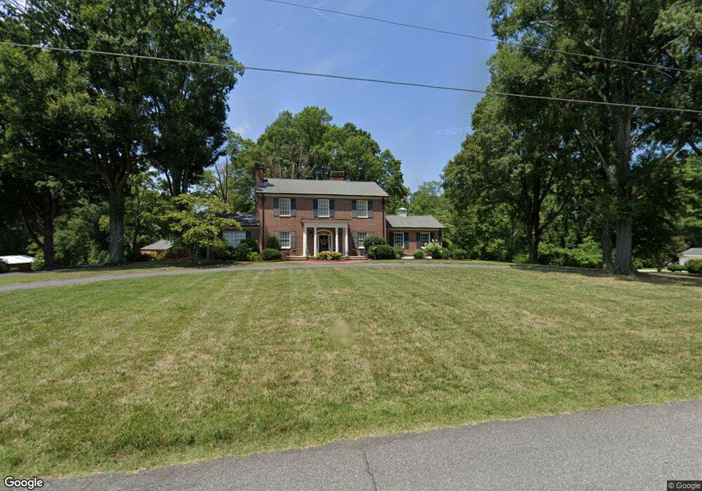
904 S Zion St Landis, NC 28088
Estimated Value: $493,000 - $807,000
--
Bed
3
Baths
4,574
Sq Ft
$146/Sq Ft
Est. Value
About This Home
This home is located at 904 S Zion St, Landis, NC 28088 and is currently estimated at $669,015, approximately $146 per square foot. 904 S Zion St is a home located in Rowan County with nearby schools including Landis Elementary School, Corriher Lipe Middle School, and South Rowan High School.
Ownership History
Date
Name
Owned For
Owner Type
Purchase Details
Closed on
Dec 17, 2020
Sold by
522 Properties Llc
Bought by
Murphy Marshall D and Murphy Jennie K
Current Estimated Value
Purchase Details
Closed on
Jan 1, 2011
Bought by
522 Properties Llc
Purchase Details
Closed on
Jul 5, 2007
Sold by
Corriher Joseph Frederick and Lavonne T Corriher E
Bought by
522 Properties Llc
Create a Home Valuation Report for This Property
The Home Valuation Report is an in-depth analysis detailing your home's value as well as a comparison with similar homes in the area
Home Values in the Area
Average Home Value in this Area
Purchase History
| Date | Buyer | Sale Price | Title Company |
|---|---|---|---|
| Murphy Marshall D | -- | None Available | |
| 522 Properties Llc | -- | -- | |
| 522 Properties Llc | $600,000 | None Available |
Source: Public Records
Tax History Compared to Growth
Tax History
| Year | Tax Paid | Tax Assessment Tax Assessment Total Assessment is a certain percentage of the fair market value that is determined by local assessors to be the total taxable value of land and additions on the property. | Land | Improvement |
|---|---|---|---|---|
| 2025 | $6,503 | $607,778 | $95,845 | $511,933 |
| 2024 | $6,503 | $607,778 | $95,845 | $511,933 |
| 2023 | $6,503 | $607,778 | $95,845 | $511,933 |
| 2022 | $4,794 | $403,685 | $79,423 | $324,262 |
| 2021 | $4,794 | $403,685 | $79,423 | $324,262 |
| 2020 | $4,794 | $403,685 | $79,423 | $324,262 |
| 2019 | $4,794 | $403,685 | $79,423 | $324,262 |
| 2018 | $4,392 | $373,937 | $79,423 | $294,514 |
| 2017 | $4,083 | $362,852 | $79,423 | $283,429 |
| 2016 | $4,083 | $362,852 | $79,423 | $283,429 |
| 2015 | $4,146 | $362,852 | $79,423 | $283,429 |
| 2014 | $3,827 | $338,690 | $74,423 | $264,267 |
Source: Public Records
Map
Nearby Homes
- 813 S Zion St
- 604 S Zion St
- 411 S Central Ave
- 233 E Rice St Unit 9
- 0 S Chapel St
- 2909 Glendale Ave
- 859 Irish Creek Dr
- 0 W Ridge Ave
- 208 S Chapel St
- 413 W Ridge Ave
- 2885 Vale Ave
- 0 N Chapel St
- 406 W Mill St
- 515 Rosemont Ave
- 2274 Tullymore Dr Unit 14
- 616 S Main St
- 2319 Tullymore Dr Unit 39
- 602 E Ryder Ave
- 710 E Mills Dr
- 0 N Cannon Blvd Unit CAR4271457
- 812 S Zion St
- 903 S Zion St
- 901 S Zion St
- 905 S Zion St
- 810 S Zion St
- 806 S Highland Ave
- 802 S Highland Ave
- 810 S Highland Ave
- 809 S Zion St
- 915 S Zion St
- 916 S Zion St
- 812 S Highland Ave
- 808 S Zion St
- 726 S Highland Ave
- 207 W 4th St
- 805 S Zion St
- 917 S Zion St
- 203 W 4th St
- 920 S Zion St
- 724 S Highland Ave