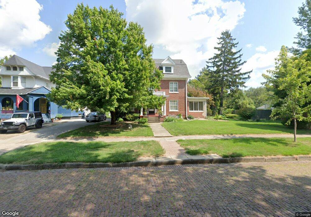
904 W William St Decatur, IL 62522
Millikin Home NeighborhoodEstimated Value: $162,000 - $185,780
6
Beds
4
Baths
6,260
Sq Ft
$28/Sq Ft
Est. Value
About This Home
This home is located at 904 W William St, Decatur, IL 62522 and is currently estimated at $176,945, approximately $28 per square foot. 904 W William St is a home located in Macon County with nearby schools including Dennis Lab School, St. Patrick School, and Teen Challenge-Home For Girls.
Ownership History
Date
Name
Owned For
Owner Type
Purchase Details
Closed on
Jan 4, 2008
Sold by
Shields Terry and Shields Christina
Bought by
Lewis Joan H and Baylis Terry
Current Estimated Value
Home Financials for this Owner
Home Financials are based on the most recent Mortgage that was taken out on this home.
Original Mortgage
$117,600
Interest Rate
5.89%
Mortgage Type
New Conventional
Purchase Details
Closed on
May 1, 2001
Create a Home Valuation Report for This Property
The Home Valuation Report is an in-depth analysis detailing your home's value as well as a comparison with similar homes in the area
Home Values in the Area
Average Home Value in this Area
Purchase History
| Date | Buyer | Sale Price | Title Company |
|---|---|---|---|
| Lewis Joan H | $147,000 | None Available | |
| -- | $154,000 | -- |
Source: Public Records
Mortgage History
| Date | Status | Borrower | Loan Amount |
|---|---|---|---|
| Closed | Lewis Joan H | $117,600 |
Source: Public Records
Tax History Compared to Growth
Tax History
| Year | Tax Paid | Tax Assessment Tax Assessment Total Assessment is a certain percentage of the fair market value that is determined by local assessors to be the total taxable value of land and additions on the property. | Land | Improvement |
|---|---|---|---|---|
| 2024 | $4,509 | $57,581 | $4,374 | $53,207 |
| 2023 | $4,433 | $55,542 | $4,219 | $51,323 |
| 2022 | $3,865 | $48,791 | $3,706 | $45,085 |
| 2021 | $3,557 | $45,566 | $3,461 | $42,105 |
| 2020 | $3,451 | $43,450 | $3,300 | $40,150 |
| 2019 | $3,451 | $43,450 | $3,300 | $40,150 |
| 2018 | $3,425 | $43,594 | $3,311 | $40,283 |
| 2017 | $3,536 | $44,757 | $3,399 | $41,358 |
| 2016 | $3,615 | $45,214 | $3,434 | $41,780 |
| 2015 | $3,415 | $44,414 | $3,373 | $41,041 |
| 2014 | $3,161 | $43,975 | $3,340 | $40,635 |
| 2013 | $3,306 | $45,626 | $3,465 | $42,161 |
Source: Public Records
Map
Nearby Homes
- 958 W William St
- 254 N Pine St
- 717 W Prairie Ave Unit 2
- 899 W Main St
- 1005 W Main St
- 609 W William St
- 657 W Wood St
- 452 W Prairie Ave
- 875 N Monroe St
- 442 W Prairie Ave
- 1065 W Green St
- 612 W Macon St
- 422 W William St
- 233 N Edward St
- 366 W Prairie Ave
- 330 W William St
- 617 W Decatur St
- 450 W Macon St
- 320 W Main St
- 440 W Macon St
- 920 W William St
- 926 W William St
- 890 W William St
- 934 W William St
- 917 W North St
- 901 W North St
- 927 W North St
- 942 W William St
- 884 W William St
- 899 W North St
- 929 W North St
- 950 W William St
- 905 W William St
- 878 W William St Upstairs
- 919 W William St
- 891 W William St
- 878 W William St
- 887 W North St
- 945 W William St
- 945 W William St