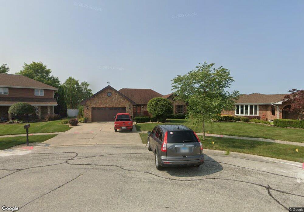
9043 Linden Dr Tinley Park, IL 60487
Central Tinley Park NeighborhoodEstimated Value: $435,000 - $496,141
3
Beds
3
Baths
2,418
Sq Ft
$198/Sq Ft
Est. Value
About This Home
This home is located at 9043 Linden Dr, Tinley Park, IL 60487 and is currently estimated at $479,035, approximately $198 per square foot. 9043 Linden Dr is a home located in Cook County with nearby schools including Christa Mcauliffe School, Prairie View Middle School, and Victor J Andrew High School.
Ownership History
Date
Name
Owned For
Owner Type
Purchase Details
Closed on
May 19, 2021
Sold by
Fuja Karen L
Bought by
Kraft Esther G
Current Estimated Value
Home Financials for this Owner
Home Financials are based on the most recent Mortgage that was taken out on this home.
Original Mortgage
$190,000
Outstanding Balance
$172,586
Interest Rate
3.25%
Mortgage Type
New Conventional
Estimated Equity
$306,449
Create a Home Valuation Report for This Property
The Home Valuation Report is an in-depth analysis detailing your home's value as well as a comparison with similar homes in the area
Home Values in the Area
Average Home Value in this Area
Purchase History
| Date | Buyer | Sale Price | Title Company |
|---|---|---|---|
| Kraft Esther G | $390,000 | Chicago Title Insurance Co |
Source: Public Records
Mortgage History
| Date | Status | Borrower | Loan Amount |
|---|---|---|---|
| Open | Kraft Esther G | $190,000 |
Source: Public Records
Tax History Compared to Growth
Tax History
| Year | Tax Paid | Tax Assessment Tax Assessment Total Assessment is a certain percentage of the fair market value that is determined by local assessors to be the total taxable value of land and additions on the property. | Land | Improvement |
|---|---|---|---|---|
| 2024 | $10,185 | $40,000 | $12,019 | $27,981 |
| 2023 | $9,463 | $40,000 | $12,019 | $27,981 |
| 2022 | $9,463 | $29,966 | $10,517 | $19,449 |
| 2021 | $10,339 | $29,964 | $10,516 | $19,448 |
| 2020 | $10,070 | $29,964 | $10,516 | $19,448 |
| 2019 | $8,448 | $32,220 | $9,515 | $22,705 |
| 2018 | $8,263 | $32,220 | $9,515 | $22,705 |
| 2017 | $8,077 | $32,220 | $9,515 | $22,705 |
| 2016 | $7,907 | $28,089 | $8,513 | $19,576 |
| 2015 | $7,752 | $28,089 | $8,513 | $19,576 |
| 2014 | $7,716 | $28,089 | $8,513 | $19,576 |
| 2013 | $9,273 | $33,332 | $8,513 | $24,819 |
Source: Public Records
Map
Nearby Homes
- 17964 Upland Dr
- 18055 Upland Dr
- 17533 Pecan Ln
- 9280 Windsor Pkwy Unit 92
- 9038 Mansfield Dr Unit 8
- 9260 Windsor Pkwy Unit 80
- 9201 175th St
- 9051 Mansfield Dr Unit 1
- 17631 Dover Ct
- 18248 Murphy Cir Unit 182
- Fremont Plan at Radcliffe Place
- Calysta Plan at Radcliffe Place
- Danbury Plan at Radcliffe Place
- Briarcliffe Plan at Radcliffe Place
- Eden Plan at Radcliffe Place
- Amberwood Plan at Radcliffe Place
- 17535 S La Grange Rd
- 17535-2 Lagrange Rd
- 17500 Lagrange Rd
- 17230 Shetland Dr
- 9046 Linden Dr
- 9037 Linden Dr
- 17855 Elmwood Dr
- 17849 Elmwood Dr
- 9031 Linden Dr
- 17843 Elmwood Dr
- 9049 Linden Dr
- 9055 Linden Dr
- 9025 Linden Dr
- 9030 Linden Dr
- 17831 Elmwood Dr
- 9031 Poplar St
- 17854 Elmwood Dr
- 9024 Linden Dr
- 17848 Elmwood Dr
- 9019 Linden Dr
- 17842 Elmwood Dr
- 17836 Elmwood Dr
- 9025 Poplar St
- 9018 Linden Dr