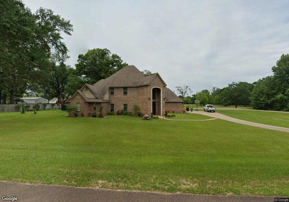
9045 Bobcat Trail Texarkana, TX 75503
Estimated Value: $495,642 - $579,000
--
Bed
--
Bath
3,416
Sq Ft
$157/Sq Ft
Est. Value
About This Home
This home is located at 9045 Bobcat Trail, Texarkana, TX 75503 and is currently estimated at $537,911, approximately $157 per square foot. 9045 Bobcat Trail is a home located in Bowie County with nearby schools including Red Lick Elementary School and Red Lick Middle School.
Ownership History
Date
Name
Owned For
Owner Type
Purchase Details
Closed on
Jun 19, 2015
Sold by
Harris Misty and Harris Clayton
Bought by
Barnette James D and Barnette Heather L
Current Estimated Value
Home Financials for this Owner
Home Financials are based on the most recent Mortgage that was taken out on this home.
Original Mortgage
$330,220
Outstanding Balance
$256,402
Interest Rate
3.82%
Mortgage Type
New Conventional
Estimated Equity
$281,509
Create a Home Valuation Report for This Property
The Home Valuation Report is an in-depth analysis detailing your home's value as well as a comparison with similar homes in the area
Home Values in the Area
Average Home Value in this Area
Purchase History
| Date | Buyer | Sale Price | Title Company |
|---|---|---|---|
| Barnette James D | -- | None Available |
Source: Public Records
Mortgage History
| Date | Status | Borrower | Loan Amount |
|---|---|---|---|
| Open | Barnette James D | $330,220 |
Source: Public Records
Tax History Compared to Growth
Tax History
| Year | Tax Paid | Tax Assessment Tax Assessment Total Assessment is a certain percentage of the fair market value that is determined by local assessors to be the total taxable value of land and additions on the property. | Land | Improvement |
|---|---|---|---|---|
| 2025 | $7,244 | $546,042 | $35,150 | $510,892 |
| 2024 | $7,244 | $531,903 | $35,150 | $496,753 |
| 2023 | $8,050 | $489,141 | $0 | $0 |
| 2022 | $7,477 | $471,807 | $35,150 | $436,657 |
| 2021 | $7,122 | $404,249 | $35,150 | $369,099 |
| 2020 | $6,972 | $391,559 | $35,150 | $356,409 |
| 2019 | $6,915 | $375,728 | $35,150 | $340,578 |
| 2018 | $6,691 | $363,533 | $35,150 | $328,383 |
| 2017 | $6,528 | $357,575 | $35,150 | $322,425 |
| 2016 | $6,590 | $360,953 | $35,150 | $325,803 |
| 2015 | $5,603 | $357,979 | $35,150 | $322,829 |
| 2014 | $5,603 | $346,492 | $35,150 | $311,342 |
Source: Public Records
Map
Nearby Homes
- 12 Red Oak Ln
- 21 Red Oak Ln
- 8163 Coyote Trail
- 1529 Akin Rd
- 8905 River Ridge Dr
- TBD Noah Ave
- 60 Akin Oak Dr
- 45 Akin Oak Dr
- 15 Akin Oak Dr
- 0 Ava Ln
- 10 Akin Oak Dr
- 16030 Broadleaf
- 8204 Thames Cir
- Lot 18,19 Lakeridge
- 17 Oakridge Dr
- 5 River Plantation
- 24 Silver Hill Dr
- TBD Arnold Ln
- 1302 Arnold Ln
- 7012 Cameron
- 11 Bobcat Trail Unit 9011 Bobcat Trl
- 0 Bobcat Trail Unit 19035159
- 0 Bobcat Trail
- 9099 Bobcat Trail
- 9030 Bobcat Trail
- 9005 Bobcat Trail
- 9140 Bobcat Trail
- 8504 Quail Hollow Dr
- 8504 Quail Hollow Dr
- 9010 Bobcat Trail
- 8410 Quail Hollow Dr
- 9112 White Oak Ln
- 9116 White Oak Ln
- 8304 Quail Hollow Dr
- 5 Red Oak Ln
- 7 Red Oak Ln
- 8407 Quail Hollow Dr
- 9117 White Oak Ln
- 9120 White Oak Ln
- 14 Red Oak Ln