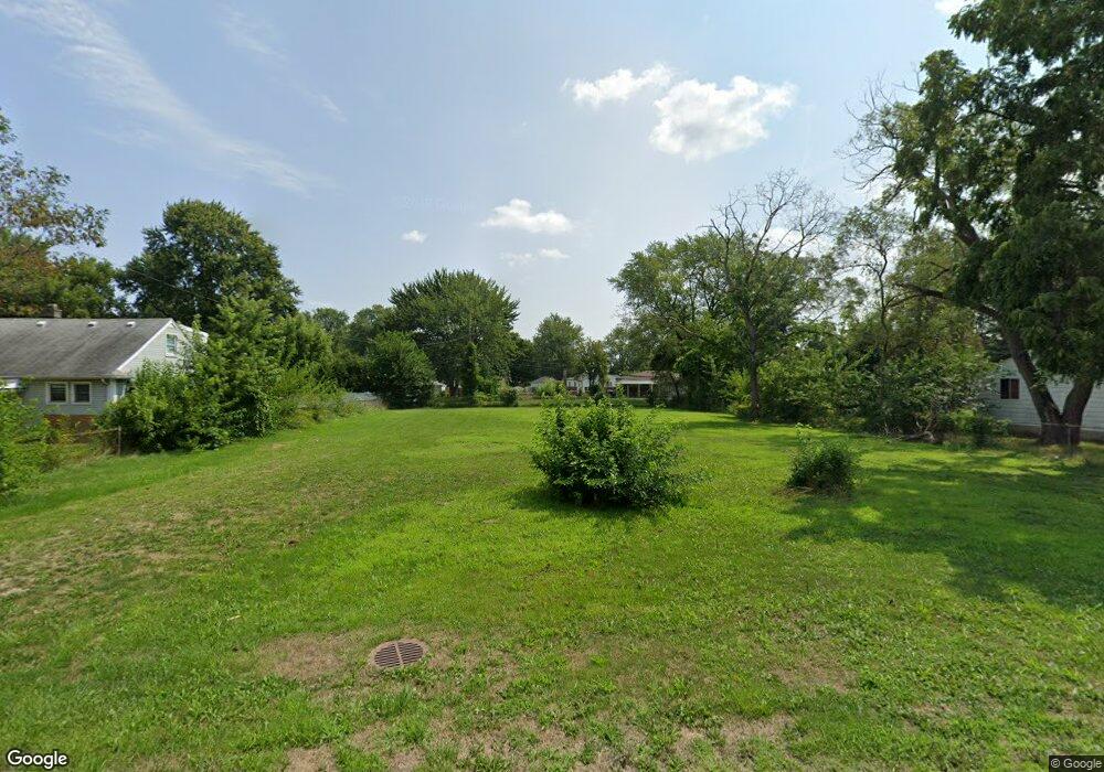
9045 Rosella St Taylor, MI 48180
Estimated Value: $146,631 - $308,000
3
Beds
2
Baths
1,589
Sq Ft
$150/Sq Ft
Est. Value
About This Home
This home is located at 9045 Rosella St, Taylor, MI 48180 and is currently estimated at $238,658, approximately $150 per square foot. 9045 Rosella St is a home located in Wayne County with nearby schools including Blair Moody Elementary School and Robert J. West Middle School.
Ownership History
Date
Name
Owned For
Owner Type
Purchase Details
Closed on
Mar 23, 2016
Sold by
Wayne County Treasurer
Bought by
Alexa Daniel I
Current Estimated Value
Purchase Details
Closed on
Mar 30, 2011
Sold by
Tachar Larry J
Bought by
Great Lakes National Bank Of Michigan and Tcf National Bank
Purchase Details
Closed on
Dec 30, 1998
Sold by
Davis Gary L and Davis Sharon
Bought by
Jtachar Larry
Purchase Details
Closed on
Jun 29, 1995
Sold by
Hall Charles N
Bought by
Gary L and Gary Sharon Davis
Create a Home Valuation Report for This Property
The Home Valuation Report is an in-depth analysis detailing your home's value as well as a comparison with similar homes in the area
Home Values in the Area
Average Home Value in this Area
Purchase History
| Date | Buyer | Sale Price | Title Company |
|---|---|---|---|
| Alexa Daniel I | $200 | None Available | |
| Great Lakes National Bank Of Michigan | $98,400 | None Available | |
| Jtachar Larry | $127,500 | -- | |
| Gary L | $78,000 | -- |
Source: Public Records
Tax History Compared to Growth
Tax History
| Year | Tax Paid | Tax Assessment Tax Assessment Total Assessment is a certain percentage of the fair market value that is determined by local assessors to be the total taxable value of land and additions on the property. | Land | Improvement |
|---|---|---|---|---|
| 2025 | $430 | $9,900 | $0 | $0 |
| 2024 | $429 | $9,900 | $0 | $0 |
| 2023 | $577 | $9,900 | $0 | $0 |
| 2022 | $452 | $9,900 | $0 | $0 |
| 2021 | $542 | $9,900 | $0 | $0 |
| 2020 | $544 | $9,900 | $0 | $0 |
| 2019 | $55,094 | $9,900 | $0 | $0 |
| 2018 | $424 | $9,900 | $0 | $0 |
| 2017 | $296 | $9,600 | $0 | $0 |
| 2016 | $564 | $9,600 | $0 | $0 |
| 2015 | $1,750 | $17,500 | $0 | $0 |
| 2013 | $4,060 | $41,900 | $0 | $0 |
| 2012 | $1,774 | $41,000 | $17,500 | $23,500 |
Source: Public Records
Map
Nearby Homes
- 9134 Weddel St
- 20812 Wick Rd
- 20945 Millard St
- 9444 Polk St
- 8319 Ziegler St
- 8910 Mason St
- 21059 Wick Rd
- 20234 Champaign St
- 7972 Hipp St
- 18650 Grey Ave
- 7854 Jackson St
- 9949 Allen Pointe Dr Unit 14
- 9959 Allen Pointe Dr Unit 20
- 8054 Robinson Ave
- 9687 Seavitt Dr
- 9720 Seavitt Dr
- 17439 Brody Ave
- 8132 Balfour Ave
- 10045 Allen Pointe Dr Unit 96
- 7580 Mayfair St
- 9071 Rosella St
- 9070 Weddel St
- 9041 Rosella St
- 8980 Weddel St
- 9011 Rosella St
- 9076 Weddel St
- 9121 Rosella St
- 9064 Weddel St Unit Bldg-Unit
- 9064 Weddel St
- 8974 Weddel St
- 8986 Weddel St
- 9048 Rosella St
- 9001 Rosella St
- 9040 Rosella St
- 9040 Rosella St
- 9070 Rosella St
- 9026 Rosella St
- 9082 Weddel St
- 9018 Weddel St
- 8991 Rosella St
