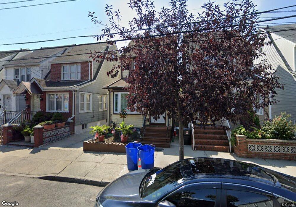
9048 Desarc Rd Ozone Park, NY 11417
Ozone Park NeighborhoodEstimated Value: $612,576 - $710,000
Studio
--
Bath
1,218
Sq Ft
$558/Sq Ft
Est. Value
About This Home
This home is located at 9048 Desarc Rd, Ozone Park, NY 11417 and is currently estimated at $679,894, approximately $558 per square foot. 9048 Desarc Rd is a home located in Queens County with nearby schools including P.S. 63 - Old South, Robert H. Goddard High School, and Divine Mercy Catholic Academy.
Ownership History
Date
Name
Owned For
Owner Type
Purchase Details
Closed on
Nov 26, 1996
Sold by
Catinella Pasquale and Catinella Lillian
Bought by
Silva Robert and Silva Camille
Current Estimated Value
Home Financials for this Owner
Home Financials are based on the most recent Mortgage that was taken out on this home.
Original Mortgage
$158,700
Interest Rate
7.57%
Mortgage Type
FHA
Create a Home Valuation Report for This Property
The Home Valuation Report is an in-depth analysis detailing your home's value as well as a comparison with similar homes in the area
Home Values in the Area
Average Home Value in this Area
Purchase History
| Date | Buyer | Sale Price | Title Company |
|---|---|---|---|
| Silva Robert | $160,000 | First American Title Ins Co |
Source: Public Records
Mortgage History
| Date | Status | Borrower | Loan Amount |
|---|---|---|---|
| Previous Owner | Silva Robert | $158,700 |
Source: Public Records
Tax History
| Year | Tax Paid | Tax Assessment Tax Assessment Total Assessment is a certain percentage of the fair market value that is determined by local assessors to be the total taxable value of land and additions on the property. | Land | Improvement |
|---|---|---|---|---|
| 2025 | $4,554 | $25,474 | $7,994 | $17,480 |
| 2024 | $4,835 | $24,074 | $7,580 | $16,494 |
| 2023 | $4,295 | $22,784 | $6,563 | $16,221 |
| 2022 | $4,004 | $33,480 | $11,580 | $21,900 |
| 2021 | $4,228 | $35,820 | $11,580 | $24,240 |
| 2020 | $4,197 | $33,960 | $11,580 | $22,380 |
| 2019 | $3,904 | $31,980 | $11,580 | $20,400 |
| 2018 | $3,573 | $18,987 | $7,256 | $11,731 |
| 2017 | $3,352 | $17,914 | $7,279 | $10,635 |
| 2016 | $3,271 | $17,914 | $7,279 | $10,635 |
| 2015 | $1,819 | $17,690 | $8,970 | $8,720 |
| 2014 | $1,819 | $16,719 | $9,032 | $7,687 |
Source: Public Records
Map
Nearby Homes
- 13723 Lafayette St
- 8851 Pitkin Ave
- 91-25 Gold Rd
- 8839 Pitkin Ave
- 8837 Pitkin Ave
- 13803 Lafayette St
- 9003 Albert Rd
- 8812 Albert Rd
- 13319 Crossbay Blvd
- 13716 88th St
- 9417 Pitkin Ave
- 13734 94th St
- 9439 134th Ave
- 9515 Pitkin Ave
- 95-03 149th Ave
- 96-06 134th Rd
- 9610 Linden Blvd
- 84-07 Sutter Ave
- 133-42 86th St
- 133-28 86th St
- 9050 Desarc Rd
- 90-50 Desarc Rd
- 9052 Desarc Rd
- 9046 Desarc Rd
- 9054 Desarc Rd
- 90-46 Desarc Rd
- 9044 Desarc Rd
- 9042 Desarc Rd
- 90-38 Desarc Rd
- 90-49 Pitkin Ave
- 9051 Pitkin Ave
- 9053 Pitkin Ave
- 9040 Desarc Rd
- 9049 Pitkin Ave
- 9049 Pitkin Ave
- 9049 Pitkin Ave Unit 2
- 9047 Pitkin Ave
- 9045 Desarc Rd
- 9047 Desarc Rd
- 9045 Pitkin Ave
Your Personal Tour Guide
Ask me questions while you tour the home.