Estimated Value: $41,779 - $138,000
2
Beds
1
Bath
1,040
Sq Ft
$87/Sq Ft
Est. Value
About This Home
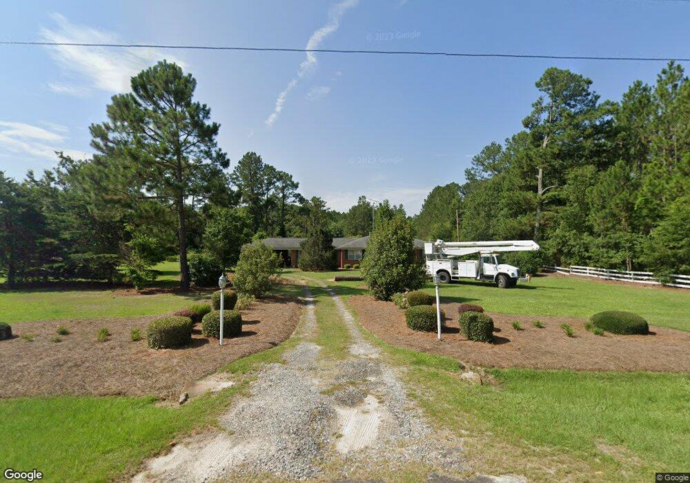
This home is located at 9055 Ga Highway 215, Pitts, GA 31072 and is currently estimated at $90,195, approximately $86 per square foot. 9055 Ga Highway 215 is a home located in Wilcox County with nearby schools including Wilcox County Elementary School, Wilcox County Middle School, and Wilcox County High School.
Ownership History
Date
Name
Owned For
Owner Type
Purchase Details
Closed on
Oct 4, 2022
Sold by
Brown Michael Eugene
Bought by
Payne Sharon Virginia
Current Estimated Value
Purchase Details
Closed on
Jan 4, 2022
Sold by
Brown Eugene Albert
Bought by
Brown Michael Eugene and Payne Sharon Virginia
Purchase Details
Closed on
Jan 4, 2006
Sold by
Plantersfirst
Bought by
Brown Eugene Albert
Create a Home Valuation Report for This Property
The Home Valuation Report is an in-depth analysis detailing your home's value as well as a comparison with similar homes in the area
Home Values in the Area
Average Home Value in this Area
Purchase History
| Date | Buyer | Sale Price | Title Company |
|---|---|---|---|
| Payne Sharon Virginia | -- | -- | |
| Brown Michael Eugene | -- | -- | |
| Brown Eugene Albert | $15,000 | -- |
Source: Public Records
Tax History Compared to Growth
Tax History
| Year | Tax Paid | Tax Assessment Tax Assessment Total Assessment is a certain percentage of the fair market value that is determined by local assessors to be the total taxable value of land and additions on the property. | Land | Improvement |
|---|---|---|---|---|
| 2024 | $657 | $13,976 | $448 | $13,528 |
| 2023 | $518 | $10,930 | $448 | $10,482 |
| 2022 | $338 | $10,930 | $448 | $10,482 |
| 2021 | $394 | $12,777 | $448 | $12,329 |
| 2020 | $311 | $9,324 | $689 | $8,635 |
| 2019 | $311 | $9,324 | $689 | $8,635 |
| 2018 | $311 | $9,324 | $689 | $8,635 |
| 2017 | $311 | $9,324 | $689 | $8,635 |
| 2016 | -- | $9,324 | $689 | $8,635 |
| 2015 | -- | $9,324 | $689 | $8,635 |
| 2014 | -- | $9,324 | $689 | $8,635 |
| 2013 | -- | $9,323 | $688 | $8,634 |
Source: Public Records
Map
Nearby Homes
- 501 Cottonwood Rd
- 00 Griffin Rd
- 595 Georgia 257
- 0 Barrentine Rd
- 000 Brady Rd
- 0 Barentine Rd
- 337 Friendship Church Rd
- 1088 Tippettville Rd
- 655 Tom Howard Farm Rd
- 650 Tom Howard Farm Rd
- 293 Wildwood Dr
- 146 7th Ave W
- 1 Tippettville Rd
- 0 Watson Rd Unit LOTWP001
- 0 Watson Rd Unit LotWP001 22591913
- 0 Lois Rd
- 2.78 ACRES Pineway Hwy
- 0 Folds Rd Unit 22934248
- 0 Folds Rd Unit 11453576
- 00 Folds Rd
- 9055 Ga Highway 215
- 9055 Ga Highway 215
- 8979 Ga Highway 215
- 9227 Ga Highway 215
- 8694 Ga Highway 215
- 8694 Georgia 215
- 1637 McGlamry Rd
- 11681 Ga Highway 215
- 8570 Ga Highway 215
- 496 Rhodes Ln
- 421 Griffin Rd
- 1549 McGlamry Rd
- 684 McGlamry Rd
- 1797 McGlamry Rd
- 8411 Ga Highway 215
- 407 Griffin Rd
- 54 Rhodes Ln
- 102 Rhodes Ln
- 1280 McGlamry Rd
- 45 Collins Cir