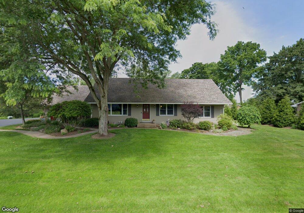
9058 Paula Way Mc Kean, PA 16426
Estimated Value: $286,000 - $473,000
4
Beds
3
Baths
3,193
Sq Ft
$125/Sq Ft
Est. Value
About This Home
This home is located at 9058 Paula Way, Mc Kean, PA 16426 and is currently estimated at $398,470, approximately $124 per square foot. 9058 Paula Way is a home located in Erie County with nearby schools including McKean Elementary School, James W. Parker Middle School, and General McLane High School.
Ownership History
Date
Name
Owned For
Owner Type
Purchase Details
Closed on
Aug 19, 2014
Sold by
Blount John and Wray Judith
Bought by
Blount John
Current Estimated Value
Purchase Details
Closed on
Jun 30, 2007
Sold by
Mehler Helen W and Mehler Richard J
Bought by
Laughlin Jerome M and Laughlin Elizabeth
Purchase Details
Closed on
Mar 28, 1996
Sold by
Purchase Olivia C
Bought by
Neylon Elizabeth A
Create a Home Valuation Report for This Property
The Home Valuation Report is an in-depth analysis detailing your home's value as well as a comparison with similar homes in the area
Home Values in the Area
Average Home Value in this Area
Purchase History
| Date | Buyer | Sale Price | Title Company |
|---|---|---|---|
| Blount John | -- | None Available | |
| Laughlin Jerome M | $3,000 | None Available | |
| Neylon Elizabeth A | $122,000 | -- |
Source: Public Records
Tax History Compared to Growth
Tax History
| Year | Tax Paid | Tax Assessment Tax Assessment Total Assessment is a certain percentage of the fair market value that is determined by local assessors to be the total taxable value of land and additions on the property. | Land | Improvement |
|---|---|---|---|---|
| 2025 | $4,907 | $215,600 | $45,200 | $170,400 |
| 2024 | $4,752 | $215,600 | $45,200 | $170,400 |
| 2023 | $4,472 | $215,600 | $45,200 | $170,400 |
| 2022 | $4,342 | $215,600 | $45,200 | $170,400 |
| 2021 | $4,286 | $215,600 | $45,200 | $170,400 |
| 2020 | $4,232 | $215,600 | $45,200 | $170,400 |
| 2019 | $4,204 | $215,600 | $45,200 | $170,400 |
| 2018 | $4,114 | $215,600 | $45,200 | $170,400 |
| 2017 | $4,114 | $215,600 | $45,200 | $170,400 |
| 2016 | $4,940 | $215,600 | $45,200 | $170,400 |
| 2015 | $4,886 | $215,600 | $45,200 | $170,400 |
| 2014 | $2,328 | $215,600 | $45,200 | $170,400 |
Source: Public Records
Map
Nearby Homes
- 5115 West Rd
- 11897 Silverthorn (Tr 86 Rt T438) Rd
- 0 Edinboro Rd Unit 182375
- 4954 East Ave
- 702 Skyline Dr
- 4854 N Main St
- 209 Timberlake Dr
- 6330 Rick Rd
- 8580 Rick Rd
- 15 Woodside Dr
- 8389 Edinboro Rd
- 6797 Sterrettania Rd
- 6419 Sterrettania Rd
- 2880 Cardinal Dr Unit 34
- 2800 Sun Ridge Dr
- 0 Pagan Rd
- 9731 Silverthorn Rd
- 5472 Granite Ln
- 8535 Oliver Rd
- 4385 Stone Creek Dr