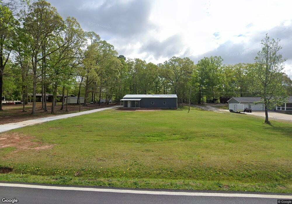
906 Airport Rd Oxford, GA 30054
Estimated Value: $208,000 - $258,825
--
Bed
1
Bath
1,800
Sq Ft
$125/Sq Ft
Est. Value
About This Home
This home is located at 906 Airport Rd, Oxford, GA 30054 and is currently estimated at $224,206, approximately $124 per square foot. 906 Airport Rd is a home located in Newton County with nearby schools including Flint Hill Elementary School, Cousins Middle School, and Newton High School.
Ownership History
Date
Name
Owned For
Owner Type
Purchase Details
Closed on
May 23, 2019
Sold by
Dunn Jack E
Bought by
Kitchens Joshua Michael
Current Estimated Value
Purchase Details
Closed on
May 15, 1998
Sold by
Kitchens Mary L
Bought by
Dunn Jack E and Dunn Betty J
Home Financials for this Owner
Home Financials are based on the most recent Mortgage that was taken out on this home.
Original Mortgage
$39,000
Interest Rate
7.04%
Mortgage Type
New Conventional
Create a Home Valuation Report for This Property
The Home Valuation Report is an in-depth analysis detailing your home's value as well as a comparison with similar homes in the area
Home Values in the Area
Average Home Value in this Area
Purchase History
| Date | Buyer | Sale Price | Title Company |
|---|---|---|---|
| Kitchens Joshua Michael | $50,000 | -- | |
| Dunn Jack E | $52,000 | -- |
Source: Public Records
Mortgage History
| Date | Status | Borrower | Loan Amount |
|---|---|---|---|
| Previous Owner | Dunn Jack E | $39,000 |
Source: Public Records
Tax History Compared to Growth
Tax History
| Year | Tax Paid | Tax Assessment Tax Assessment Total Assessment is a certain percentage of the fair market value that is determined by local assessors to be the total taxable value of land and additions on the property. | Land | Improvement |
|---|---|---|---|---|
| 2024 | $1,372 | $54,160 | $6,000 | $48,160 |
| 2023 | $1,361 | $50,160 | $6,000 | $44,160 |
| 2022 | $163 | $6,000 | $6,000 | $0 |
| 2021 | $182 | $6,000 | $6,000 | $0 |
| 2020 | $202 | $6,000 | $6,000 | $0 |
| 2019 | $16 | $18,000 | $6,000 | $12,000 |
| 2018 | $8 | $17,480 | $6,000 | $11,480 |
| 2017 | $16 | $17,400 | $6,000 | $11,400 |
| 2016 | $16 | $17,400 | $6,000 | $11,400 |
| 2015 | $15 | $17,440 | $6,000 | $11,440 |
| 2014 | $14 | $17,440 | $0 | $0 |
Source: Public Records
Map
Nearby Homes
- 135 Carole Dr
- 2.44 ACRES City Pond Rd
- 0 City Pond Rd Unit 10626589
- 0 City Pond Rd Unit 7667278
- 0 City Pond Rd Unit 7617916
- 0 City Pond Rd Unit 10566978
- 0 City Pond Rd Unit 7538927
- 0 City Pond Rd Unit 10476135
- 216 E Richardson St
- 35 Orchard Dr
- 65 Orchard Dr
- 175 Orchard Ln
- 75 Orchard Dr
- 385 Orchard Ln
- 165 Ryan Ln
- 180 Ryan Ln
- 205 Emory Way
- 205 Orchard Dr
- 215 Ryan Ln
- 235 Orchard Dr
- 886 Airport Rd
- 895 Airport Rd
- 45 Danielle Dr
- 933 Airport Rd
- 25 Danielle Dr
- 125 Danielle Dr
- 15 Danielle Dr
- 873 Airport Rd
- 949 Airport Rd
- 220 Danielle Dr
- 988 Airport Rd
- 140 Danielle Dr
- 0 Danielle Dr Unit 3100070
- 0 Danielle Dr
- 190 Danielle Dr
- 963 Airport Rd
- 60 Danielle Dr
- 180 Danielle Dr
- 1000 Airport Rd
- 40 Danielle Dr