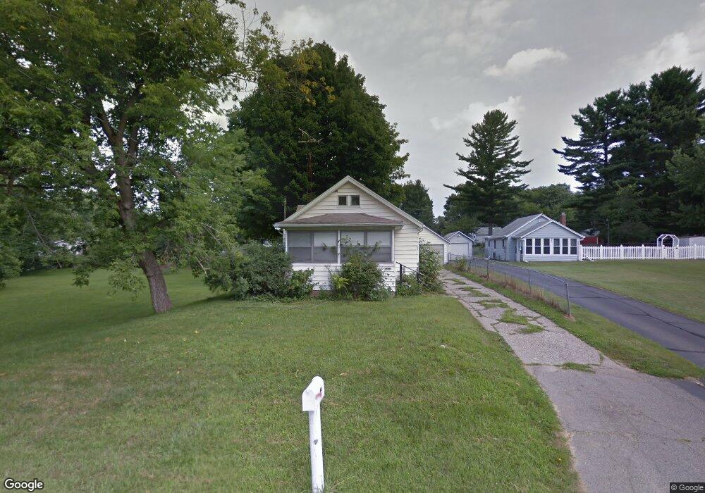
906 Grant St Jackson, MI 49203
Estimated Value: $148,443 - $165,000
2
Beds
1
Bath
881
Sq Ft
$178/Sq Ft
Est. Value
About This Home
This home is located at 906 Grant St, Jackson, MI 49203 and is currently estimated at $156,861, approximately $178 per square foot. 906 Grant St is a home located in Jackson County with nearby schools including Townsend Elementary School, Vandercook Lake High School, and Jackson Preparatory & Early College.
Ownership History
Date
Name
Owned For
Owner Type
Purchase Details
Closed on
Oct 2, 2007
Sold by
Trepka Michael and Trepka Sonja Marie
Bought by
The Cit Group/Consumer Finance Inc
Current Estimated Value
Purchase Details
Closed on
Aug 1, 2005
Sold by
Trepka Michael E and Trepka Patricia A
Bought by
Trepka Michael and Trepka Sonja Marie
Purchase Details
Closed on
Feb 23, 1989
Sold by
Bertsch Janet Herman
Bought by
Herman Gladys F
Purchase Details
Closed on
Feb 13, 1989
Sold by
Herman Gerald W and Herman Marjorie J
Bought by
Herman Gladys F
Create a Home Valuation Report for This Property
The Home Valuation Report is an in-depth analysis detailing your home's value as well as a comparison with similar homes in the area
Home Values in the Area
Average Home Value in this Area
Purchase History
| Date | Buyer | Sale Price | Title Company |
|---|---|---|---|
| The Cit Group/Consumer Finance Inc | $89,918 | None Available | |
| Trepka Michael | $80,809 | None Available | |
| Herman Gladys F | -- | -- | |
| Herman Gladys F | -- | -- |
Source: Public Records
Tax History
| Year | Tax Paid | Tax Assessment Tax Assessment Total Assessment is a certain percentage of the fair market value that is determined by local assessors to be the total taxable value of land and additions on the property. | Land | Improvement |
|---|---|---|---|---|
| 2025 | $1,395 | $71,700 | $0 | $0 |
| 2024 | $9 | $69,000 | $0 | $0 |
| 2023 | $848 | $57,300 | $0 | $0 |
| 2022 | $1,817 | $48,700 | $0 | $0 |
| 2021 | $1,861 | $46,900 | $0 | $0 |
| 2020 | $1,700 | $44,100 | $0 | $0 |
| 2019 | $1,224 | $40,100 | $0 | $0 |
| 2018 | $1,781 | $38,600 | $0 | $0 |
| 2017 | $1,056 | $37,500 | $0 | $0 |
| 2016 | $728 | $36,300 | $36,300 | $0 |
| 2015 | $1,456 | $32,600 | $32,600 | $0 |
| 2014 | $1,456 | $31,400 | $0 | $0 |
| 2013 | -- | $31,400 | $31,400 | $0 |
Source: Public Records
Map
Nearby Homes
- 121 Bagg Ave
- 108 Bagg Ave
- 1400 Floyd Ave
- 5400 Sharon Dr
- 5252 Draper Rd
- 172 Taylor Ave Unit 84
- 1225 Lucy Ave Unit 100
- 204 Meyers Ave
- 1222 Connie Ave Unit 125
- 1248 Upper Lucy #111 Unit 111
- 171 Carolyn Ave Unit 120
- 206 W Vandercook Dr
- 61 Lois Ln Unit 61
- 1 Pete St Unit 39
- 118 Ridge St
- 108 S Cove St
- 411 Hinckley Blvd
- 5182 Grande View Ln
- 2000 Evergreen Trail
- 4030 Gatewood Dr