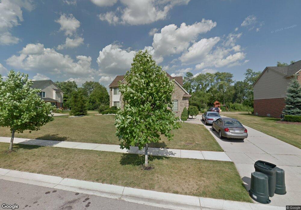
906 Huntsville Dr Unit 21 Canton, MI 48187
Estimated Value: $717,092 - $861,000
4
Beds
4
Baths
3,957
Sq Ft
$203/Sq Ft
Est. Value
About This Home
This home is located at 906 Huntsville Dr Unit 21, Canton, MI 48187 and is currently estimated at $803,523, approximately $203 per square foot. 906 Huntsville Dr Unit 21 is a home located in Wayne County with nearby schools including Canton High School, Plymouth High School, and Salem High School.
Ownership History
Date
Name
Owned For
Owner Type
Purchase Details
Closed on
Nov 14, 2012
Sold by
Parker David and Parker Valerie
Bought by
Mehar Nadeem and Manzoor Lubna
Current Estimated Value
Home Financials for this Owner
Home Financials are based on the most recent Mortgage that was taken out on this home.
Original Mortgage
$253,680
Outstanding Balance
$174,965
Interest Rate
3.35%
Mortgage Type
New Conventional
Estimated Equity
$628,558
Purchase Details
Closed on
Mar 16, 2007
Sold by
Thornton Kendra D and Knight Chris
Bought by
Parker David S
Purchase Details
Closed on
May 1, 2006
Sold by
Tuason Renato
Bought by
Thornton Kendra
Create a Home Valuation Report for This Property
The Home Valuation Report is an in-depth analysis detailing your home's value as well as a comparison with similar homes in the area
Home Values in the Area
Average Home Value in this Area
Purchase History
| Date | Buyer | Sale Price | Title Company |
|---|---|---|---|
| Mehar Nadeem | $317,100 | Continental Title Agency | |
| Parker David S | $385,000 | None Available | |
| Thornton Kendra | -- | None Available |
Source: Public Records
Mortgage History
| Date | Status | Borrower | Loan Amount |
|---|---|---|---|
| Open | Mehar Nadeem | $253,680 |
Source: Public Records
Tax History Compared to Growth
Tax History
| Year | Tax Paid | Tax Assessment Tax Assessment Total Assessment is a certain percentage of the fair market value that is determined by local assessors to be the total taxable value of land and additions on the property. | Land | Improvement |
|---|---|---|---|---|
| 2025 | $3,925 | $348,700 | $0 | $0 |
| 2024 | $3,925 | $312,600 | $0 | $0 |
| 2023 | $3,742 | $290,400 | $0 | $0 |
| 2022 | $8,068 | $261,000 | $0 | $0 |
| 2021 | $7,829 | $242,200 | $0 | $0 |
| 2020 | $7,735 | $234,600 | $0 | $0 |
| 2019 | $7,590 | $237,370 | $0 | $0 |
| 2018 | $3,180 | $223,550 | $0 | $0 |
| 2017 | $7,624 | $223,900 | $0 | $0 |
| 2016 | $6,891 | $225,800 | $0 | $0 |
| 2015 | $17,473 | $199,030 | $0 | $0 |
| 2013 | $16,927 | $176,870 | $0 | $0 |
| 2010 | -- | $161,170 | $66,847 | $94,323 |
Source: Public Records
Map
Nearby Homes
- 685 N Beck Rd
- 300 E Canford Park Unit 30
- 48030 Cherry Hill Rd
- 1300 N Beck Rd
- 1630 Mistwood Ct
- 47078 Bing Dr
- 46676 Grand Oak Ct
- 316 Queen Anne Dr
- 48375 Ford Rd
- 1273 Kennebec
- 46859 Hendrie Ct
- 49276 Garden Ln
- 5872 Meadowview Dr
- 00000 Denton Rd
- 0000 Denton Rd
- 48859 Garden Ln
- 48416 Manhattan Cir
- 2032 Tradition Dr
- 49335 Dominion Ct
- 1304 Tradition Dr
- 956 Huntsville Dr Unit 22
- 856 Huntsville Dr Unit 20
- 47892 Jake Ln Unit 34
- 47927 Jake Ln Unit 32
- 756 Huntsville Dr Unit 18
- 706 Huntsville Dr Unit 17
- 656 Huntsville Dr Unit 16
- 806 Huntsville Dr Unit 19
- 47924 Jake Ln Unit 35
- 47893 Jake Ln Unit 33
- 47820 Candace Ln Unit 27
- 47823 Jake Ln Unit 26
- 47822 Jake Ln Unit 25
- 47890 Candace Ln Unit 28
- 47963 Jake Ln Unit 31
- 47926 Candace Ln Unit 29
- 1006 Huntsville Dr Unit 23
- 47891 Candace Ln Unit 13
- 47960 Candace Ln Unit 30
- 47925 Candace Ln Unit 12