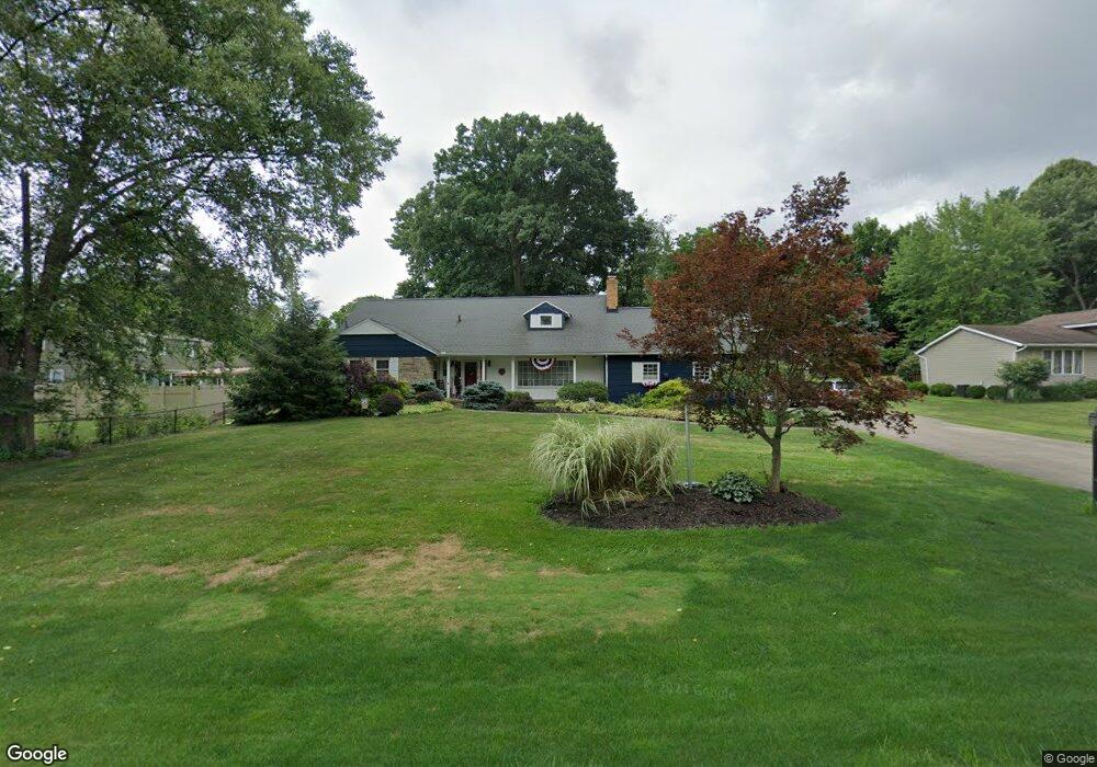
906 Norton Dr Tallmadge, OH 44278
Estimated Value: $305,000 - $362,000
4
Beds
3
Baths
1,628
Sq Ft
$207/Sq Ft
Est. Value
About This Home
This home is located at 906 Norton Dr, Tallmadge, OH 44278 and is currently estimated at $337,283, approximately $207 per square foot. 906 Norton Dr is a home located in Summit County with nearby schools including Tallmadge Middle School, Tallmadge High School, and Cornerstone Community School.
Ownership History
Date
Name
Owned For
Owner Type
Purchase Details
Closed on
Dec 12, 2023
Sold by
Denise M Thompson Trust
Bought by
Thompson Gary B and Thompson Denise M
Current Estimated Value
Purchase Details
Closed on
Dec 9, 2023
Sold by
Denise M Thompson Trust and Thompson Denise M
Bought by
Thompson Gary B and Thompson Denise M
Purchase Details
Closed on
Jun 28, 2000
Sold by
Thompson Gary B and Thompson Denise M
Bought by
Thompson Denise M and Denise M Thompson Trust
Purchase Details
Closed on
Feb 4, 1997
Sold by
Giulitto Margaret M
Bought by
Thompson Gary B and Thompson Denise M
Create a Home Valuation Report for This Property
The Home Valuation Report is an in-depth analysis detailing your home's value as well as a comparison with similar homes in the area
Home Values in the Area
Average Home Value in this Area
Purchase History
| Date | Buyer | Sale Price | Title Company |
|---|---|---|---|
| Thompson Gary B | -- | None Listed On Document | |
| Thompson Gary B | -- | None Listed On Document | |
| Thompson Denise M | -- | -- | |
| Thompson Gary B | $139,000 | -- |
Source: Public Records
Tax History Compared to Growth
Tax History
| Year | Tax Paid | Tax Assessment Tax Assessment Total Assessment is a certain percentage of the fair market value that is determined by local assessors to be the total taxable value of land and additions on the property. | Land | Improvement |
|---|---|---|---|---|
| 2025 | $5,120 | $99,131 | $16,804 | $82,327 |
| 2024 | $5,120 | $99,131 | $16,804 | $82,327 |
| 2023 | $5,120 | $99,131 | $16,804 | $82,327 |
| 2022 | $4,322 | $68,254 | $11,431 | $56,823 |
| 2021 | $4,341 | $68,254 | $11,431 | $56,823 |
| 2020 | $4,309 | $68,250 | $11,430 | $56,820 |
| 2019 | $3,948 | $55,840 | $10,630 | $45,210 |
| 2018 | $3,496 | $55,840 | $10,630 | $45,210 |
| 2017 | $3,533 | $55,840 | $10,630 | $45,210 |
| 2016 | $3,799 | $55,840 | $10,630 | $45,210 |
| 2015 | $3,533 | $55,840 | $10,630 | $45,210 |
| 2014 | $3,511 | $55,840 | $10,630 | $45,210 |
| 2013 | $3,461 | $56,040 | $10,630 | $45,410 |
Source: Public Records
Map
Nearby Homes
- 810 Norton Dr
- 206 Fawnwood Dr
- 821 Olde Orchard Dr
- 988 Beechwood Dr
- 330 Hanna Dr
- 1075 Amy Trail
- 243 S Munroe Rd
- 288 S Munroe Rd
- 1029 Maple St
- 523 S Munroe Rd
- 549 S Munroe Rd
- 1239 Glenoak Dr
- 490 Vandalia Dr
- 0 East Ave
- 1289 Peartree Ct
- 786 Southeast Ave
- 187 Oakview Cir
- 1034 Southeast Ave
- 1168 East Ave
- 750 Danner Rd
- 916 Norton Dr
- 894 Norton Dr
- 911 Martindale Dr
- 884 Norton Dr
- 350 Dunbar Rd
- 905 Norton Dr
- 893 Norton Dr
- 915 Norton Dr
- 899 Martindale Dr
- 934 Norton Dr
- 883 Norton Dr
- 874 Norton Dr
- 889 Martindale Dr
- 931 Martindale Dr
- 933 Norton Dr
- 944 Norton Dr
- 873 Norton Dr
- 879 Martindale Dr
- 300 Dunbar Rd
- 943 Martindale Dr