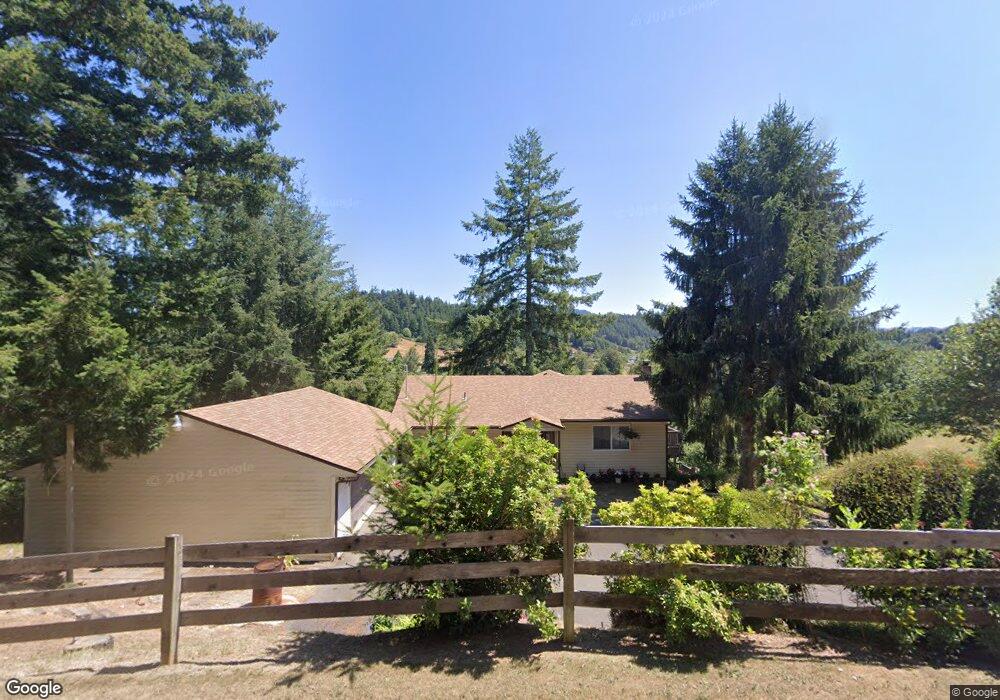
90600 N Fork Ln Myrtle Point, OR 97458
Estimated Value: $788,000
3
Beds
3
Baths
3,224
Sq Ft
$244/Sq Ft
Est. Value
About This Home
This home is located at 90600 N Fork Ln, Myrtle Point, OR 97458 and is currently estimated at $788,000, approximately $244 per square foot. 90600 N Fork Ln is a home located in Coos County with nearby schools including Myrtle Crest School and Myrtle Point High School.
Ownership History
Date
Name
Owned For
Owner Type
Purchase Details
Closed on
Jan 23, 2020
Sold by
Celestino Jean and Celestino 2019 Family Trust
Bought by
Wright David and Wright Lisa
Current Estimated Value
Home Financials for this Owner
Home Financials are based on the most recent Mortgage that was taken out on this home.
Original Mortgage
$292,500
Outstanding Balance
$258,535
Interest Rate
3.73%
Mortgage Type
New Conventional
Estimated Equity
$529,465
Purchase Details
Closed on
Feb 8, 2019
Sold by
Jeer Celestino
Bought by
The Celrstlno 2019 Family Trust
Purchase Details
Closed on
Nov 22, 2013
Sold by
Peper Betty A
Bought by
Celestino Jean and The Celestino Family 2007 Trust
Home Financials for this Owner
Home Financials are based on the most recent Mortgage that was taken out on this home.
Original Mortgage
$206,200
Interest Rate
4.18%
Mortgage Type
Seller Take Back
Create a Home Valuation Report for This Property
The Home Valuation Report is an in-depth analysis detailing your home's value as well as a comparison with similar homes in the area
Home Values in the Area
Average Home Value in this Area
Purchase History
| Date | Buyer | Sale Price | Title Company |
|---|---|---|---|
| Wright David | $325,000 | Ticor Title Company Of Or | |
| The Celrstlno 2019 Family Trust | -- | None Available | |
| Celestino Jean | $306,200 | First American Title |
Source: Public Records
Mortgage History
| Date | Status | Borrower | Loan Amount |
|---|---|---|---|
| Open | Wright David | $292,500 | |
| Previous Owner | Celestino Jean | $206,200 |
Source: Public Records
Tax History Compared to Growth
Tax History
| Year | Tax Paid | Tax Assessment Tax Assessment Total Assessment is a certain percentage of the fair market value that is determined by local assessors to be the total taxable value of land and additions on the property. | Land | Improvement |
|---|---|---|---|---|
| 2025 | $2,493 | $246,295 | -- | -- |
| 2024 | $2,463 | $239,181 | -- | -- |
| 2023 | $2,326 | $232,216 | $0 | $0 |
| 2022 | $2,311 | $225,457 | $0 | $0 |
| 2021 | $2,259 | $218,891 | $0 | $0 |
| 2020 | $2,828 | $287,060 | $0 | $0 |
| 2019 | $2,680 | $270,590 | $0 | $0 |
| 2018 | $2,635 | $262,710 | $0 | $0 |
| 2017 | $2,574 | $255,060 | $0 | $0 |
| 2016 | $2,503 | $247,640 | $0 | $0 |
| 2015 | $162 | $240,430 | $0 | $0 |
| 2014 | $162 | $233,430 | $0 | $0 |
Source: Public Records
Map
Nearby Homes
- 1211 Fairview St
- 227 Border St
- 1627 Maple St
- 1112 Spruce St
- 1713 Maple St
- 1311 Willow St
- 1829 E Willow St
- 1873 E Cedar St
- 92433 Ward Creek Ln
- 1404 Harris St
- 655 6th St
- 805 C St
- 1434 Maryland Ave
- 1938 Maryland Ave
- 52991 Stringtown Rd
- 53621 Weekly Creek Rd
- 1783 View St
- 1861 View St
- 1893 Sunset Ln
- 2047 Roseburg Rd
- 90600 N Fork Ln
- 90500 N Fork Ln
- 90129 N Fork Ln
- 90773 N Fork Ln
- 90127 N Fork Ln
- 95727 Sitkum Ln
- 95687 Sitkum Ln
- 90799 N Fork Ln
- 95685 Sitkum Ln
- 95695 Sitkum Ln
- 95694 Sitkum Ln
- 95643 Sitkum Ln
- 53934 Llewellyn Creek Rd
- 95672 Sitkum Ln
- 95684 Sitkum Ln
- 95641 Sitkum Ln
- 12721 Highway 42
- 95674 Sitkum Ln
- 95632 Sitkum Ln
- 95988 Sitkum Ln