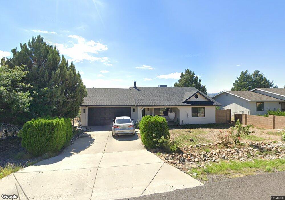
9061 E Longhorn Dr Prescott Valley, AZ 86314
Estimated Value: $354,788 - $451,000
--
Bed
--
Bath
1,548
Sq Ft
$268/Sq Ft
Est. Value
About This Home
This home is located at 9061 E Longhorn Dr, Prescott Valley, AZ 86314 and is currently estimated at $415,197, approximately $268 per square foot. 9061 E Longhorn Dr is a home located in Yavapai County with nearby schools including Mountain View Elementary School, Glassford Hill Middle School, and Bradshaw Mountain High School.
Ownership History
Date
Name
Owned For
Owner Type
Purchase Details
Closed on
Nov 15, 2023
Sold by
Bautista Jose L and Bautista Lourdes M
Bought by
Bautista-Burgos Yadira C and Barron Marco A
Current Estimated Value
Purchase Details
Closed on
Jan 17, 2006
Sold by
Sams Lynne C
Bought by
Bautista Jose L and Bautista Lourdes M
Home Financials for this Owner
Home Financials are based on the most recent Mortgage that was taken out on this home.
Original Mortgage
$161,000
Interest Rate
6.15%
Mortgage Type
New Conventional
Purchase Details
Closed on
May 1, 1994
Sold by
New Beverly M
Bought by
Sams Lynne C
Home Financials for this Owner
Home Financials are based on the most recent Mortgage that was taken out on this home.
Original Mortgage
$58,000
Interest Rate
4.75%
Mortgage Type
New Conventional
Create a Home Valuation Report for This Property
The Home Valuation Report is an in-depth analysis detailing your home's value as well as a comparison with similar homes in the area
Home Values in the Area
Average Home Value in this Area
Purchase History
| Date | Buyer | Sale Price | Title Company |
|---|---|---|---|
| Bautista-Burgos Yadira C | -- | -- | |
| Bautista Jose L | $215,000 | Pioneer Title Agency Inc | |
| Sams Lynne C | $78,000 | Westitle Agency |
Source: Public Records
Mortgage History
| Date | Status | Borrower | Loan Amount |
|---|---|---|---|
| Previous Owner | Bautista Jose L | $161,000 | |
| Previous Owner | Sams Lynne C | $58,000 |
Source: Public Records
Tax History Compared to Growth
Tax History
| Year | Tax Paid | Tax Assessment Tax Assessment Total Assessment is a certain percentage of the fair market value that is determined by local assessors to be the total taxable value of land and additions on the property. | Land | Improvement |
|---|---|---|---|---|
| 2026 | $1,579 | $32,678 | -- | -- |
| 2024 | $1,447 | $33,796 | -- | -- |
| 2023 | $1,447 | $28,246 | $4,109 | $24,137 |
| 2022 | $1,423 | $23,199 | $3,309 | $19,890 |
| 2021 | $1,487 | $20,807 | $3,472 | $17,335 |
| 2020 | $1,429 | $0 | $0 | $0 |
| 2019 | $1,412 | $0 | $0 | $0 |
| 2018 | $1,342 | $0 | $0 | $0 |
| 2017 | $1,316 | $0 | $0 | $0 |
| 2016 | $1,271 | $0 | $0 | $0 |
| 2015 | $1,253 | $0 | $0 | $0 |
| 2014 | -- | $0 | $0 | $0 |
Source: Public Records
Map
Nearby Homes
- 9101 E Bighorn Dr
- 4581 N Ranger Rd
- 4595 N Raven Dr
- 4661 N Carla Vista Dr
- 8820 E Beaver Dr
- 4250 N Cholla Dr
- 4225 N Saratoga Dr
- 9274 E Manzanita Cir Unit 20
- 4501 N Jokake Cir
- 0 E Lakeshore Dr Unit PAR1074038
- 8800 E Westward Way
- 4420 N Katie Cir E
- 9331 E Serpentine Ln
- 4321 N Tonopah Dr
- 4471 N Romero Cir E Unit E
- 4100 N Kearny Dr
- 4767 N Stallion Dr
- 8591 E Tracy Dr
- 9101 E Manley Dr
- 3958 N Catherine Dr
- 9081 E Longhorn Dr
- 9041 E Longhorn Dr
- 9080 E Swift Trail Dr
- 9060 E Swift Trail Dr
- 9040 E Longhorn Dr
- 9100 E Swift Trail Dr
- 9100 E Swift Trail Dr Unit 20
- 9101 E Longhorn Dr
- 9021 E Longhorn Dr
- 9080 E Longhorn Dr
- 9080 E Longhorn Dr Unit 1
- 9080 E Longhorn Dr Unit 20
- 9020 E Longhorn Dr
- 4445 N Carla Vista Dr
- 9061 E Bighorn Dr
- 9041 E Bighorn Dr
- 9100 E Longhorn Dr Unit 20
- 9100 E Longhorn Dr
- 9120 E Swift Trail Dr
- 9089 E Swift Trail Dr