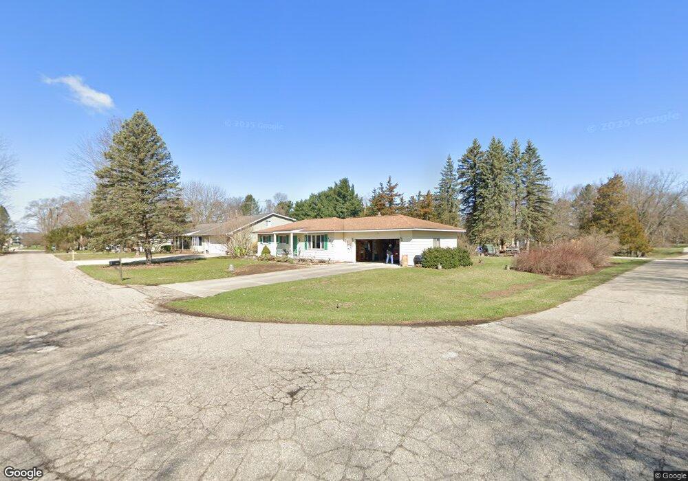
9063 Buchanan Rd Brighton, MI 48116
Estimated Value: $271,373 - $333,000
3
Beds
1
Bath
1,136
Sq Ft
$262/Sq Ft
Est. Value
About This Home
This home is located at 9063 Buchanan Rd, Brighton, MI 48116 and is currently estimated at $297,343, approximately $261 per square foot. 9063 Buchanan Rd is a home located in Livingston County with nearby schools including Hawkins Elementary School, Scranton Middle School, and Brighton High School.
Ownership History
Date
Name
Owned For
Owner Type
Purchase Details
Closed on
Jun 17, 2020
Sold by
Chall Margaret F
Bought by
Chall Margaret F and Chall Margaret Francis
Current Estimated Value
Purchase Details
Closed on
Sep 12, 1995
Sold by
Keranen Robert P
Bought by
Chall Margaret F
Home Financials for this Owner
Home Financials are based on the most recent Mortgage that was taken out on this home.
Original Mortgage
$90,000
Interest Rate
7.68%
Mortgage Type
New Conventional
Create a Home Valuation Report for This Property
The Home Valuation Report is an in-depth analysis detailing your home's value as well as a comparison with similar homes in the area
Home Values in the Area
Average Home Value in this Area
Purchase History
| Date | Buyer | Sale Price | Title Company |
|---|---|---|---|
| Chall Margaret F | -- | None Available | |
| Chall Margaret F | $122,000 | -- |
Source: Public Records
Mortgage History
| Date | Status | Borrower | Loan Amount |
|---|---|---|---|
| Closed | Chall Margaret F | $90,000 |
Source: Public Records
Tax History
| Year | Tax Paid | Tax Assessment Tax Assessment Total Assessment is a certain percentage of the fair market value that is determined by local assessors to be the total taxable value of land and additions on the property. | Land | Improvement |
|---|---|---|---|---|
| 2025 | $900 | $121,100 | $0 | $0 |
| 2024 | $874 | $117,100 | $0 | $0 |
| 2023 | $836 | $104,200 | $0 | $0 |
| 2022 | $1,706 | $84,600 | $0 | $0 |
| 2021 | $1,706 | $85,000 | $0 | $0 |
| 2020 | $1,692 | $87,000 | $0 | $0 |
| 2019 | $1,662 | $84,600 | $0 | $0 |
| 2018 | $1,634 | $78,100 | $0 | $0 |
| 2017 | $1,606 | $78,300 | $0 | $0 |
| 2016 | $1,598 | $79,400 | $0 | $0 |
| 2014 | $1,462 | $62,200 | $0 | $0 |
| 2012 | $1,462 | $53,200 | $0 | $0 |
Source: Public Records
Map
Nearby Homes
- 00 Cheddar Valley
- 253 Lantana Dr
- 265 Lantana Dr
- 259 Lantana Dr
- Lot 12 Wyndam Ln
- 271 Lantana Dr
- 9245 Lee Rd
- 6466 Marcy St
- 410 Spring Brooke Dr
- 1239 Cedarwood Dr
- 413 Water Tower Cir Unit 97
- 1201 Arbor Ridge Dr Unit 18
- 6332 Superior Dr
- 1016 Pinewood Ct Unit 48
- 5851 Kinyon Dr
- 8185 Carston Ln
- 1004 Rosewood Ct
- 210 Sisu Knoll Dr
- 6277 Northridge Woods Dr
- 10540 Kenrich Dr
- 9039 Buchanan Rd
- 6802 Somerset Dr
- 9050 Buchanan Rd
- 6875 Somerset Dr
- 9051 Buchanan Rd
- 9046 Buchanan Rd
- 6792 Somerset Dr
- 6851 Somerset Dr
- 6851 Rickett Rd
- 6911 Somerset Dr
- 9033 Buchanan Rd
- 6910 Somerset Dr
- 9030 Buchanan Rd
- 6888 Cheddar Valley Dr
- 6880 Cheddar Valley Dr
- 6888 Cheddar Valley Dr
- 6904 Cheddar Valley Dr
- 6874 Cheddar Valley Dr
- 6797 Somerset Dr
- 6904 Cheddar Valley
Your Personal Tour Guide
Ask me questions while you tour the home.