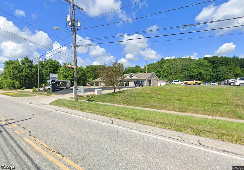
9065 Main St Unit 2 McKean, PA 16426
--
Bed
2
Baths
2,688
Sq Ft
2
Acres
About This Home
This home is located at 9065 Main St Unit 2, McKean, PA 16426. 9065 Main St Unit 2 is a home located in Erie County with nearby schools including McKean Elementary School, James W. Parker Middle School, and General McLane High School.
Ownership History
Date
Name
Owned For
Owner Type
Purchase Details
Closed on
Apr 5, 2019
Sold by
Kifer Enterprises Llc
Bought by
K L Soety Homes Llc
Home Financials for this Owner
Home Financials are based on the most recent Mortgage that was taken out on this home.
Original Mortgage
$456,000
Outstanding Balance
$400,905
Interest Rate
4.3%
Mortgage Type
Commercial
Purchase Details
Closed on
Oct 31, 2008
Sold by
P & A Group Inc
Bought by
Kifer Enterprises Llc
Home Financials for this Owner
Home Financials are based on the most recent Mortgage that was taken out on this home.
Original Mortgage
$206,000
Interest Rate
5.83%
Mortgage Type
Future Advance Clause Open End Mortgage
Purchase Details
Closed on
Jun 12, 1997
Sold by
Matz Kathryn B
Bought by
P & A Group Inc
Create a Home Valuation Report for This Property
The Home Valuation Report is an in-depth analysis detailing your home's value as well as a comparison with similar homes in the area
Home Values in the Area
Average Home Value in this Area
Purchase History
| Date | Buyer | Sale Price | Title Company |
|---|---|---|---|
| K L Soety Homes Llc | $355,000 | None Available | |
| Kifer Enterprises Llc | $258,000 | None Available | |
| P & A Group Inc | $120,000 | -- |
Source: Public Records
Mortgage History
| Date | Status | Borrower | Loan Amount |
|---|---|---|---|
| Open | K L Soety Homes Llc | $456,000 | |
| Previous Owner | Kifer Enterprises Llc | $206,000 |
Source: Public Records
Tax History Compared to Growth
Tax History
| Year | Tax Paid | Tax Assessment Tax Assessment Total Assessment is a certain percentage of the fair market value that is determined by local assessors to be the total taxable value of land and additions on the property. | Land | Improvement |
|---|---|---|---|---|
| 2025 | $6,002 | $263,700 | $60,000 | $203,700 |
| 2024 | $5,812 | $263,700 | $60,000 | $203,700 |
| 2023 | $5,469 | $263,700 | $60,000 | $203,700 |
| 2022 | $5,311 | $263,700 | $60,000 | $203,700 |
| 2021 | $5,242 | $263,700 | $60,000 | $203,700 |
| 2020 | $5,176 | $263,700 | $60,000 | $203,700 |
| 2019 | $5,142 | $263,700 | $60,000 | $203,700 |
| 2018 | $5,031 | $263,700 | $60,000 | $203,700 |
| 2017 | $5,031 | $263,700 | $60,000 | $203,700 |
| 2016 | $6,158 | $263,700 | $60,000 | $203,700 |
| 2015 | $6,093 | $263,700 | $60,000 | $203,700 |
| 2014 | $2,750 | $247,000 | $60,000 | $187,000 |
Source: Public Records
Map
Nearby Homes
- 11897 Silverthorn (Tr 86 Rt T438) Rd
- 5115 West Rd
- 4954 East Ave
- 0 Edinboro Rd Unit 182375
- 4854 N Main St
- 702 Skyline Dr
- 209 Timberlake Dr
- 6330 Rick Rd
- 8580 Rick Rd
- 8389 Edinboro Rd
- 15 Woodside Dr
- 6419 Sterrettania Rd
- 6797 Sterrettania Rd
- 2880 Cardinal Dr Unit 34
- 2800 Sun Ridge Dr
- 0 Pagan Rd
- 8535 Oliver Rd
- 8340-8350 Oliver Rd
- 8350 Oliver Rd
- 8340 Oliver Rd