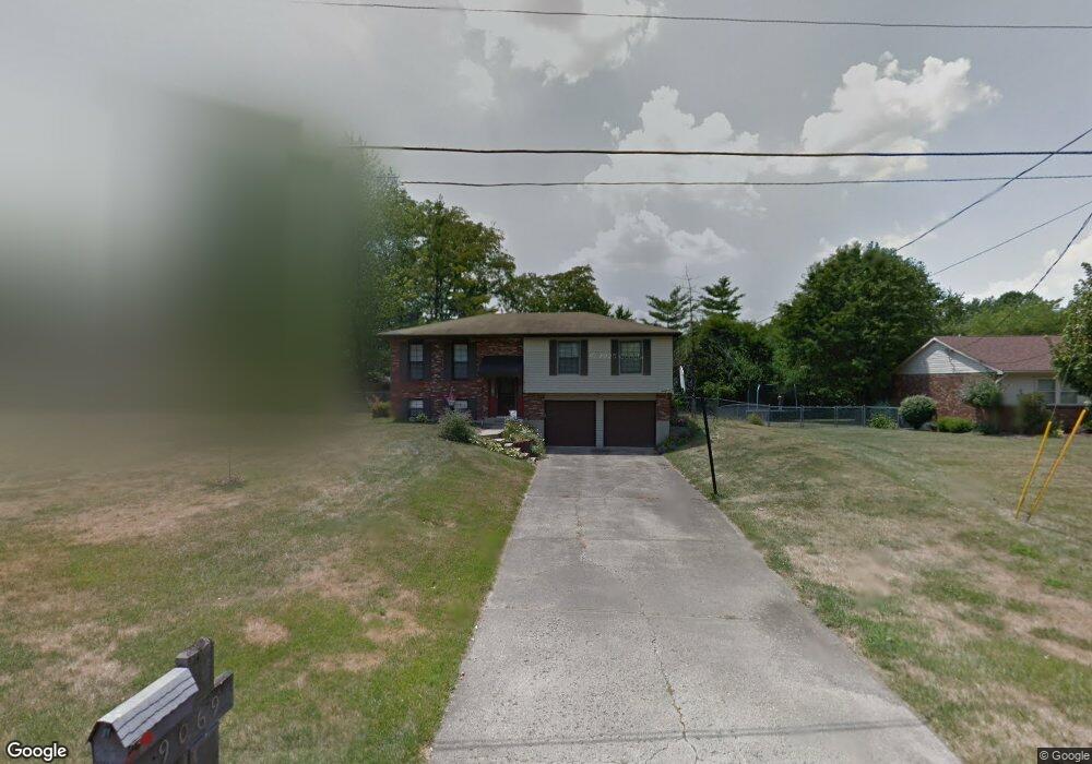
9069 Quentin Ct West Chester, OH 45069
West Chester Township NeighborhoodEstimated Value: $299,000 - $316,000
3
Beds
3
Baths
1,562
Sq Ft
$196/Sq Ft
Est. Value
About This Home
This home is located at 9069 Quentin Ct, West Chester, OH 45069 and is currently estimated at $306,829, approximately $196 per square foot. 9069 Quentin Ct is a home located in Butler County with nearby schools including Hopewell Early Childhood School, Adena Elementary School, and Lakota Ridge Junior School.
Ownership History
Date
Name
Owned For
Owner Type
Purchase Details
Closed on
Feb 24, 2010
Sold by
Federal Home Loan Mortgage Corporation
Bought by
Arslan Hakan and Arslan Serkan
Current Estimated Value
Purchase Details
Closed on
Jan 27, 2010
Sold by
Lynch Dustin S
Bought by
Federal Home Loan Mortgage Corp
Purchase Details
Closed on
Aug 26, 1999
Sold by
Cosculluela Mark P
Bought by
Lynch Dustin S and Lynch Tracey L
Home Financials for this Owner
Home Financials are based on the most recent Mortgage that was taken out on this home.
Original Mortgage
$123,436
Interest Rate
7.59%
Mortgage Type
FHA
Purchase Details
Closed on
Aug 30, 1995
Sold by
Childress Trou B
Bought by
Sanders Glenn J and Sanders Virginia
Purchase Details
Closed on
Jun 1, 1987
Purchase Details
Closed on
Aug 1, 1985
Create a Home Valuation Report for This Property
The Home Valuation Report is an in-depth analysis detailing your home's value as well as a comparison with similar homes in the area
Home Values in the Area
Average Home Value in this Area
Purchase History
| Date | Buyer | Sale Price | Title Company |
|---|---|---|---|
| Arslan Hakan | $114,000 | Attorney | |
| Federal Home Loan Mortgage Corp | $90,800 | None Available | |
| Lynch Dustin S | $123,500 | -- | |
| Sanders Glenn J | $110,500 | -- | |
| -- | $83,000 | -- | |
| -- | $69,900 | -- |
Source: Public Records
Mortgage History
| Date | Status | Borrower | Loan Amount |
|---|---|---|---|
| Previous Owner | Lynch Dustin S | $123,436 | |
| Closed | Sanders Glenn J | -- |
Source: Public Records
Tax History Compared to Growth
Tax History
| Year | Tax Paid | Tax Assessment Tax Assessment Total Assessment is a certain percentage of the fair market value that is determined by local assessors to be the total taxable value of land and additions on the property. | Land | Improvement |
|---|---|---|---|---|
| 2024 | $3,087 | $72,880 | $10,530 | $62,350 |
| 2023 | $3,065 | $72,980 | $10,530 | $62,450 |
| 2022 | $3,102 | $54,290 | $10,530 | $43,760 |
| 2021 | $2,826 | $52,210 | $10,530 | $41,680 |
| 2020 | $2,893 | $52,210 | $10,530 | $41,680 |
| 2019 | $4,378 | $45,680 | $12,040 | $33,640 |
| 2018 | $2,660 | $45,680 | $12,040 | $33,640 |
| 2017 | $2,707 | $45,680 | $12,040 | $33,640 |
| 2016 | $2,548 | $41,540 | $12,040 | $29,500 |
| 2015 | $2,539 | $41,540 | $12,040 | $29,500 |
| 2014 | $2,794 | $41,540 | $12,040 | $29,500 |
| 2013 | $2,794 | $44,350 | $10,230 | $34,120 |
Source: Public Records
Map
Nearby Homes
- 9052 Saxton Dr
- 7761 Jonathan Ct
- 8997 Saxton Dr
- 7853 W Chester Rd
- 9337 Cincinnati Columbus Rd
- 7476 W Chester Rd
- 7950 Ruth Ct
- 8749 Monticello Dr
- 9302 W Meadow Dr
- 9024 Revere Run
- 8698 Cox Rd
- 9447 Eastbrook Dr
- 7470 Susan Springs Dr
- 7971 Jasmine Trail
- 7318 Hollywood Dr
- 7661 Brookdale Dr
- 8558 Cox Rd
- 8141 Stone Dr
- 9616 Holly Leaf Cir
- 7186 Willow Oak Ct
- 9059 Quentin Ct
- 9079 Quentin Ct
- 9034 Saxton Dr
- 9051 Quentin Ct
- 9087 Quentin Ct
- 9070 Quentin Ct
- 9032 Saxton Dr
- 9060 Quentin Ct
- 9093 Quentin Ct
- 9050 Quentin Ct
- 9080 Quentin Ct
- 9040 Quentin Ct
- 9043 Quentin Ct
- 9042 Saxton Dr
- 9088 Quentin Ct
- 9030 Saxton Dr
- 7740 Joan Dr
- 7744 Joan Dr
- 9046 Saxton Dr
- 7657 Jonathan Ct