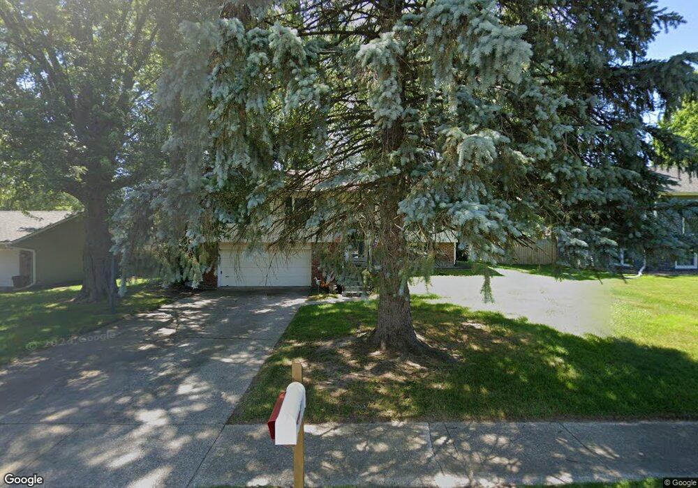
907 Fox Point Dr Chesterton, IN 46304
Estimated Value: $270,256 - $296,000
3
Beds
3
Baths
1,572
Sq Ft
$182/Sq Ft
Est. Value
About This Home
This home is located at 907 Fox Point Dr, Chesterton, IN 46304 and is currently estimated at $286,814, approximately $182 per square foot. 907 Fox Point Dr is a home located in Porter County with nearby schools including Bailly Elementary School, Westchester Intermediate School, and Chesterton Middle School.
Ownership History
Date
Name
Owned For
Owner Type
Purchase Details
Closed on
Dec 2, 2006
Sold by
Race Ronald W and Race Charlene L
Bought by
Furdo Robert and Furdo Pamela
Current Estimated Value
Home Financials for this Owner
Home Financials are based on the most recent Mortgage that was taken out on this home.
Original Mortgage
$158,757
Outstanding Balance
$95,180
Interest Rate
6.36%
Mortgage Type
FHA
Estimated Equity
$191,634
Create a Home Valuation Report for This Property
The Home Valuation Report is an in-depth analysis detailing your home's value as well as a comparison with similar homes in the area
Home Values in the Area
Average Home Value in this Area
Purchase History
| Date | Buyer | Sale Price | Title Company |
|---|---|---|---|
| Furdo Robert | -- | Ticor Title Insurance |
Source: Public Records
Mortgage History
| Date | Status | Borrower | Loan Amount |
|---|---|---|---|
| Open | Furdo Robert | $158,757 |
Source: Public Records
Tax History Compared to Growth
Tax History
| Year | Tax Paid | Tax Assessment Tax Assessment Total Assessment is a certain percentage of the fair market value that is determined by local assessors to be the total taxable value of land and additions on the property. | Land | Improvement |
|---|---|---|---|---|
| 2024 | $2,037 | $206,700 | $47,400 | $159,300 |
| 2023 | $2,017 | $194,100 | $43,800 | $150,300 |
| 2022 | $2,063 | $187,600 | $43,800 | $143,800 |
| 2021 | $1,783 | $168,700 | $43,800 | $124,900 |
| 2020 | $1,713 | $163,100 | $38,200 | $124,900 |
| 2019 | $1,531 | $145,800 | $38,200 | $107,600 |
| 2018 | $1,449 | $140,900 | $38,200 | $102,700 |
| 2017 | $1,369 | $140,500 | $38,200 | $102,300 |
| 2016 | $1,292 | $139,100 | $42,300 | $96,800 |
| 2014 | $1,301 | $131,800 | $40,100 | $91,700 |
| 2013 | -- | $125,300 | $40,400 | $84,900 |
Source: Public Records
Map
Nearby Homes
- 542 Dunewood Dr
- 1730 S 11th St
- 604 Oakwood Dr
- 550 Windridge Dr
- 723 S Park Dr
- 701 S Park Dr
- 711 Timber Ct
- 1887 Jacob Ln
- 514 S Park Dr
- 1958 Texas St
- 1501 Maximilian Dr
- 2091 Texas St
- 611 W Porter Ave
- 419 Jefferson Ave
- 260 Ivy St
- 422 Jefferson Ave
- 1908 Catkin Cir
- 108 Washington Ave
- 0 W 1050 N
- 1915 David Dr
- 907 Fox Dr
- 901 Fox Point Dr
- 913 Fox Point Dr
- 913 Fox Dr
- 900 Chestnut Blvd
- 818 Chestnut Blvd
- 815 Fox Point Dr
- 906 Chestnut Blvd
- 919 Fox Point Dr
- 906 Fox Point Dr
- 900 Fox Point Dr
- 1525 Fox Point Dr
- 912 Fox Dr
- 912 Fox Point Dr
- 812 Fox Point Dr
- 1533 Fox Dr
- 1533 Fox Point Dr
- 918 Fox Point Dr
- 807 Fox Point Dr
- 812 Chestnut Blvd