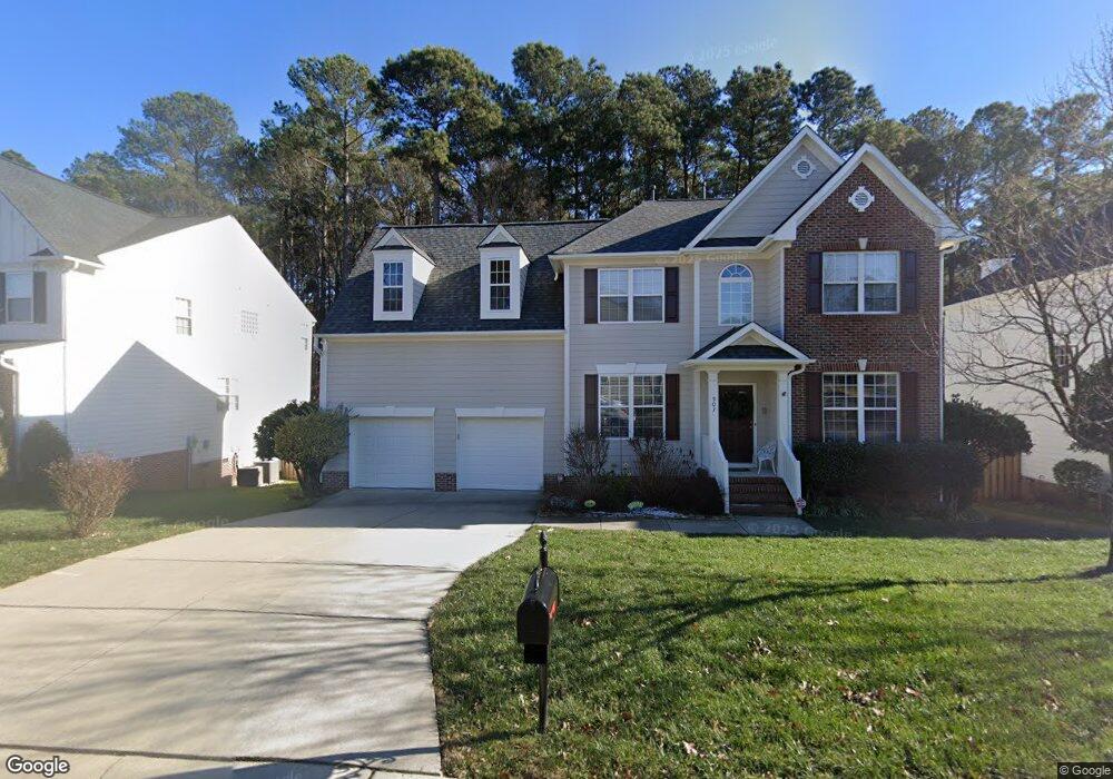
907 Martry Rd Durham, NC 27713
South Durham NeighborhoodEstimated Value: $574,268 - $676,000
3
Beds
3
Baths
2,424
Sq Ft
$259/Sq Ft
Est. Value
About This Home
This home is located at 907 Martry Rd, Durham, NC 27713 and is currently estimated at $628,817, approximately $259 per square foot. 907 Martry Rd is a home located in Durham County with nearby schools including Lowe's Grove Middle, Hillside High School, and Kestrel Heights School.
Ownership History
Date
Name
Owned For
Owner Type
Purchase Details
Closed on
Jan 14, 2008
Sold by
Walthall Donald J and Walthall Elizabeth A
Bought by
Walthall Donald J and Walthall Elizabeth A
Current Estimated Value
Purchase Details
Closed on
Dec 7, 2007
Sold by
Walthall Donald J and Walthall Elizabeth A
Bought by
Walthall Donald J and Walthall Elizabeth A
Purchase Details
Closed on
Jul 10, 2007
Sold by
Hicks Thomas B and Hicks Molly Moore
Bought by
Walthall Donald J and Walthall Elizabeth A
Purchase Details
Closed on
Oct 28, 2004
Sold by
Dr Horton Inc
Bought by
Hicks Thomas B and Hicks Molly Moore
Home Financials for this Owner
Home Financials are based on the most recent Mortgage that was taken out on this home.
Original Mortgage
$39,417
Interest Rate
5.65%
Mortgage Type
Credit Line Revolving
Create a Home Valuation Report for This Property
The Home Valuation Report is an in-depth analysis detailing your home's value as well as a comparison with similar homes in the area
Home Values in the Area
Average Home Value in this Area
Purchase History
| Date | Buyer | Sale Price | Title Company |
|---|---|---|---|
| Walthall Donald J | -- | None Available | |
| Walthall Donald J | -- | None Available | |
| Walthall Donald J | $295,000 | None Available | |
| Hicks Thomas B | $263,000 | -- |
Source: Public Records
Mortgage History
| Date | Status | Borrower | Loan Amount |
|---|---|---|---|
| Previous Owner | Hicks Thomas B | $39,417 | |
| Previous Owner | Hicks Thomas B | $210,228 |
Source: Public Records
Tax History
| Year | Tax Paid | Tax Assessment Tax Assessment Total Assessment is a certain percentage of the fair market value that is determined by local assessors to be the total taxable value of land and additions on the property. | Land | Improvement |
|---|---|---|---|---|
| 2025 | $5,264 | $530,978 | $139,500 | $391,478 |
| 2024 | $4,180 | $299,684 | $77,687 | $221,997 |
| 2023 | $3,926 | $299,684 | $77,687 | $221,997 |
| 2022 | $3,836 | $299,684 | $77,687 | $221,997 |
| 2021 | $3,818 | $299,684 | $77,687 | $221,997 |
| 2020 | $3,728 | $299,684 | $77,687 | $221,997 |
| 2019 | $3,728 | $299,684 | $77,687 | $221,997 |
| 2018 | $4,157 | $306,458 | $70,000 | $236,458 |
| 2017 | $4,126 | $306,458 | $70,000 | $236,458 |
| 2016 | $3,987 | $306,458 | $70,000 | $236,458 |
| 2015 | $3,805 | $274,876 | $63,200 | $211,676 |
| 2014 | $3,805 | $274,876 | $63,200 | $211,676 |
Source: Public Records
Map
Nearby Homes
- 1425 Cherob Ln
- 1448 Cherob Ln
- 1 Haycox Ct
- 211 Cool Spring Rd
- 7 Monteith Ct
- 204 S Bend Dr
- 8115 Massey Chapel Rd
- 109 Settlers Mill Ln
- 1010 Sturbridge Dr
- 903 Limerick Ln
- 1021 Pondfield Way
- 7502 Hedfield Way
- 4517 Grandale Dr
- 4 Green Springs Ct
- 7 Scenic Ct
- 7907 Massey Chapel Rd
- 43 Redbud Ct
- 111 Wenonah Way
- 6353 Grandale Dr
- 1604 Timber Wolf Dr
- 905 Martry Rd
- 909 Martry Rd
- 903 Martry Rd
- 1001 Martry Rd
- 1505 Carrickfergus Ct
- 901 Martry Rd
- 1520 Bally Castle Dr
- 1508 Carrickfergus Ct
- 1003 Martry Rd
- 1503 Carrickfergus Ct
- 1518 Bally Castle Dr
- 807 Martry Rd
- 1005 Martry Rd
- 1506 Carrickfergus Ct
- 1519 Bally Castle Dr
- 1516 Bally Castle Dr
- 805 Martry Rd
- 1007 Martry Rd
- 1504 Carrickfergus Ct
- 1515 Bally Castle Dr
Your Personal Tour Guide
Ask me questions while you tour the home.