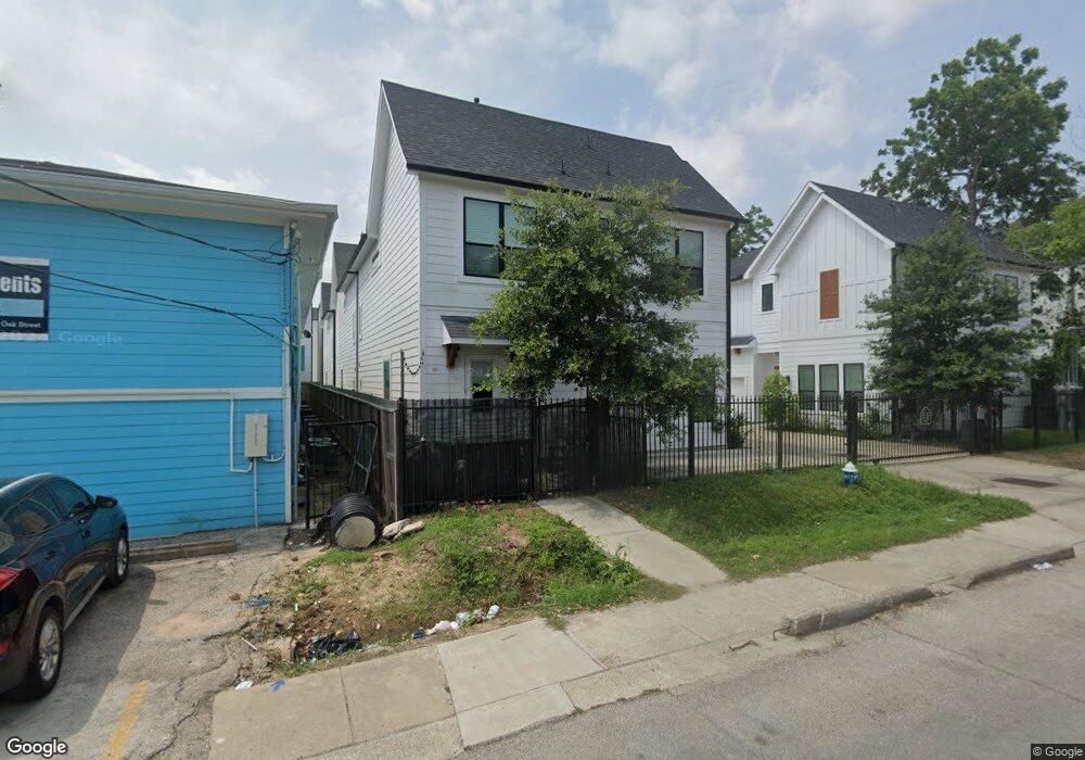
907 Oak St Unit A Houston, TX 77018
Oak Forest-Garden Oaks NeighborhoodEstimated Value: $402,000 - $447,094
3
Beds
3
Baths
1,902
Sq Ft
$223/Sq Ft
Est. Value
About This Home
This home is located at 907 Oak St Unit A, Houston, TX 77018 and is currently estimated at $424,774, approximately $223 per square foot. 907 Oak St Unit A is a home located in Harris County with nearby schools including Durham Elementary School, Frank Black Middle School, and Waltrip High School.
Ownership History
Date
Name
Owned For
Owner Type
Purchase Details
Closed on
Apr 10, 2020
Sold by
Sumerton Homes Llc
Bought by
Leal Jason and Silvia Liva
Current Estimated Value
Home Financials for this Owner
Home Financials are based on the most recent Mortgage that was taken out on this home.
Original Mortgage
$261,757
Outstanding Balance
$231,885
Interest Rate
3.4%
Mortgage Type
New Conventional
Estimated Equity
$192,889
Purchase Details
Closed on
Oct 22, 2010
Sold by
Cooper Sam Bronson
Bought by
Musslewhite Donald Ray
Create a Home Valuation Report for This Property
The Home Valuation Report is an in-depth analysis detailing your home's value as well as a comparison with similar homes in the area
Home Values in the Area
Average Home Value in this Area
Purchase History
| Date | Buyer | Sale Price | Title Company |
|---|---|---|---|
| Leal Jason | -- | None Available | |
| Musslewhite Donald Ray | $26,000 | None Available |
Source: Public Records
Mortgage History
| Date | Status | Borrower | Loan Amount |
|---|---|---|---|
| Open | Leal Jason | $261,757 |
Source: Public Records
Tax History Compared to Growth
Tax History
| Year | Tax Paid | Tax Assessment Tax Assessment Total Assessment is a certain percentage of the fair market value that is determined by local assessors to be the total taxable value of land and additions on the property. | Land | Improvement |
|---|---|---|---|---|
| 2025 | $9,554 | $497,468 | $100,447 | $397,021 |
| 2024 | $9,554 | $499,936 | $82,184 | $417,752 |
| 2023 | $9,554 | $380,518 | $83,345 | $297,173 |
| 2022 | $6,881 | $312,524 | $83,345 | $229,179 |
| 2021 | $7,284 | $312,524 | $83,345 | $229,179 |
| 2020 | $6,219 | $256,829 | $83,345 | $173,484 |
| 2019 | $4,707 | $194,395 | $194,395 | $0 |
| 2018 | $3,472 | $137,220 | $137,220 | $0 |
| 2017 | $1,306 | $51,637 | $51,637 | $0 |
| 2016 | $1,306 | $51,637 | $51,637 | $0 |
| 2015 | -- | $68,610 | $68,610 | $0 |
| 2014 | -- | $68,610 | $68,610 | $0 |
Source: Public Records
Map
Nearby Homes
- 810 Martin St
- 807 Martin St Unit D
- 807 Martin St Unit C
- 808 Woodcrest Dr Unit A
- 4854 Brinkman St
- 804 Woodcrest Dr Unit F
- 819 Woodcrest Dr
- 717 Janisch Rd Unit I
- 717 Janisch Rd Unit E
- 812 Thornton Rd Unit C
- 817 Thornton Rd Unit G
- 811 Thornton Rd Unit B
- 9388 Plan at Thornton Oaks
- 9384 Plan at Thornton Oaks
- 719 Thornton Rd Unit B
- 719 Thornton Rd Unit A
- 719 Thornton Rd Unit F
- 911 Lehman St
- 806 Lehman St
- 913 Lehman St
- 907 Oak St
- 907 Oak St Unit B
- 907 Oak St Unit C
- 907 Oak Ave
- 909 Oak St Unit A
- 909 Oak St Unit C
- 909 Oak St Unit B
- 911 Oak St
- 910 1/2 Oak St
- 910 Oak St
- 910 Oak St
- 901 Oak St
- 913 Oak St
- 913 Oak St Unit A
- 913 Oak St Unit B
- 913 Oak St Unit C
- 913 Oak St Unit D
- 913 Oak St Unit E
- 904 Martin St
- 904 Martin St Unit A