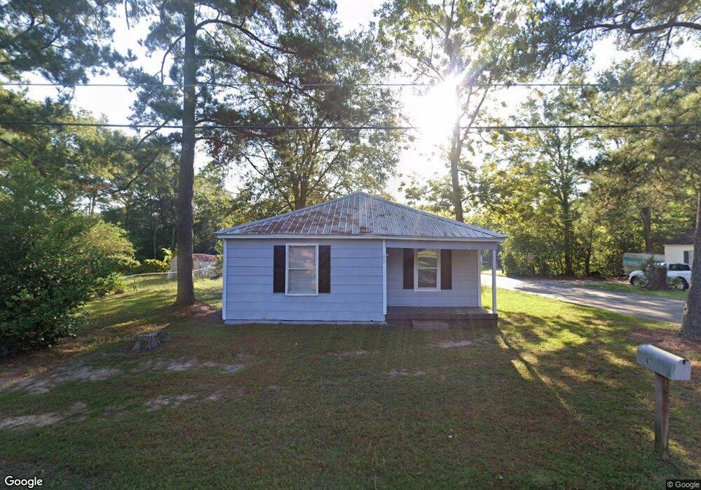
907 S Range St Dothan, AL 36301
Estimated Value: $52,000 - $111,000
2
Beds
1
Bath
934
Sq Ft
$88/Sq Ft
Est. Value
About This Home
This home is located at 907 S Range St, Dothan, AL 36301 and is currently estimated at $82,656, approximately $88 per square foot. 907 S Range St is a home located in Houston County with nearby schools including Dothan City Early Education Center, Girard Elementary School, and Dothan 6th Grade Center.
Ownership History
Date
Name
Owned For
Owner Type
Purchase Details
Closed on
Jan 21, 2025
Sold by
Edwards Joshua L
Bought by
Byrne William
Current Estimated Value
Home Financials for this Owner
Home Financials are based on the most recent Mortgage that was taken out on this home.
Original Mortgage
$55,927
Outstanding Balance
$54,384
Interest Rate
0.69%
Mortgage Type
Construction
Estimated Equity
$28,272
Purchase Details
Closed on
Feb 1, 2017
Sold by
Ameris Bank
Bought by
Gay Jimmy
Purchase Details
Closed on
Apr 30, 2015
Sold by
Marsha Craig A and Ameris Bank
Bought by
Ameris Bank
Purchase Details
Closed on
Jul 15, 2010
Sold by
Baker John T
Bought by
Marsh Craig A
Create a Home Valuation Report for This Property
The Home Valuation Report is an in-depth analysis detailing your home's value as well as a comparison with similar homes in the area
Purchase History
| Date | Buyer | Sale Price | Title Company |
|---|---|---|---|
| Byrne William | $54,750 | Attorney Only | |
| Gay Jimmy | $15,000 | -- | |
| Ameris Bank | $27,400 | -- | |
| Marsh Craig A | -- | -- |
Source: Public Records
Mortgage History
| Date | Status | Borrower | Loan Amount |
|---|---|---|---|
| Open | Byrne William | $55,927 |
Source: Public Records
Tax History
| Year | Tax Paid | Tax Assessment Tax Assessment Total Assessment is a certain percentage of the fair market value that is determined by local assessors to be the total taxable value of land and additions on the property. | Land | Improvement |
|---|---|---|---|---|
| 2025 | $266 | $7,400 | $0 | $0 |
| 2024 | $266 | $7,200 | $0 | $0 |
| 2023 | $259 | $6,940 | $0 | $0 |
| 2022 | $197 | $5,720 | $0 | $0 |
| 2021 | $194 | $7,060 | $0 | $0 |
| 2020 | $197 | $5,720 | $0 | $0 |
| 2019 | $206 | $5,980 | $0 | $0 |
| 2018 | $206 | $5,980 | $0 | $0 |
| 2017 | $189 | $5,480 | $0 | $0 |
| 2016 | $189 | $0 | $0 | $0 |
| 2015 | $189 | $0 | $0 | $0 |
| 2014 | -- | $0 | $0 | $0 |
Source: Public Records
Map
Nearby Homes
- 502 Vassar St
- 808 Dutch St
- 411 Kornegay St
- 1010 Irwin St
- 959 S Saint Andrews St
- 973 S Saint Andrews St
- 209 Pearl St
- 137 Highland St
- 211 Massee Dr
- 107 Roberts St
- 1657 Third Ave
- 737 S Saint Andrews St
- 1208 Jonathan St
- 300 Reid Dr
- 512 S College St
- 1304 Jonathan St
- 211 Cumberland Dr
- 605 Collier St
- 402 Hill St
- 1437 E Selma St
- 905 S Range St
- 601 Vassar St
- 1001 S Range St
- 904 S Range St
- 903 S Range St
- 1003 S Range St
- 603 Vassar St
- 513 Vassar St
- 626 E Selma St
- 1005 S Range St
- 588 E Selma St
- 640 E Selma St
- 1000 S Range St
- 509 Vassar St
- 652 E Selma St
- 1007 S Range St
- 576 E Selma St
- 1004 S Range St
- 1002 Citadel Ave
- 662 E Selma St
Your Personal Tour Guide
Ask me questions while you tour the home.