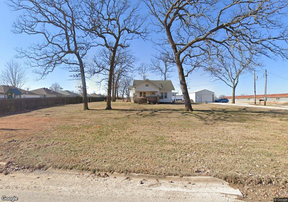
9071 Lee Harris Rd Bentonville, AR 72713
Estimated Value: $210,000
--
Bed
4
Baths
896
Sq Ft
$234/Sq Ft
Est. Value
About This Home
This home is located at 9071 Lee Harris Rd, Bentonville, AR 72713 and is currently priced at $210,000, approximately $234 per square foot. 9071 Lee Harris Rd is a home located in Benton County with nearby schools including Vaughn Elementary, Grimsley Junior High School, and Creekside Middle School.
Ownership History
Date
Name
Owned For
Owner Type
Purchase Details
Closed on
Sep 14, 2020
Sold by
Roth Family Partnership Lllp
Bought by
Godsey Josiah and Godsey Abby
Current Estimated Value
Home Financials for this Owner
Home Financials are based on the most recent Mortgage that was taken out on this home.
Original Mortgage
$50,000
Interest Rate
2.8%
Mortgage Type
Construction
Purchase Details
Closed on
Feb 7, 2020
Sold by
Commissioner Of State Lands
Bought by
Roth Family Partnership Lllp
Purchase Details
Closed on
Feb 22, 2016
Sold by
Lee Harris Farms Inc
Bought by
Roth Family Partnership Lllp
Home Financials for this Owner
Home Financials are based on the most recent Mortgage that was taken out on this home.
Original Mortgage
$287,200
Interest Rate
3.79%
Mortgage Type
Future Advance Clause Open End Mortgage
Purchase Details
Closed on
Nov 22, 2004
Bought by
City Bville
Purchase Details
Closed on
Feb 4, 1981
Bought by
Harris Farm
Create a Home Valuation Report for This Property
The Home Valuation Report is an in-depth analysis detailing your home's value as well as a comparison with similar homes in the area
Home Values in the Area
Average Home Value in this Area
Purchase History
| Date | Buyer | Sale Price | Title Company |
|---|---|---|---|
| Godsey Josiah | $50,000 | Waco Title Co Fort Smith | |
| Roth Family Partnership Lllp | $9,891 | None Listed On Document | |
| Roth Family Partnership Lllp | $359,000 | First National Title Company | |
| City Bville | -- | -- | |
| Harris Farm | -- | -- |
Source: Public Records
Mortgage History
| Date | Status | Borrower | Loan Amount |
|---|---|---|---|
| Closed | Godsey Josiah | $50,000 | |
| Previous Owner | Roth Family Partnership Lllp | $287,200 |
Source: Public Records
Tax History Compared to Growth
Tax History
| Year | Tax Paid | Tax Assessment Tax Assessment Total Assessment is a certain percentage of the fair market value that is determined by local assessors to be the total taxable value of land and additions on the property. | Land | Improvement |
|---|---|---|---|---|
| 2020 | $2,713 | $46,620 | $5,980 | $40,640 |
| 2019 | -- | $46,620 | $5,980 | $40,640 |
| 2018 | -- | $46,620 | $5,980 | $40,640 |
| 2017 | -- | $46,620 | $5,980 | $40,640 |
| 2016 | -- | $46,620 | $5,980 | $40,640 |
| 2015 | -- | $45,720 | $9,880 | $35,840 |
| 2014 | -- | $45,720 | $9,880 | $35,840 |
Source: Public Records
Map
Nearby Homes
- 6404 SW High Meadow Blvd
- 6300 SW Bear Rd
- 6110 Osage St
- 5907 SW Bear Rd
- 5910 SW Bear Rd
- 6705 SW Dignity Ave
- 6703 SW Dignity Ave
- 6912 SW Dignity Ave
- 6709 SW Dignity Ave
- 6711 SW Dignity Ave
- 6707 SW Dignity Ave
- 6701 SW Dignity Ave
- 6100 SW Lee Ln
- 6404 SW Fair View Blvd
- 6300 SW Fair View Blvd
- 5807 SW Knotty Pine Rd
- 6306 SW Fairview Blvd
- 7014 SW Orange Ave
- 6908 SW Basswood Ave
- 7001 SW Basswood Ave
- 9071 Lee Harris Rd
- 6102 SW High Meadow Blvd
- 6100 SW High Meadow Blvd
- 6104 SW High Meadow Blvd
- 6106 SW High Meadow Blvd
- 6108 SW High Meadow Blvd
- 6202 SW High Meadow Blvd
- 9070 Lee Harris Rd
- 6103 SW High Meadow Blvd
- 6105 SW High Meadow Blvd
- 6107 SW High Meadow Blvd
- 6204 SW High Meadow Blvd
- 6201 SW High Meadow Blvd
- 6206 SW High Meadow Blvd
- 6203 SW High Meadow Blvd
- 6102 SW Meadow Well Ave
- 6104 SW Meadow Well Ave
- 6205 SW High Meadow Blvd
- 6106 SW Meadow Well Ave
- 6208 SW High Meadow Blvd