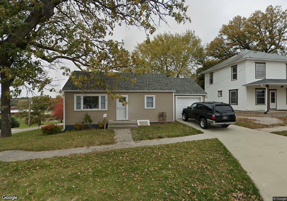
908 10th St Corning, IA 50841
Estimated Value: $65,170 - $101,000
2
Beds
1
Bath
990
Sq Ft
$79/Sq Ft
Est. Value
About This Home
This home is located at 908 10th St, Corning, IA 50841 and is currently estimated at $78,293, approximately $79 per square foot. 908 10th St is a home located in Adams County.
Ownership History
Date
Name
Owned For
Owner Type
Purchase Details
Closed on
Aug 19, 2019
Sold by
Selders Lorna B and Selders Daryn
Bought by
Roush Steven H and Hamilton Vera R
Current Estimated Value
Home Financials for this Owner
Home Financials are based on the most recent Mortgage that was taken out on this home.
Original Mortgage
$42,750
Outstanding Balance
$27,531
Interest Rate
3.7%
Mortgage Type
Construction
Estimated Equity
$50,762
Purchase Details
Closed on
Aug 5, 1997
Bought by
Fleetwood Lorna Beth
Home Financials for this Owner
Home Financials are based on the most recent Mortgage that was taken out on this home.
Original Mortgage
$48,770
Interest Rate
7.36%
Mortgage Type
New Conventional
Create a Home Valuation Report for This Property
The Home Valuation Report is an in-depth analysis detailing your home's value as well as a comparison with similar homes in the area
Purchase History
| Date | Buyer | Sale Price | Title Company |
|---|---|---|---|
| Roush Steven H | $45,000 | -- | |
| Fleetwood Lorna Beth | -- | -- |
Source: Public Records
Mortgage History
| Date | Status | Borrower | Loan Amount |
|---|---|---|---|
| Open | Roush Steven H | $42,750 | |
| Previous Owner | Fleetwood Lorna Beth | $48,770 |
Source: Public Records
Tax History
| Year | Tax Paid | Tax Assessment Tax Assessment Total Assessment is a certain percentage of the fair market value that is determined by local assessors to be the total taxable value of land and additions on the property. | Land | Improvement |
|---|---|---|---|---|
| 2025 | $962 | $60,500 | $8,300 | $52,200 |
| 2024 | $962 | $58,800 | $8,300 | $50,500 |
| 2023 | $932 | $58,800 | $8,300 | $50,500 |
| 2022 | $708 | $44,600 | $8,300 | $36,300 |
| 2021 | $674 | $36,700 | $3,500 | $33,200 |
| 2020 | $668 | $36,700 | $3,500 | $33,200 |
| 2019 | $668 | $35,900 | $0 | $0 |
| 2018 | $654 | $35,900 | $0 | $0 |
| 2017 | $672 | $35,900 | $0 | $0 |
| 2016 | $656 | $35,900 | $0 | $0 |
| 2015 | $514 | $29,917 | $0 | $0 |
| 2014 | $480 | $29,917 | $0 | $0 |
Source: Public Records
Map
Nearby Homes
- 1007 9th St
- 806 11th St
- 1017 9th St Unit 160 Grove Add
- 907 Nodaway St
- 1207 Grove Ave
- 1303 Benton Ave
- 604 Terrace Hill Dr
- 1403 Benton Ave
- 808 Adams St
- 58.34 Acres Quincy Township
- 1 US Hwy 34
- 0002 East St
- 901 Timber Ln Unit B
- 0001 East St
- 73.80 Acres Adams County Iowa
- 1764 205th St
- 87.20 Acres Adams County Iowa
- 1872 260th St
- 1426 260th St
- 1226-B 210th St
Your Personal Tour Guide
Ask me questions while you tour the home.