Estimated Value: $299,766 - $331,000
3
Beds
3
Baths
2,064
Sq Ft
$154/Sq Ft
Est. Value
About This Home
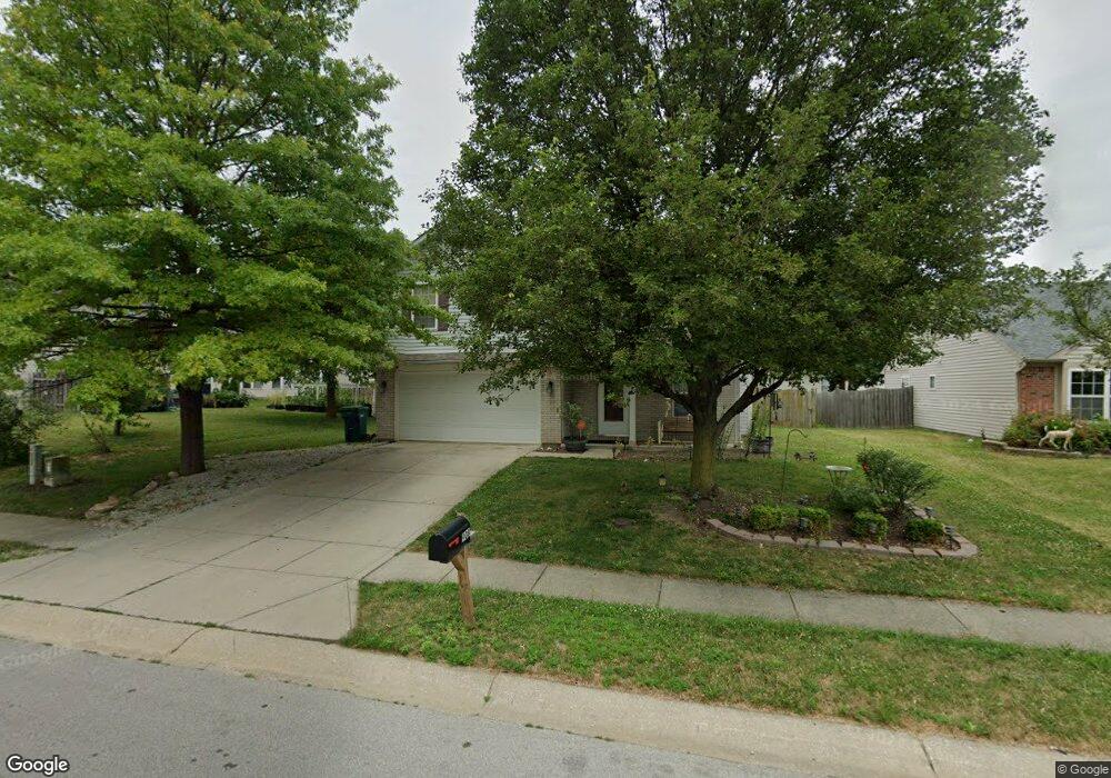
This home is located at 908 Comb Run Ln, Avon, IN 46123 and is currently estimated at $317,192, approximately $153 per square foot. 908 Comb Run Ln is a home located in Hendricks County with nearby schools including Maple Elementary School, White Oak Elementary School, and Avon Middle School North.
Ownership History
Date
Name
Owned For
Owner Type
Purchase Details
Closed on
Mar 1, 2022
Sold by
Lynn Haynes Kara and Lynn Ann Karen
Bought by
Karen Aoles Family Trust
Current Estimated Value
Purchase Details
Closed on
Jan 4, 2011
Sold by
Boyce James
Bought by
Oles Kara Lynn and Oles Karen Ann
Purchase Details
Closed on
Aug 18, 2010
Sold by
Secretary Of Housing & Urban Development
Bought by
Boyce James
Purchase Details
Closed on
Mar 18, 2010
Sold by
Everbank
Bought by
Secretary Of Housing & Urban Development
Purchase Details
Closed on
Aug 3, 2007
Sold by
Williamson Mitchell
Bought by
Williamosn Deborah A
Create a Home Valuation Report for This Property
The Home Valuation Report is an in-depth analysis detailing your home's value as well as a comparison with similar homes in the area
Home Values in the Area
Average Home Value in this Area
Purchase History
| Date | Buyer | Sale Price | Title Company |
|---|---|---|---|
| Karen Aoles Family Trust | -- | None Listed On Document | |
| Oles Kara Lynn | -- | First American Title Ins Co | |
| Boyce James | -- | None Available | |
| Secretary Of Housing & Urban Development | -- | None Available | |
| Everbank | $145,764 | None Available | |
| Williamosn Deborah A | -- | None Available |
Source: Public Records
Tax History
| Year | Tax Paid | Tax Assessment Tax Assessment Total Assessment is a certain percentage of the fair market value that is determined by local assessors to be the total taxable value of land and additions on the property. | Land | Improvement |
|---|---|---|---|---|
| 2025 | $6,288 | $287,700 | $42,800 | $244,900 |
| 2024 | $6,288 | $280,700 | $42,800 | $237,900 |
| 2023 | $5,642 | $249,500 | $37,200 | $212,300 |
| 2022 | $2,797 | $242,300 | $35,400 | $206,900 |
| 2021 | $2,084 | $179,700 | $33,700 | $146,000 |
| 2020 | $1,959 | $171,800 | $33,700 | $138,100 |
| 2019 | $1,862 | $162,400 | $31,800 | $130,600 |
| 2018 | $1,899 | $157,700 | $31,800 | $125,900 |
| 2017 | $1,550 | $152,700 | $30,300 | $122,400 |
| 2016 | $1,516 | $149,100 | $30,300 | $118,800 |
| 2014 | $1,377 | $135,100 | $27,800 | $107,300 |
Source: Public Records
Map
Nearby Homes
- 883 Hollowood Ln
- 9663 Stonewall Ln
- 781 Hollowood Ln
- 9991 Ellsworth Ln
- 9847 Kenwood St
- 9471 Jackson Way
- 1245 Newton St
- 9605 Beckett St
- 9652 Beckett St
- 9586 Beckett St
- 542 Dalton Way
- 10194 Buell Dr
- 575 Corbin Way
- 571 Corbin Way
- 539 Corbin Way
- 9681 Crossfield Rd
- 1244 Sunset Blvd
- 825 Stone Trace Ct
- 10238 Stillwell Dr
- 745 Stone Trace Ct
Your Personal Tour Guide
Ask me questions while you tour the home.