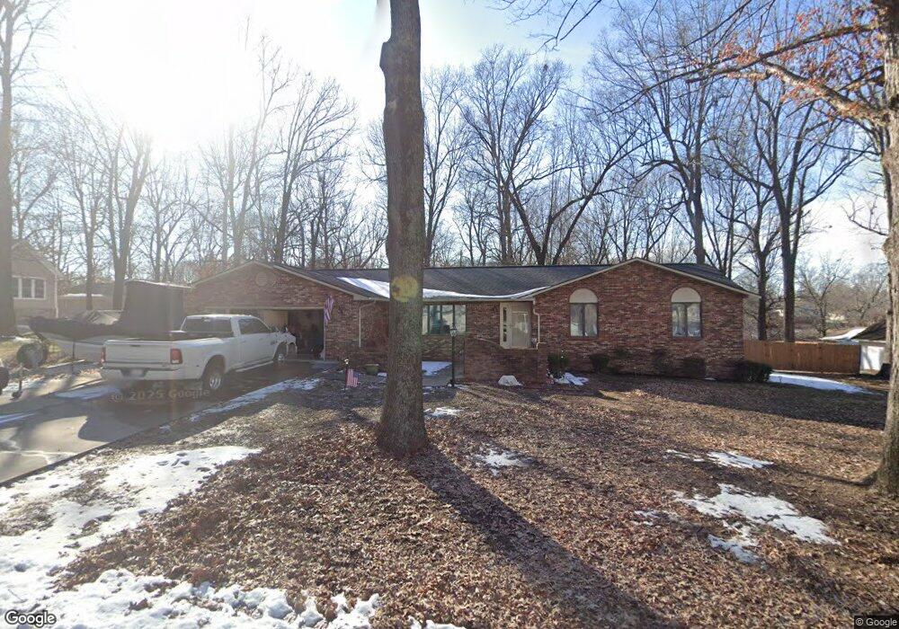
908 Forrest St Dexter, MO 63841
Estimated Value: $245,584 - $342,000
3
Beds
3
Baths
1,812
Sq Ft
$154/Sq Ft
Est. Value
About This Home
This home is located at 908 Forrest St, Dexter, MO 63841 and is currently estimated at $278,896, approximately $153 per square foot. 908 Forrest St is a home located in Stoddard County with nearby schools including Southwest Elementary School, Central Elementary School, and T.S. Hill Middle School.
Ownership History
Date
Name
Owned For
Owner Type
Purchase Details
Closed on
May 24, 2024
Sold by
Cowart Logan and Cowart Meghan
Bought by
Shotwell Joseph M
Current Estimated Value
Home Financials for this Owner
Home Financials are based on the most recent Mortgage that was taken out on this home.
Original Mortgage
$100,000
Outstanding Balance
$95,945
Interest Rate
0.63%
Mortgage Type
Construction
Estimated Equity
$182,951
Purchase Details
Closed on
Sep 6, 2022
Sold by
Hillis Keith E
Bought by
Cowart Logan
Purchase Details
Closed on
Jun 15, 2018
Sold by
Carroll C D & C L Trust
Bought by
Hillis Gladys C
Create a Home Valuation Report for This Property
The Home Valuation Report is an in-depth analysis detailing your home's value as well as a comparison with similar homes in the area
Home Values in the Area
Average Home Value in this Area
Purchase History
| Date | Buyer | Sale Price | Title Company |
|---|---|---|---|
| Shotwell Joseph M | $125,000 | National Title & Escrow Inc | |
| Cowart Logan | -- | National Title & Escrow Inc | |
| Hillis Gladys C | $221,715 | National Title & Escrow Inc |
Source: Public Records
Mortgage History
| Date | Status | Borrower | Loan Amount |
|---|---|---|---|
| Open | Shotwell Joseph M | $100,000 |
Source: Public Records
Tax History
| Year | Tax Paid | Tax Assessment Tax Assessment Total Assessment is a certain percentage of the fair market value that is determined by local assessors to be the total taxable value of land and additions on the property. | Land | Improvement |
|---|---|---|---|---|
| 2025 | $1,448 | $34,314 | $0 | $0 |
| 2024 | $14 | $31,274 | $0 | $0 |
| 2023 | $1,445 | $31,274 | $0 | $0 |
| 2022 | $1,348 | $29,203 | $0 | $0 |
| 2021 | $1,348 | $29,203 | $0 | $0 |
| 2020 | $1,253 | $21,622 | $0 | $0 |
| 2019 | $1,251 | $26,999 | $0 | $0 |
| 2018 | $995 | $21,622 | $0 | $0 |
| 2016 | $925 | $20,729 | $0 | $0 |
| 2015 | -- | $20,729 | $0 | $0 |
| 2014 | -- | $20,387 | $0 | $0 |
| 2013 | -- | $0 | $0 | $0 |
Source: Public Records
Map
Nearby Homes
- 0 Lewis & Albert St Unit MAR25013843
- 902 Albert St
- 1001 S One Mile Rd
- 404 Moore St
- 427 State Highway Af
- 909 Saddle Spur Rd
- 811 Houston St
- 727 W Fannetta St
- 11289 S Business Highway 25
- 345 S Catalpa St
- 725 W Bain St
- 805 W Bain St
- 106 W Grant St
- 1029 N Woodland Dr
- 502 Chautauqua Ln
- 2 S One Mile Rd
- 804 Susan St Unit A & B
- 128 S Mulberry St
- 1014 N Woodland Dr
- 1407 Birch Creek Ct
Your Personal Tour Guide
Ask me questions while you tour the home.